193.132.125.38 - IP Lookup: Free IP Address Lookup, Postal Code Lookup, IP Location Lookup, IP ASN, Public IP
Country:
Region:
City:
Location:
Time Zone:
Postal Code:
IP information under different IP Channel
ip-api
Country
Region
City
ASN
Time Zone
ISP
Blacklist
Proxy
Latitude
Longitude
Postal
Route
Luminati
Country
Region
eng
City
windsor
ASN
Time Zone
Europe/London
ISP
UUNET
Latitude
Longitude
Postal
IPinfo
Country
Region
City
ASN
Time Zone
ISP
Blacklist
Proxy
Latitude
Longitude
Postal
Route
IP2Location
193.132.125.38Country
Region
northern ireland
City
ashfield
Time Zone
Europe/London
ISP
Language
User-Agent
Latitude
Longitude
Postal
db-ip
Country
Region
City
ASN
Time Zone
ISP
Blacklist
Proxy
Latitude
Longitude
Postal
Route
ipdata
Country
Region
City
ASN
Time Zone
ISP
Blacklist
Proxy
Latitude
Longitude
Postal
Route
Popular places and events near this IP address

A1 road (Northern Ireland)
Major route in Northern Ireland
Distance: Approx. 1608 meters
Latitude and longitude: 54.39665,-6.17586
The A1 is a major route in Northern Ireland. It runs from Belfast via Lisburn and Banbridge to the border with the Republic of Ireland south of Newry, from where the road continues to Dublin, becoming the N1 road and M1 motorway. Between Sprucefield and Carrickcarnan the road forms part of the European route E01.

Dromore, County Down
Town and civil parish in County Down, Northern Ireland
Distance: Approx. 3702 meters
Latitude and longitude: 54.415,-6.149
Dromore (from Irish Droim Mór, meaning 'large ridge') is a small market town and civil parish in County Down, Northern Ireland. It lies within the local government district of Armagh City, Banbridge and Craigavon. It is 19 miles (31 km) southwest of Belfast, on the A1 Belfast–Dublin road.
Blackskull
Village in County Down, Northern Ireland
Distance: Approx. 2642 meters
Latitude and longitude: 54.402865,-6.24047
Blackskull is a small village in County Down, Northern Ireland. It lies near Donaghcloney and Dromore. In the 2001 Census it had a population of 168 people.
Dromore Central Primary School
Controlled primary school in Dromore, Northern Ireland, United Kingdom
Distance: Approx. 3457 meters
Latitude and longitude: 54.4138,-6.1522
Dromore Central Primary School (colloquially referred to as "the Central") is a primary school located in Dromore, County Down, Northern Ireland. The original school building was built in 1938 and had approximately 700 pupils aged from 4–11 years in 28 classes. This building was replaced with a new multi-million pound purpose built campus on the Mossvale Road which opened in 2016.
Break of Dromore
1689 battle
Distance: Approx. 3808 meters
Latitude and longitude: 54.417,-6.149
The Break of Dromore took place on 14 March 1689 near Dromore, County Down in the early stages of the Williamite War in Ireland. It featured Catholic Jacobite troops under Richard Hamilton and Protestant Williamite militia led by Hugh Montgomery and Arthur Rawdon. The Protestant forces were taken by surprise and there was little fighting, reflected in the term "Break", a Scottish word for rout.
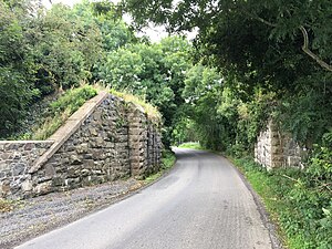
Ashfield Halt railway station
Railway station in Northern Ireland
Distance: Approx. 1555 meters
Latitude and longitude: 54.3943,-6.1781
Ashfield Halt railway station served Ashfield in County Down, Northern Ireland. Sited 2 miles south of Dromore the station was served by the line from Lisburn to Banbridge.
Iveagh (Northern Ireland Parliament constituency)
Distance: Approx. 1892 meters
Latitude and longitude: 54.383,-6.2
Iveagh ( EYE-vay) was a constituency of the Parliament of Northern Ireland.

Dromore Railway Station
Railway station in County Down, Northern Ireland
Distance: Approx. 3185 meters
Latitude and longitude: 54.414682,-6.157815
Dromore railway station was on the Banbridge, Lisburn and Belfast Junction Railway which ran from Knockmore Junction to Banbridge in Northern Ireland.

Mullafernaghan railway station
Former railway station in County Down, Northern Ireland
Distance: Approx. 1902 meters
Latitude and longitude: 54.384615,-6.212773
Mullafernaghan railway station was on the Banbridge, Lisburn and Belfast Railway which ran from Knockmore Junction to Banbridge in Northern Ireland. It served the village of Mullafernaghan, and the neighbouring villages of Blackskull and Donaghcloney.

Dromore Cathedral
Church in County Down, Northern Ireland
Distance: Approx. 3534 meters
Latitude and longitude: 54.41472222,-6.15166667
Dromore Cathedral, formally The Cathedral Church of Christ the Redeemer, Dromore, is one of two cathedral churches (the other is Down Cathedral) in the Diocese of Down and Dromore of the Church of Ireland (Anglican / Episcopal). It is situated in the small town of Dromore, County Down, Northern Ireland, in the ecclesiastical province of Armagh. The cathedral is an active parish church with a wide demographic of about 600 families, but also serves an important role in Diocesan life.

Dromore Viaduct
Distance: Approx. 2982 meters
Latitude and longitude: 54.41377,-6.16053
The Dromore Viaduct is an abandoned railway viaduct in Dromore, County Down, Northern Ireland.

Dromore Town Hall
Municipal Building in Dromore, Northern Ireland
Distance: Approx. 3677 meters
Latitude and longitude: 54.4145,-6.149
Dromore Town Hall is a municipal structure in the centre of Dromore, County Down. The structure, which is now used as a public library, is a Grade B1 listed building.
Weather in this IP's area
overcast clouds
2 Celsius
-4 Celsius
2 Celsius
2 Celsius
1003 hPa
85 %
1003 hPa
989 hPa
10000 meters
9.28 m/s
17.7 m/s
283 degree
100 %