193.132.121.167 - IP Lookup: Free IP Address Lookup, Postal Code Lookup, IP Location Lookup, IP ASN, Public IP
Country:
Region:
City:
Location:
Time Zone:
Postal Code:
IP information under different IP Channel
ip-api
Country
Region
City
ASN
Time Zone
ISP
Blacklist
Proxy
Latitude
Longitude
Postal
Route
Luminati
Country
Region
eng
City
windsor
ASN
Time Zone
Europe/London
ISP
UUNET
Latitude
Longitude
Postal
IPinfo
Country
Region
City
ASN
Time Zone
ISP
Blacklist
Proxy
Latitude
Longitude
Postal
Route
IP2Location
193.132.121.167Country
Region
england
City
hampton
Time Zone
Europe/London
ISP
Language
User-Agent
Latitude
Longitude
Postal
db-ip
Country
Region
City
ASN
Time Zone
ISP
Blacklist
Proxy
Latitude
Longitude
Postal
Route
ipdata
Country
Region
City
ASN
Time Zone
ISP
Blacklist
Proxy
Latitude
Longitude
Postal
Route
Popular places and events near this IP address

Hampton railway station (London)
National Rail station in London, England
Distance: Approx. 436 meters
Latitude and longitude: 51.4159,-0.3717
Hampton railway station, serving Hampton in the London Borough of Richmond upon Thames, is on the Shepperton branch line. It is in Travelcard Zone 6, 14 miles 47 chains (23.5 km) down the line from London Waterloo. The station and all trains serving it are operated by South Western Railway.
Moulsey Hurst
Cricket ground located in United Kingdom
Distance: Approx. 555 meters
Latitude and longitude: 51.41,-0.361
Moulsey Hurst is in West Molesey, Surrey on the south bank of the River Thames above Molesey Lock. It is one of England's oldest sporting venues and was used in the 18th and 19th centuries for cricket, prizefighting and other sports. This area is now called Hurst Park; the area currently called Molesey Hurst is smaller, and some 500m to the south.

Hampton & Richmond Borough F.C.
Association football club in London, England
Distance: Approx. 358 meters
Latitude and longitude: 51.41555556,-0.36333333
Hampton & Richmond Borough Football Club is a semi-professional association football club based in the suburb of Hampton, in the London Borough of Richmond upon Thames, England. The team competes in the National League South, the sixth level of the English football league system. They were founded in 1921 and formerly known as Hampton FC until 1999 when they changed their name in an attempt to draw a wider support base from around the borough.

Hurst Park Racecourse
Closed horse racing venue in England
Distance: Approx. 462 meters
Latitude and longitude: 51.4096,-0.364
Hurst Park Racecourse was a racecourse at Moulsey Hurst, West Molesey, Surrey, near the River Thames. It was first laid out in 1890 and held its last race in 1962. There was racing at nearby Hampton for many years until 1887.
Platt's Eyot
Human settlement in England
Distance: Approx. 504 meters
Latitude and longitude: 51.4098,-0.3716
Platt's Eyot or Platt's Ait is an island on the River Thames at Hampton, in the London Borough of Richmond upon Thames, England, on the reach between Molesey Lock and Sunbury Lock.
Garrick's Ait
Distance: Approx. 501 meters
Latitude and longitude: 51.41166667,-0.36027778
Garrick's Ait (or Garrick's Eyot on Ordnance Survey maps), previously known as Shank's Eyot, is an ait in the River Thames in England on the reach above Molesey Lock, the nearest land being Moulsey Hurst (park) on the Surrey bank and the opposite bank being a much narrower riverside park of Hampton. It is the only island in the United Kingdom named after an actor.
Hampton Ferry (River Thames)
Ferry between London and Surrey
Distance: Approx. 344 meters
Latitude and longitude: 51.412,-0.3625
Hampton Ferry is a seasonal foot (and cycle) ferry across the Thames in England. It is about 1 mile (1.6 km) upstream, west, of Hampton Court Bridge. The bridge links a busy zone of activity on both banks including Hampton Court Palace.
Benn's Island
Island in the River Thames, England
Distance: Approx. 281 meters
Latitude and longitude: 51.41222222,-0.36333333
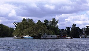
Benn's Island, previously named Church Eyot, Kember's Eyot and sometimes referred to as Benn's Ait, is a private 0.1-acre (0.040 ha) ait (island) on the River Thames south-west of London. It is among a string of narrow islands above Molesey Lock and due to its clubhouse and size — the second-smallest named island on the Thames — it has deep foundation pilings to raise the building more than 1 m above the water line.

St Mary's Parish Church, Hampton
Church in London , England
Distance: Approx. 400 meters
Latitude and longitude: 51.413019,-0.361261
St Mary's Parish Church, Hampton, is an Anglican church in Hampton in the London Borough of Richmond upon Thames.

Garrick's Temple to Shakespeare
Garden folly in Hampton, London, England
Distance: Approx. 537 meters
Latitude and longitude: 51.4124,-0.3594
Garrick's Temple to Shakespeare is a small garden folly erected in 1756 on the north bank of the River Thames at Hampton in the London Borough of Richmond upon Thames. Grade I listed, it was built by the actor David Garrick to honour the playwright William Shakespeare, whose plays Garrick performed to great acclaim throughout his career. During his lifetime Garrick used it to house his extensive collection of Shakespearean relics and for entertaining his family and guests.

St Theodore's Roman Catholic Church, Hampton
Church in Hampton , United Kingdom
Distance: Approx. 311 meters
Latitude and longitude: 51.41583333,-0.36888889
St Theodore's Roman Catholic Church, Hampton is a Roman Catholic church on Station Road in Hampton in the London Borough of Richmond upon Thames.
Hampton Water Treatment Works
A water treatment works in Hampton, London
Distance: Approx. 319 meters
Latitude and longitude: 51.412569,-0.371447
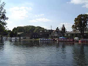
Hampton Water Treatment Works are water treatment works located on the River Thames in Hampton, London. Built in the second half of the 19th Century to supply London with fresh water, the Waterworks was in the past a significant local employer, and its brick pumphouses dominate the local landscape. The Waterworks are currently owned and operated by Thames Water, occupying a 66 ha site located between the Upper Sunbury Road (A308) and the River Thames.
Weather in this IP's area
light rain
6 Celsius
2 Celsius
6 Celsius
7 Celsius
1005 hPa
76 %
1005 hPa
999 hPa
10000 meters
7.2 m/s
250 degree
20 %


