193.131.127.240 - IP Lookup: Free IP Address Lookup, Postal Code Lookup, IP Location Lookup, IP ASN, Public IP
Country:
Region:
City:
Location:
Time Zone:
Postal Code:
IP information under different IP Channel
ip-api
Country
Region
City
ASN
Time Zone
ISP
Blacklist
Proxy
Latitude
Longitude
Postal
Route
Luminati
Country
ASN
Time Zone
Europe/London
ISP
UUNET
Latitude
Longitude
Postal
IPinfo
Country
Region
City
ASN
Time Zone
ISP
Blacklist
Proxy
Latitude
Longitude
Postal
Route
IP2Location
193.131.127.240Country
Region
scotland
City
dundee
Time Zone
Europe/London
ISP
Language
User-Agent
Latitude
Longitude
Postal
db-ip
Country
Region
City
ASN
Time Zone
ISP
Blacklist
Proxy
Latitude
Longitude
Postal
Route
ipdata
Country
Region
City
ASN
Time Zone
ISP
Blacklist
Proxy
Latitude
Longitude
Postal
Route
Popular places and events near this IP address
Baldragon Academy
School in Scotland
Distance: Approx. 1575 meters
Latitude and longitude: 56.494023,-2.989936
Baldragon Academy is a six-year comprehensive in the Kirkton area of the city of Dundee, Scotland. It was originally named Kirkton High School until merging with Rockwell High School in August 1997. The school is set in over 20 acres (8.1 ha) of its own grounds.

Strathmartine
Human settlement in Scotland
Distance: Approx. 1891 meters
Latitude and longitude: 56.501263,-2.997399
Strathmartine is an area of Angus, Scotland (named after a local mythical hero, Strathmartin The Dragonslayer). It is to the north of Dundee and the surrounding district is often referred to as "the Howe o Strathmartine". The parishes of Mains and Strathmartine were united on 21 Nov 1792.

Claverhouse
Human settlement in Scotland
Distance: Approx. 786 meters
Latitude and longitude: 56.493,-2.965
Claverhouse is a residential area located on the northern outskirts of Dundee, Scotland with the city centre located 2 miles (3.2 km) from the area.

Powrie Castle
Castle in Dundee, Scotland
Distance: Approx. 1556 meters
Latitude and longitude: 56.49944444,-2.94138889
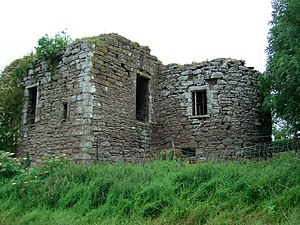
Powrie Castle is a ruined 16th-century castle located in the north of Dundee, Scotland. It was designated as a scheduled monument in 1971. The early 17th-century north range of the castle is now a separate fortified house and has been converted into a private residence.
Scottish School of Contemporary Dance
Distance: Approx. 1844 meters
Latitude and longitude: 56.4847,-2.9782
The Scottish School of Contemporary Dance is a dance and performing arts school affiliated with the Dundee College. It offers a four-year training from foundation level and prepares students for careers as dance performers, choreographers, and community artists. The School is relatively small (approx 100 students) and has close links with a variety of professional artists, including the Scottish Dance Theatre, and Thomas Small, director of Shaper Caper.

Mains Castle
Castle in Dundee City, Scotland, UK
Distance: Approx. 1693 meters
Latitude and longitude: 56.48555556,-2.95805556
Mains Castle (also known as Claverhouse Castle or Fintry Castle ) is a 16th-century castle in Dundee, Scotland. The castle consists of several buildings surrounding a courtyard, although several of the original western buildings no longer exist. The northern and eastern buildings are where the family would have lived, with the servants occupying the southern quarters.

Kirkton, Dundee
Human settlement in Scotland
Distance: Approx. 1851 meters
Latitude and longitude: 56.487867,-2.987304
Kirkton is a residential housing scheme located in the north of Dundee. The area is bordered by Downfield to the west, Trottick to the east and Fairmuir to the south.
Downfield F.C.
Association football club in Scotland
Distance: Approx. 1705 meters
Latitude and longitude: 56.493212,-2.991572
Downfield Football Club are a Scottish junior football club based in the Downfield area of Dundee. Their home ground is Downfield Park.

St Paul's Roman Catholic Academy
Secondary school in Dundee, Scotland
Distance: Approx. 1692 meters
Latitude and longitude: 56.48632,-2.9787
St. Paul's R.C. Academy is a Roman Catholic secondary school in Dundee, Scotland.
Caird Park Velodrome
Distance: Approx. 1998 meters
Latitude and longitude: 56.4833,-2.9548
The Caird Park Velodrome is an outdoor 402.25-metre (1,319.7 ft) concrete velodrome in Dundee, Scotland. Adjacent to the velodrome is an athletics stadium with a 400-metre (1,300 ft) running track, 18- and 9-hole golf courses, several football pitches and a rugby pitch, whilst in the centre of the velodrome is a football pitch, as it is one of two major outdoor sport complexes in the city. In 2012 Sport Scotland spent £300,000 on redevelopment of the velodrome.

Trottick Mill Ponds
Nature Reserve in Dundee, Scotland
Distance: Approx. 923 meters
Latitude and longitude: 56.49171,-2.9672027
Trottick Mill Ponds and Nature Reserve is a local nature reserve located in the Trottick area in Dundee, Scotland. The nature reserve connects with the Dighty Burn and is voluntarily operated by Countryside Rangers as well as the Scottish Wildlife Trust and owned by Dundee City Council.

Mill of Mains
Human settlement in Scotland
Distance: Approx. 1414 meters
Latitude and longitude: 56.4892,-2.9546
Mill of Mains is a residential area located in the north of Dundee, Scotland.
Weather in this IP's area
broken clouds
2 Celsius
-4 Celsius
2 Celsius
3 Celsius
989 hPa
86 %
989 hPa
977 hPa
10000 meters
9.3 m/s
17.6 m/s
271 degree
66 %