193.128.15.54 - IP Lookup: Free IP Address Lookup, Postal Code Lookup, IP Location Lookup, IP ASN, Public IP
Country:
Region:
City:
Location:
Time Zone:
Postal Code:
IP information under different IP Channel
ip-api
Country
Region
City
ASN
Time Zone
ISP
Blacklist
Proxy
Latitude
Longitude
Postal
Route
Luminati
Country
ASN
Time Zone
Europe/London
ISP
UUNET
Latitude
Longitude
Postal
IPinfo
Country
Region
City
ASN
Time Zone
ISP
Blacklist
Proxy
Latitude
Longitude
Postal
Route
IP2Location
193.128.15.54Country
Region
england
City
guildford
Time Zone
Europe/London
ISP
Language
User-Agent
Latitude
Longitude
Postal
db-ip
Country
Region
City
ASN
Time Zone
ISP
Blacklist
Proxy
Latitude
Longitude
Postal
Route
ipdata
Country
Region
City
ASN
Time Zone
ISP
Blacklist
Proxy
Latitude
Longitude
Postal
Route
Popular places and events near this IP address

Guildford Castle
Castle in Surrey, England
Distance: Approx. 178 meters
Latitude and longitude: 51.234314,-0.572431
Guildford Castle is in Guildford, Surrey, England. It is thought to have been built by William the Conqueror, or one of his barons, shortly after the 1066 invasion of England.

Guildford Museum
Local museum in Guildford, England
Distance: Approx. 182 meters
Latitude and longitude: 51.233839,-0.573502
Guildford Museum is the main museum in the town of Guildford, Surrey, England. The museum is on Quarry Street, a narrow road lined by pre-1900 cottages running just off the pedestrianised High Street. This main site of the museum forms the gatehouse and annex of Guildford Castle, which the staff help to run.

Yvonne Arnaud Theatre
Theatre in Guildford, England
Distance: Approx. 209 meters
Latitude and longitude: 51.233571,-0.574964
The Yvonne Arnaud Theatre is a theatre located in Guildford, Surrey, England. Named after the actress Yvonne Arnaud, it presents a series of locally produced and national touring productions, including opera, ballet and pantomime. The theatre has two performance venues, the main auditorium and the smaller Mill Studio.

Guildford House
Town house in Guildford, Surrey
Distance: Approx. 210 meters
Latitude and longitude: 51.236115,-0.571508
Guildford House is a historic house at 155 High Street, Guildford, Surrey, England. Built in 1660, it is currently a municipal museum and art gallery.
Electric Theatre
Distance: Approx. 233 meters
Latitude and longitude: 51.236127,-0.577431
The Electric Theatre is a theatre located in Guildford, Surrey, England, which has gained a widespread reputation for promotion of the musical arts at all levels from community workshops to concerts by internationally well-known artists. The theatre is housed in a former electricity works which used to provide power to Guildford town centre. The works lay dormant from 1968 until the building's potential as a theatre was recognised; 1997 saw the opening of The Electric Theatre in the converted premises.
Guildford Black Friary
Former Dominican friary in Surrey, England
Distance: Approx. 167 meters
Latitude and longitude: 51.23638889,-0.57611111
Guildford Friary was a medieval monastic house in Guildford, Surrey, England. It was founded c. 1275 by Eleanor of Provence, wife of Henry III and occupied a site of around 10 acres (4.0 ha) on the east side of the River Wey. It was dissolved in 1537.
St Nicolas Church, Guildford
Church in Surrey, England
Distance: Approx. 236 meters
Latitude and longitude: 51.23466,-0.57747
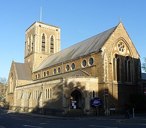
St Nicolas' is an Anglican parish church in Guildford, England.

Guildford Guildhall
Municipal building in Guildford, Surrey, England
Distance: Approx. 145 meters
Latitude and longitude: 51.23587,-0.57236
The Guildford Guildhall is a Guildhall located on the High Street of the town of Guildford, Surrey. It is a Grade I listed building.
St Mary's Church, Guildford
Church in Guildford, England
Distance: Approx. 234 meters
Latitude and longitude: 51.2346,-0.5774
St Mary's Church is an Anglican church in Guildford in Surrey, England; the church's Anglo-Saxon tower is the oldest surviving structure in the town. Charles Lutwidge Dodgson, the author Lewis Carroll, preached here and his funeral was held in the church in 1898. Coming under the Diocese of Guildford, the church has been Grade I listed since 1953.

Town Mill, Guildford
Watermill in Guildford, Surrey
Distance: Approx. 175 meters
Latitude and longitude: 51.23387,-0.574848
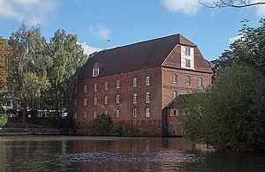
The Town Mill is a Grade II listed 18th-century watermill located in the centre of Guildford on the River Wey.

The Undercroft, Guildford
Undercroft in Guildford, Surrey
Distance: Approx. 50 meters
Latitude and longitude: 51.23527778,-0.57361111
The Undercroft at 72/74 High Street in Guildford in Surrey is a medieval undercroft or storage room. It has been described as one of the finest examples of its type in the country. Since 1976 it has been a Grade II* listed building and Scheduled Monument on the List of Historic England.

Tunsgate
Commercial building in Guildford, Surrey, England
Distance: Approx. 157 meters
Latitude and longitude: 51.2357,-0.5721
Tunsgate is a neoclassical style building in Guildford, Surrey, England. The structure, which was originally a corn exchange and now forms the entrance to a shopping centre, is a Grade II listed building.
Weather in this IP's area
clear sky
1 Celsius
-1 Celsius
0 Celsius
3 Celsius
1022 hPa
82 %
1022 hPa
1017 hPa
10000 meters
2.06 m/s
290 degree
7 %


