193.128.14.141 - IP Lookup: Free IP Address Lookup, Postal Code Lookup, IP Location Lookup, IP ASN, Public IP
Country:
Region:
City:
Location:
Time Zone:
Postal Code:
ISP:
ASN:
language:
User-Agent:
Proxy IP:
Blacklist:
IP information under different IP Channel
ip-api
Country
Region
City
ASN
Time Zone
ISP
Blacklist
Proxy
Latitude
Longitude
Postal
Route
db-ip
Country
Region
City
ASN
Time Zone
ISP
Blacklist
Proxy
Latitude
Longitude
Postal
Route
IPinfo
Country
Region
City
ASN
Time Zone
ISP
Blacklist
Proxy
Latitude
Longitude
Postal
Route
IP2Location
193.128.14.141Country
Region
england
City
esher
Time Zone
Europe/London
ISP
Language
User-Agent
Latitude
Longitude
Postal
ipdata
Country
Region
City
ASN
Time Zone
ISP
Blacklist
Proxy
Latitude
Longitude
Postal
Route
Popular places and events near this IP address

Esher
Town in Surrey, England
Distance: Approx. 54 meters
Latitude and longitude: 51.3691,-0.365
Esher ( EE-shər) is a town in the borough of Elmbridge in Surrey, England, to the east of the River Mole. Esher is an outlying suburb of London, close to the London–Surrey border; with Esher Commons at its southern end, the town marks one limit of the Greater London Built-Up Area. Elevations range from 10m to 47m above sea level.
Borough of Elmbridge
Local government district in Surrey, England
Distance: Approx. 282 meters
Latitude and longitude: 51.37,-0.3618
Elmbridge is a local government district with borough status in Surrey, England. Its council is based in Esher, and other notable towns and villages include Cobham, Walton-on-Thames, Weybridge and Molesey. The borough lies just outside the administrative boundary of Greater London, but is almost entirely within the M25 motorway which encircles London.

Sandown Park Racecourse
Racecourse and leisure venue in Esher, Surrey
Distance: Approx. 779 meters
Latitude and longitude: 51.37583333,-0.36166667
Sandown Park is a horse racing course and leisure venue in Esher, Surrey, England, located in the outer suburbs of London. It hosts 5 Grade One National Hunt races and one Group 1 flat race, the Eclipse Stakes. It regularly has horse racing during afternoons, evenings and on weekends, and also hosts many non-racing events such as trade shows, wedding fairs, toy fairs, car shows and auctions, property shows, concerts, and even some private events.
Esher Urban District
Distance: Approx. 54 meters
Latitude and longitude: 51.3691,-0.365
Esher Urban District was an urban district in Surrey, England created by merging two urban districts and adding two parishes to the south-west. It existed from 1933 to 1974 and was governed by the elected Esher Urban District Council which shared local government functions with Surrey County Council. Its main building was the large town hall in Esher.
St George's Church, Esher
Church in Surrey, United Kingdom
Distance: Approx. 83 meters
Latitude and longitude: 51.3693,-0.3645
St George's Church, Esher is a Grade I listed Anglican church in Esher, Surrey, England. Built in the 16th century, it was Esher's parish church for 300 years, though later worshippers included Queen Victoria. However, by the mid-19th century the building was deemed too small for the growing population, and was replaced by Christ Church, built nearby on Esher Green in 1853/4.

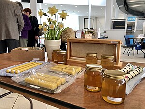
National Honey Show
UK food festival
Distance: Approx. 504 meters
Latitude and longitude: 51.3733,-0.3623
The National Honey Show is an annual British show of honey and other bee products. It first took place in 1923 at The Crystal Palace, and continued to be held there until 1936, when The Crystal Palace burnt down. For a time it was held at St George's College, Weybridge, Surrey; it is now held every October at Sandown Park Racecourse.

Esher Place
Grade I listed building in Esher, Surrey, England
Distance: Approx. 566 meters
Latitude and longitude: 51.372,-0.3726
Esher Place is a Grade-II listed country house, since 1953 used as a college by the trade union Unite, in Esher, Surrey, United Kingdom. The building is at least the fourth on approximately the same site and mainly dates to the 1890s. It incorporates traces and small parts of some its earlier forebears.
Milbourne Lodge School
Pre-prep & prep school in Esher, Surrey, England
Distance: Approx. 442 meters
Latitude and longitude: 51.36536389,-0.36653889
Milbourne Lodge School is a co-educational pre-prep and preparatory school for children aged four to thirteen. Located in Esher, Surrey, the school is housed in a Victorian mansion situated on 8.5 acres (3.4 ha) of Surrey countryside.

Esher Church of England High School
Academy in Esher, Surrey, England
Distance: Approx. 731 meters
Latitude and longitude: 51.3749,-0.3712
Esher Church of England High School is a coeducational Church of England secondary school and academy in Esher, Surrey, England.

Wayneflete Tower
Gatehouse in Esher, Surrey
Distance: Approx. 566 meters
Latitude and longitude: 51.372,-0.3726
Wayneflete Tower, also known as Waynflete's Tower, is a historical gatehouse located in Esher, near London. it was originally part of the Palace of Esher, established in 1462 by Bishop William Waynflete of Winchester, and was connected to the keep by a curtain wall. During the 17th century, much of the palace was demolished, including its furnishings and granite blocks.
Esher Theatre
Theatre in Esher, England
Distance: Approx. 239 meters
Latitude and longitude: 51.370417,-0.362759
Esher Theatre in Esher opened on 4 September 2021. It features a 200-seat main theatre with 350 standing. Esher Theatre is a "multi-faceted entertainment venue for the arts".

Sandown House
Municipal building in Esher, Surrey, England
Distance: Approx. 308 meters
Latitude and longitude: 51.371,-0.3622
Sandown House, known as Esher Town Hall during much of the 20th century, is a historic building in the High Street in Esher, a town in Surrey, in England. The building, which has been converted into flats, is a Grade II listed building.
Weather in this IP's area
clear sky
2 Celsius
1 Celsius
2 Celsius
2 Celsius
1034 hPa
91 %
1034 hPa
1027 hPa
10000 meters
1.44 m/s
1.56 m/s
174 degree
1 %

