Country:
 Ukraine
Region:
City:
Latitude and Longitude:
Time Zone:
Postal Code:
IP information under different IP Channel
ip-api
Country
Region
City
ASN
Time Zone
ISP
Blacklist
Proxy
Latitude
Longitude
Postal
Route
IPinfo
Country
Region
City
ASN
Time Zone
ISP
Blacklist
Proxy
Latitude
Longitude
Postal
Route
MaxMind
Country
Region
City
ASN
Time Zone
ISP
Blacklist
Proxy
Latitude
Longitude
Postal
Route
Luminati
Country
UAASN
Time Zone
Europe/Kyiv
ISP
JV Optima Pharm, LTD
Latitude
Longitude
Postal
db-ip
Country
Region
City
ASN
Time Zone
ISP
Blacklist
Proxy
Latitude
Longitude
Postal
Route
ipdata
Country
Region
City
ASN
Time Zone
ISP
Blacklist
Proxy
Latitude
Longitude
Postal
Route
Popular places and events near this IP address

Darnytskyi District
Urban district in Kyiv in Kyiv City Municipality, Ukraine
Distance: Approx. 614 meters
Latitude and longitude: 50.40611111,30.67666667
Darnytskyi District (Ukrainian: Дарницький район, romanized: Darnytskyi raion) is an urban district of the Ukrainian capital Kyiv. It is the southeastern district of Kyiv, located on the left bank of the Dnipro river. It borders the Holosiivskyi District of the city to its west, across the river, Dniprovskyi District of city to its north, and the Brovary Raion of the Kyiv Oblast to its east and Boryspil Raion of Kyiv Oblast to its east and south.

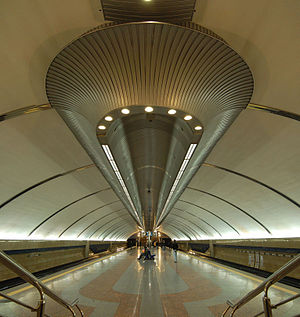
Vyrlytsia (Kyiv Metro)
Kyiv Metro Station
Distance: Approx. 1283 meters
Latitude and longitude: 50.40333333,30.66611111
Vyrlytsia (Ukrainian: Вирлиця, ) is a station on the Kyiv Metro's Syretsko-Pecherska Line. It was opened on 4 March 2006 on the already functioning stretch, Kharkivska-Boryspilska. The station is by far the most unusual in the system.
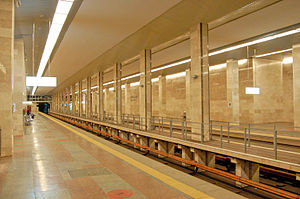
Boryspilska (Kyiv Metro)
Kyiv Metro Station
Distance: Approx. 101 meters
Latitude and longitude: 50.40333333,30.68277778
Boryspilska (Ukrainian: Бориспільська, ) is a station on Kyiv Metro's Syretsko-Pecherska Line. Designed by architects V. Gnevyshev, T. Tselikovska and A. Yukhnovsky, the station is a shallow level single-vault (Kharkiv Technology). Although planned to open in the late 1990s, financial offsets put off the date to 23 August 2005, when it was opened to the public.

Darnytsia railway station
Railway station in Kyiv, Ukraine
Distance: Approx. 4101 meters
Latitude and longitude: 50.43111111,30.64611111
Darnytsia (Ukrainian: Дарниця) is the largest Ukrainian Railways station (and the main freight station) of the Ukrainian capital Kyiv, located in the city's Left-bank Darnytsia neighborhood. Built in the nineteenth century, the Darnytsia railway hub has grown into a gigantic railway center, expanding for more than 10 km along the main east–west route. Started in 2004, construction is under way at the new Darnytsia railway terminal complex.

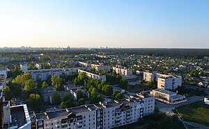
Pozniaky
Distance: Approx. 3968 meters
Latitude and longitude: 50.4087,30.6289
Pozniaky (Ukrainian: Позняки) is a historical neighbourhood, a residential area and the remains of a village on the territory of the Darnitskyi district, on the left bank of Kyiv, the capital of Ukraine. Pozniaky metro station is situated in this neighborhood. Pozniaky is a historical area, of Kyiv.
Chervonyi Khutir (Kyiv Metro)
Kyiv Metro Station
Distance: Approx. 950 meters
Latitude and longitude: 50.40888889,30.69444444
Chervonyi Khutir (Ukrainian: Червоний хутір, ) is the terminus station of the Kyiv Metro's Syretsko-Pecherska Line. It opened on 23 May 2008. The station's name arises from an old village "Chervonyi Khutir" that was subsequently absorbed into Kyiv city limits and is now an industrial neighbourhood.

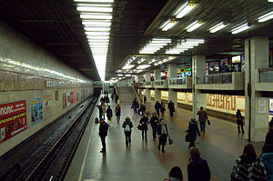
Kharkivska (Kyiv Metro)
Kyiv Metro Station
Distance: Approx. 2287 meters
Latitude and longitude: 50.40083333,30.65222222
Kharkivska (Ukrainian: Харківська, ) is a station of Kyiv Metro's Syretsko-Pecherska Line. It is between the Pozniaky and Vyrlytsia stations. This station was opened on 28 December 1994.
Pozniaky (Kyiv Metro)
Kyiv Metro Station
Distance: Approx. 3658 meters
Latitude and longitude: 50.39805556,30.63333333
Pozniaky (Ukrainian: Позняки, ) is a station of Kyiv Metro's Syretsko–Pecherska line. It is situated between Osokorky and Kharkivska stations. This station was opened on 28 December 1994.

Osokorky (Kyiv Metro)
Kyiv Metro Station
Distance: Approx. 4929 meters
Latitude and longitude: 50.39555556,30.61583333
Osokorky (Ukrainian: Осокорки, ) is a station of Kyiv Metro's Syretsko-Pecherska Line. It is situated between Slavutych and Pozniaky stations. This station was opened on 30 December 1992.
Bortnychi
Distance: Approx. 2314 meters
Latitude and longitude: 50.38389444,30.69545833
Bortnychi (Ukrainian: Бортничі) is a historic neighbourhood in the southern part of Kyiv. Its southern and eastern boundaries are bordered with forests. Now Bortnychi is included in the Darnytsia Raion.
Chervonyi Khutir
Distance: Approx. 771 meters
Latitude and longitude: 50.40846667,30.67679167
Chervonyi Khutir (Ukrainian: Червоний Хутір) is a historic neighbourhood in the Darnytskyi District of Kyiv, the capital of Ukraine. It is located between Kharkivske Highway, Kronshtadtska Street, Borova Street, Yalynkova Street, and forest. Most of the buildings are low-rise private homes, while some are industrial enterprises.
Kharkivska Square
Square in Kyiv, Ukraine
Distance: Approx. 136 meters
Latitude and longitude: 50.4024,30.6831
Kharkivska Square is a square in the Darnytskyi District of Kyiv in Chervonyi Khutir. It is located between Kharkiv Highway, Tashkentska Street, Boryspil Highway, Svitla Street, Kollektorna Street and Mykola Bazhan Avenue.
Weather in this IP's area
moderate rain
18 Celsius
18 Celsius
17 Celsius
18 Celsius
1006 hPa
100 %
1006 hPa
994 hPa
3667 meters
0.89 m/s
1.34 m/s
194 degree
100 %
07:05:26
18:24:56