Country:
Region:
City:
Latitude and Longitude:
Time Zone:
Postal Code:
IP information under different IP Channel
ip-api
Country
Region
City
ASN
Time Zone
ISP
Blacklist
Proxy
Latitude
Longitude
Postal
Route
Luminati
Country
ASN
Time Zone
Europe/Berlin
ISP
Plusnet GmbH
Latitude
Longitude
Postal
IPinfo
Country
Region
City
ASN
Time Zone
ISP
Blacklist
Proxy
Latitude
Longitude
Postal
Route
db-ip
Country
Region
City
ASN
Time Zone
ISP
Blacklist
Proxy
Latitude
Longitude
Postal
Route
ipdata
Country
Region
City
ASN
Time Zone
ISP
Blacklist
Proxy
Latitude
Longitude
Postal
Route
Popular places and events near this IP address

Pulheim
Town in North Rhine-Westphalia, Germany
Distance: Approx. 5159 meters
Latitude and longitude: 51,6.8
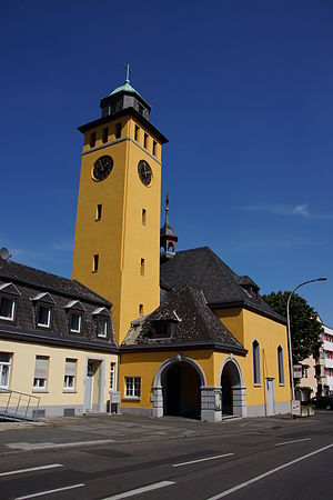
Pulheim (; Ripuarian: Pullem) is a town in the Rhein-Erft-Kreis, North Rhine-Westphalia, Germany. Since the 1920s, a large substation of the Rheinisch-Westfälisches Elektrizitätswerk AG (RWE) is located at Pulheim. It is the end of the North–South Powerline and a large control center for the power grid of the RWE. In the communal reform of 1975, several previously independent municipalities were added to the municipality Pulheim, which received city rights in 1981.

Brauweiler
Distance: Approx. 1470 meters
Latitude and longitude: 50.96666667,6.78333333
Brauweiler is a part of Pulheim, west of Cologne, North Rhine-Westphalia in Germany. The former Benedictine abbey, Brauweiler Abbey, founded 1024, is used today by the Rhein Department for the Care of Historic Monuments. In Brauweiler in the 1920s a large power transmission station was built, which supplied up to 380 kV. It was also the starting point of the north south powerline.

Frechen
Town in North Rhine-Westphalia, Germany
Distance: Approx. 5850 meters
Latitude and longitude: 50.91666667,6.81666667
Frechen (German pronunciation: [ˈfʁɛçn̩]; Ripuarian: Frechem) is a town in the Rhein-Erft District, North Rhine-Westphalia, Germany. Frechen was first mentioned in 877. It is situated at the western Cologne city border.

Brauweiler Abbey
Distance: Approx. 1164 meters
Latitude and longitude: 50.96111111,6.78277778
Brauweiler Abbey (German: Abtei Brauweiler) is a former Benedictine monastery located at Brauweiler, now in Pulheim near Cologne, North Rhine-Westphalia, in Germany. It is now used as a regional cultural center.

Köln-Weiden West station
Railway station in Cologne, Germany
Distance: Approx. 3972 meters
Latitude and longitude: 50.94061,6.81544
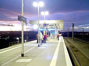
Köln-Weiden West is a railway station situated at Weiden, Cologne in the German state of North Rhine-Westphalia on the Cologne–Aachen railway. It is classified by Deutsche Bahn as a category 5 station.
Horrem station
Railway station in Kerpen, Germany
Distance: Approx. 5942 meters
Latitude and longitude: 50.916492,6.714768
Horrem station is a station in the Kerpen district of Horrem in the German state of North Rhine-Westphalia. It is a railway junction of the Cologne–Aachen high-speed railway and the Erft Railway (Horrem–Bedburg, connecting with Neuss). The triangular station of Horrem is served by regional services and by S-Bahn trains of the Rhine-Ruhr S-Bahn.

Frechen-Königsdorf station
Railway station in Germany
Distance: Approx. 2585 meters
Latitude and longitude: 50.93646349,6.77722138
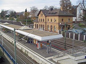
Frechen-Königsdorf station is a station in the village of Königsdorf in the German state of North Rhine-Westphalia on the Cologne–Aachen high-speed railway. The station was opened as Königsdorf on 6 September 1841 on a section of the Cologne–Aachen railway that was opened by the Rhenish Railway Company between Cologne and Müngersdorf at the same time. In the late 19th century, it was renamed Großkönigsdorf.

Pulheimer Bach
River in Germany
Distance: Approx. 5886 meters
Latitude and longitude: 50.9959,6.8263
Pulheimer Bach is a river of North Rhine-Westphalia, Germany.

Weiden Römergrab station
Railway station in Germany
Distance: Approx. 4903 meters
Latitude and longitude: 50.93833333,6.82861111
Weiden Römergrab is a Cologne Stadtbahn station served by line 1 and located on Aachener Straße in the district of Köln-Weiden. The station was renamed on December, 15th 2019 from Weiden Schulstraße to Weiden Römergrab.
Weiden Zentrum station
Distance: Approx. 5318 meters
Latitude and longitude: 50.93805556,6.835
Weiden Zentrum is a Kölner Verkehrs-Betriebe station. Line 1 of the Stadtbahn serves this station. The station is also served by buses, and buses on routes 141 and 149 terminate at the station.

Geyen
Ortsteil of Pulheim in North Rhine-Westphalia, Germany
Distance: Approx. 2925 meters
Latitude and longitude: 50.9818,6.7865
Geyen is a village, part of the town Pulheim in the Rhein-Erft-Kreis, North Rhine-Westphalia, Germany.

Pulheim station
Railway station in Pulheim, Germany
Distance: Approx. 4878 meters
Latitude and longitude: 50.998056,6.797222
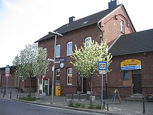
Pulheim is a station in the city of Pulheim in the German state of North Rhine-Westphalia. It is on the Cologne–Mönchengladbach railway. It lies between Köln-Bocklemünd station, which was closed the 1970s, and Stommeln station, 11.5 km from Köln-Ehrenfeld station.
Weather in this IP's area
scattered clouds
11 Celsius
10 Celsius
10 Celsius
14 Celsius
1023 hPa
70 %
1023 hPa
1013 hPa
10000 meters
2.57 m/s
80 degree
40 %
07:32:24
17:00:39

