Country:
 Ukraine
Region:
City:
Latitude and Longitude:
Time Zone:
Postal Code:
IP information under different IP Channel
ip-api
Country
Region
City
ASN
Time Zone
ISP
Blacklist
Proxy
Latitude
Longitude
Postal
Route
IPinfo
Country
Region
City
ASN
Time Zone
ISP
Blacklist
Proxy
Latitude
Longitude
Postal
Route
MaxMind
Country
Region
City
ASN
Time Zone
ISP
Blacklist
Proxy
Latitude
Longitude
Postal
Route
Luminati
Country
UAASN
Time Zone
Europe/Kyiv
ISP
Internet Invest, Ltd.
Latitude
Longitude
Postal
db-ip
Country
Region
City
ASN
Time Zone
ISP
Blacklist
Proxy
Latitude
Longitude
Postal
Route
ipdata
Country
Region
City
ASN
Time Zone
ISP
Blacklist
Proxy
Latitude
Longitude
Postal
Route
Popular places and events near this IP address

Zhuliany
Neighbourhood in the capital of Ukraine
Distance: Approx. 201 meters
Latitude and longitude: 50.39338056,30.44044722
Zhuliany (Ukrainian: Жуляни) is a neighbourhood in the south-west of Kyiv, the capital of Ukraine. It is a predominantly cottage-built area, part of the Solomianskyi district. As well as Troieshchyna, Zhuliany became a part of Kyiv municipality in 1988.

Kyiv International Airport (Zhuliany)
Airport in the capital of Ukraine, Kyiv
Distance: Approx. 1323 meters
Latitude and longitude: 50.40166667,30.45166667
Igor Sikorsky Kyiv International Airport (Zhuliany) (Ukrainian: Міжнародний аеропорт «Київ» імені Ігоря Сікорського (Жуляни)) (IATA: IEV, ICAO: UKKK) is one of the two passenger airports of the Ukrainian capital Kyiv, the other being Boryspil International Airport. It is owned by the municipality of Kyiv and located in the Zhuliany neighbourhood, about seven kilometres (four nautical miles) southwest of the city centre. Aside from facilitating regular passenger flights, Kyiv International Airport is also the main business aviation airport in Ukraine, and one of the busiest business aviation hubs in Europe.

Aircraft Repair Plant 410 (Kyiv)
Ukrainian aircraft services company
Distance: Approx. 2164 meters
Latitude and longitude: 50.4109,30.4367
Plant 410 Civil Aviation (Ukrainian: Завод 410 цивільної авіації) is a Ukrainian aircraft services company, based in Kyiv adjacent to the Kyiv Zhuliany International Airport. Primary services provided are repair of An-24, An-26, An-30, An-32 aircraft and their modifications; testing and restoration of An-72, An-74 aircraft and their modifications; repair of D-36 engines for Yak-42 and An-74 aircraft; maintenance of Ka-26 helicopters; repair of wheels and brake assembly of Boeing 737 aircraft. The company also operates ARP 410 Airlines, performing charter flights for cargo and passengers.

University of Kyiv Faculty of Radio Physics, Electronics and Computer Systems
Distance: Approx. 2320 meters
Latitude and longitude: 50.3825,30.47083333
Faculty of Radio Physics, Electronics and Computer Systems (formerly known as Faculty of Radiophysics) is a part of National Taras Shevchenko University of Kyiv and is devoted to the fundamental study in different branches of physics on the one hand and mathematics and electronics on the other.

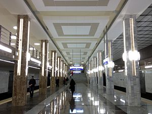
Vasylkivska (Kyiv Metro)
Kyiv Metro Station
Distance: Approx. 3309 meters
Latitude and longitude: 50.39333333,30.48805556
Vasylkivska (Ukrainian: Васильківська, ) is station on Kyiv Metro's Obolonsko–Teremkivska Line. It is named after the street which leads to Vasylkiv, south-west to capital Kyiv. The station was opened on 15 December 2010.

Academy of Technological Sciences of Ukraine
Distance: Approx. 3273 meters
Latitude and longitude: 50.3623,30.442
The Academy of Technological Sciences of Ukraine (ATS of Ukraine, ATSU) is a Ukrainian national academy, a public organization aiming at the consolidation of the intellectual and industrial-technological potential of applied scientists, technologists, and other experts in Ukraine.

Ukraine State Aviation Museum
Aviation museum in Kyiv, Ukraine
Distance: Approx. 2146 meters
Latitude and longitude: 50.407222,30.459444
The State Aviation Museum is an aviation museum located next to Zhulyany Airport in Kyiv, Ukraine. The museum offers both aircraft exhibits and interactive displays. The museum is one of the larger aviation museums displaying Soviet technology.

Vystavkovyi Tsentr (Kyiv Metro)
Kyiv Metro Station
Distance: Approx. 2753 meters
Latitude and longitude: 50.3825,30.4775
Vystavkovyi Tsentr (Ukrainian: Виставковий центр, , literally Exhibition Center) is a station on the Kyiv Metro's Obolonsko–Teremkivska Line, named after the exposition center that is located in the vicinity. Active construction began on this project in 2010 after the opening of the three new stations on the Obolonsko–Teremkivska Line from the former Lybidska terminus. The station is designed as shallow and has one underground vault, similarly to adjacent "Vasylkivska".
Ipodrom (Kyiv Metro)
Kyiv Metro Station
Distance: Approx. 2585 meters
Latitude and longitude: 50.37638889,30.46888889
Ipodrom (Ukrainian: Іподром, ) is a station on the Kyiv Metro's Obolonsko–Teremkivska Line that opened on 25 October 2012. It is located towards the southern end of the line, located just after the Vystavkovyi Tsentr station, opened a year earlier in late 2011, and before the Teremky station which opened on 6 November 2013. Ipodrom is named after Kyiv's horse racetrack and equestrian park which is located a short distance from the station.

Teremky (Kyiv Metro)
Kyiv Metro Station
Distance: Approx. 2889 meters
Latitude and longitude: 50.36704444,30.45420278
Teremky (Ukrainian: Теремки, ) is a station on the Kyiv Metro's Obolonsko–Teremkivska Line opened on 6 November 2013. It is the southern end of the line, located just after the Ipodrom station. The station is named after the Teremky neighborhood of Kyiv.

Teremky
Neighborhood of Kyiv in Holosiivskyi District, Ukraine
Distance: Approx. 2899 meters
Latitude and longitude: 50.36694444,30.45416667
Teremky (Ukrainian: Теремки) is a neighborhood located in the Holosiivskyi district of Kyiv, the capital of Ukraine. It is located in the southern part of the city, in between the city's Holosiiv, Feofaniia, and Zhuliany neighborhoods. The National Expocenter of Ukraine and Kyiv's Ipodrom horse racetrack are located in the neighborhood.

Odesa Square
Street in Kyiv, Ukraine
Distance: Approx. 2704 meters
Latitude and longitude: 50.37,30.45861111
Odesa Square (or Odeska Square; Ukrainian: Одеська площа, romanized: Odeska ploshcha) is one of the squares of Kyiv, Ukraine. It is located in the neighborhood Teremky in the Holosiiv Raion of Kyiv. It was named after big Ukrainian city port Odesa.
Weather in this IP's area
clear sky
7 Celsius
7 Celsius
7 Celsius
9 Celsius
1031 hPa
89 %
1031 hPa
1010 hPa
10000 meters
0.89 m/s
1.79 m/s
57 degree
8 %
07:27:19
17:58:40