Country:
Region:
City:
Latitude and Longitude:
Time Zone:
Postal Code:
IP information under different IP Channel
ip-api
Country
Region
City
ASN
Time Zone
ISP
Blacklist
Proxy
Latitude
Longitude
Postal
Route
Luminati
Country
ASN
Time Zone
Europe/Kyiv
ISP
ELEKS Ltd.
Latitude
Longitude
Postal
IPinfo
Country
Region
City
ASN
Time Zone
ISP
Blacklist
Proxy
Latitude
Longitude
Postal
Route
db-ip
Country
Region
City
ASN
Time Zone
ISP
Blacklist
Proxy
Latitude
Longitude
Postal
Route
ipdata
Country
Region
City
ASN
Time Zone
ISP
Blacklist
Proxy
Latitude
Longitude
Postal
Route
Popular places and events near this IP address
Galicia (Eastern Europe)
Historical region in Central Europe
Distance: Approx. 3184 meters
Latitude and longitude: 49.83,24.0142
Galicia ( gə-LISH-(ee-)ə; Polish: Galicja, IPA: [ɡaˈlit͡sja] ; Ukrainian: Галичина, romanized: Halychyna, IPA: [ɦɐlɪtʃɪˈnɑ]; Yiddish: גאַליציע, romanized: Galitsye; see below) is a historical and geographic region spanning what is now southeastern Poland and western Ukraine, long part of the Polish–Lithuanian Commonwealth. It covers much of the other historic regions of Red Ruthenia (centered on Lviv) and Lesser Poland (centered on Kraków). The name of the region derives from the medieval city of Halych, and was first mentioned in Hungarian historical chronicles in the year 1206 as Galiciæ.
Massacre of Lwów professors
1941 mass murder of Polish academics by Nazi forces in present-day Lviv, Ukraine
Distance: Approx. 3009 meters
Latitude and longitude: 49.8285,24.0135
In July 1941, 25 Polish academics from the city of Lwów (now Lviv, Ukraine) along with the 25 of their family members were killed by Nazi German occupation forces. By targeting prominent citizens and intellectuals for elimination, the Nazis hoped to prevent anti-Nazi activity and to weaken the resolve of the Polish resistance movement. According to an eyewitness the executions were carried out by an Einsatzgruppe unit (German: Einsatzkommando zur besonderen Verwendung) under the command of Karl Eberhard Schöngarth with the participation of Ukrainian translators in German uniforms.
Battle of Lemberg (1918)
1918 battle between during the Polish-Ukrainian war
Distance: Approx. 3184 meters
Latitude and longitude: 49.83,24.0142
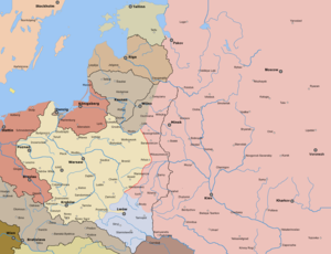
The Battle of Lemberg (Lviv, Lwów) (in Polish historiography called obrona Lwowa, the Defense of Lwów) took place from November 1918 to May 1919 and was a six-month long conflict in the region of Galicia following the dissolution of the Austro-Hungarian Empire. The battle was fought between forces of the local West Ukrainian People's Republic and urban Polish resistance, assisted later by the invading Polish military for the control over the city of Lviv. The battle sparked the Polish-Ukrainian War, ultimately won by Poland as both nations fought the Ukrainian-Soviet War and Polish-Soviet Wars concurrently.
SoftServe
Ukrainian information technology company
Distance: Approx. 1298 meters
Latitude and longitude: 49.81180556,23.98902778
SoftServe, Inc., founded in 1993 in Lviv, Ukraine, is a technology company specializing in consultancy services and software development. SoftServe provides services in the fields of big data, Internet of things, cloud computing, DevOps, e-commerce, computer security, experience design, and health care. With its United States headquarters in Austin, Texas and European headquarters in Lviv, Ukraine, the company employs more than 12,000 people in 58 offices in 14 countries.
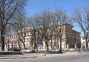
Lviv Secondary School No. 50
School in Lviv, Lviv Oblast, Ukraine
Distance: Approx. 2888 meters
Latitude and longitude: 49.82638889,24.01722222
School № 50 is the school of Russian and Ukrainian languages of instruction. Located in the city of Lviv, street Komaryntsya, 2.

Ukrainian National Forestry University
Public university in Lviv, Ukraine
Distance: Approx. 2479 meters
Latitude and longitude: 49.825,24.0033
The National Forestry and Wood-Technology University of Ukraine (Ukrainian: Національний лісотехнічний університет України) is a Ukrainian university in Lviv.

Frankivskyi District
Urban district in Lviv in Lviv Oblast, Ukraine
Distance: Approx. 959 meters
Latitude and longitude: 49.8111,23.9969
Frankívs’kyj District (Ukrainian: Франкі́вський райо́н) is an urban district in the city of Lviv, named after the Ukrainian writer and social activist Ivan Franko. This district covers the southwestern part of the city. It contains such neighborhoods as Vulka, Kastelivka, Novyi Svit and Kulparkiv.
Hetman Petro Sahaidachnyi National Ground Forces Academy
Military educational institution in Lviv, Ukraine
Distance: Approx. 2682 meters
Latitude and longitude: 49.8243,24.01736
The Hetman Petro Sahaidachny National Army Academy is one of the leading educational institutions in the military education system of the Ministry of Defense of Ukraine. The Academy trains future officers of the Ukrainian Armed Forces in facilities that have been used since 1899 by different governments for training infantry cadets and officers.

Leopolis Hotel
Hotel in Lviv, Ukraine
Distance: Approx. 314 meters
Latitude and longitude: 49.8,24
Leopolis Hotel is a hotel in Lviv, Ukraine opened in 2007. By 2011, it had twice been selected in the World Travel Awards as the best hotel in Ukraine. It was initially opened occupying just one building and featuring 43 rooms and suites.

Ukrainska Besida Theatre
First Ukrainian professional theatre (1864–1924)
Distance: Approx. 3183 meters
Latitude and longitude: 49.83,24.01416667
The Ukrainska Besida Theatre (Ukrainian: Театр Української Бесіди, romanized: Teatr Ukrainskoi Besidy, lit. 'Theatre of the Ukrainian conversation'; until 1916: Ruska Besida Theatre, Театр Руської Бесіди, Teatr Ruskoi Besidy) – was the first Ukrainian professional theatre in operation from 1864 to 1924. Its first performance took place in the premises of The Ukrainian National Home (Народний Дім) building in Lviv. The theatre was subsidized by the Ruska Besida Society in Lviv and occasionally supported by the Galician Diet.
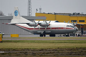
Ukraine Air Alliance Flight 4050
2019 aviation accident
Distance: Approx. 1663 meters
Latitude and longitude: 49.79138889,23.98555556
On 4 October 2019, Ukraine Air Alliance Flight 4050 crashed due to fuel exhaustion on approach to Lviv International Airport, during a flight from Vigo, Spain to Istanbul, Turkey via Lviv, Ukraine, killing five people, and three people were seriously injured. The aircraft was an Antonov An-12.

Lviv bus station
On Stryiska St in southern Lviv, Ukraine
Distance: Approx. 2125 meters
Latitude and longitude: 49.7867,24.0164
Lviv bus station (Ukrainian: Автовокзал «Львів», romanized: Avtovokzal "Lviv"; also known as Stryiska bus station) is the main bus station of Lviv, in western Ukraine. The station is located on Stryiska Street in the neighbourhood of Bodnarivka about 6 km (4 mi) south of the main train station. The building is modernist in nature, and has a triangular floor plan.
Weather in this IP's area
light rain
5 Celsius
0 Celsius
5 Celsius
5 Celsius
1009 hPa
62 %
1009 hPa
968 hPa
10000 meters
7.67 m/s
12.27 m/s
223 degree
58 %
07:41:24
16:37:21
