Country:
Region:
City:
Latitude and Longitude:
Time Zone:
Postal Code:
IP information under different IP Channel
ip-api
Country
Region
City
ASN
Time Zone
ISP
Blacklist
Proxy
Latitude
Longitude
Postal
Route
Luminati
Country
ASN
Time Zone
Europe/Paris
ISP
Societe Francaise Du Radiotelephone - SFR SA
Latitude
Longitude
Postal
IPinfo
Country
Region
City
ASN
Time Zone
ISP
Blacklist
Proxy
Latitude
Longitude
Postal
Route
db-ip
Country
Region
City
ASN
Time Zone
ISP
Blacklist
Proxy
Latitude
Longitude
Postal
Route
ipdata
Country
Region
City
ASN
Time Zone
ISP
Blacklist
Proxy
Latitude
Longitude
Postal
Route
Popular places and events near this IP address

Erdre
River in France
Distance: Approx. 3147 meters
Latitude and longitude: 47.21166667,-1.53944444
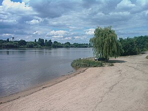
The Erdre (French pronunciation: [ɛʁdʁ]; Breton: Erzh) is a 97.4 km (60.5 mi) long river in western France, right tributary to the Loire. Its source is in the Maine-et-Loire department, near La Pouëze. It flows through the departments Maine-et-Loire and Loire-Atlantique.

Palais des Sports de Beaulieu
Distance: Approx. 2853 meters
Latitude and longitude: 47.20933056,-1.53672222
Palais des Sports de Beaulieu is an indoor sporting arena located in Nantes, France. Built in 1973, the seating capacity of the arena is for 5,500 people. It is currently home to the HBC Nantes handball team.

Saint-Sébastien-sur-Loire
Commune in Pays de la Loire, France
Distance: Approx. 958 meters
Latitude and longitude: 47.2081,-1.5014
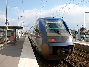
Saint-Sébastien-sur-Loire (French pronunciation: [sɛ̃ sebastjɛ̃ syʁ lwaʁ], literally Saint-Sébastien on Loire; Breton: Sant-Sebastian-an-Enk) is a commune in the Loire-Atlantique department in western France. It is the third-largest suburb of the city of Nantes, and is adjacent to it on the southeast, across the river Loire. It has two railway stations on the line to Clisson: Saint-Sébastien-Pas-Enchantés and Saint-Sébastien-Frêne-Rond.
Stade Marcel-Saupin
Distance: Approx. 3114 meters
Latitude and longitude: 47.2125,-1.53833333
The Stade Marcel-Saupin is a sports complex in the city of Nantes (Loire-Atlantique), France. It was opened in 1937 under the name Stade Malakoff, and was used primarily by Stade nantais université club for rugby union, then became the stadium of FC Nantes after World War II until the club moved to the Stade de la Beaujoire in 1984.

Basse-Goulaine
Commune in Pays de la Loire, France
Distance: Approx. 3396 meters
Latitude and longitude: 47.2161,-1.4642
Basse-Goulaine (French pronunciation: [bas ɡulɛn] ; Gallo: Bass-Góleinn, Breton: Goueled-Goulen) is a commune in the Loire-Atlantique department in western France. The commune is part of historical Brittany located in the Pays nantais (historical country) and in the Vignoble nantais (traditional country).

Vertou station
Distance: Approx. 2339 meters
Latitude and longitude: 47.18611111,-1.47805556
Vertou is a railway station in Vertou, Pays de la Loire, France. The station is located on the Nantes-Saintes railway.

Saint-Sébastien-Frêne-Rond station
Distance: Approx. 1116 meters
Latitude and longitude: 47.19027778,-1.49611111
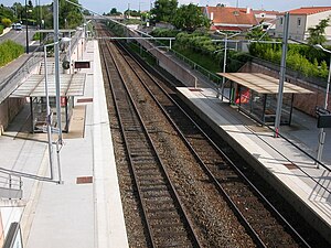
Saint-Sébastien-Frêne-Rond is a railway station in Saint-Sébastien-sur-Loire, Pays de la Loire, France. The station is located on the Nantes-Saintes railway.

Saint-Sébastien-Pas-Enchantés station
Distance: Approx. 1046 meters
Latitude and longitude: 47.20666667,-1.51083333
Saint-Sébastien-Pas-Enchantés is a railway station in Saint-Sébastien-sur-Loire, Pays de la Loire, France. The station is located on the Nantes-Saintes railway.

Château du Grand-Blottereau
Distance: Approx. 3046 meters
Latitude and longitude: 47.2262,-1.5107
The Château du Grand-Blottereau is a historic pavilion in Nantes, Loire-Atlantique, Pays de la Loire, France.

Assalam Mosque
Mosque in Nantes, France
Distance: Approx. 2546 meters
Latitude and longitude: 47.2195,-1.5182
The Assalam Mosque (French: Mosquée Assalam de Nantes) is a mosque located in Nantes, France. Construction on the mosque began in 2009 and was completed in 2012. It is the largest mosque in its region in France.
Lycée Nelson Mandela (Nantes)
Distance: Approx. 2540 meters
Latitude and longitude: 47.2084,-1.5328
Lycée Nelson Mandela is a senior high school in Nantes, France. It opened on 1 September 2014 with its official inauguration held four days later. As of 2016 the school has 140-160 teachers, 40-50 technical personnel, and 1,600 students.
Canton of Saint-Sébastien-sur-Loire
Distance: Approx. 153 meters
Latitude and longitude: 47.2,-1.5
The canton of Saint-Sébastien-sur-Loire is an administrative division of the Loire-Atlantique department, western France. It was created at the French canton reorganisation which came into effect in March 2015. Its seat is in Saint-Sébastien-sur-Loire.
Weather in this IP's area
fog
11 Celsius
11 Celsius
11 Celsius
11 Celsius
1021 hPa
100 %
1021 hPa
1019 hPa
500 meters
2.57 m/s
70 degree
100 %
07:55:30
17:43:42

