Country:
 Netherlands
Region:
City:
Latitude and Longitude:
Time Zone:
Postal Code:
IP information under different IP Channel
ip-api
Country
Region
City
ASN
Time Zone
ISP
Blacklist
Proxy
Latitude
Longitude
Postal
Route
IPinfo
Country
Region
City
ASN
Time Zone
ISP
Blacklist
Proxy
Latitude
Longitude
Postal
Route
MaxMind
Country
Region
City
ASN
Time Zone
ISP
Blacklist
Proxy
Latitude
Longitude
Postal
Route
Luminati
Country
NLASN
Time Zone
Europe/Amsterdam
ISP
Reseaux IP Europeens Network Coordination Centre (RIPE NCC)
Latitude
Longitude
Postal
db-ip
Country
Region
City
ASN
Time Zone
ISP
Blacklist
Proxy
Latitude
Longitude
Postal
Route
ipdata
Country
Region
City
ASN
Time Zone
ISP
Blacklist
Proxy
Latitude
Longitude
Postal
Route
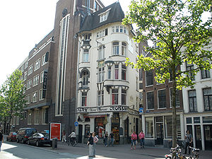
Popular places and events near this IP address

Royal Palace of Amsterdam
Palace on Dam Square in the centre of Amsterdam, Netherlands
Distance: Approx. 230 meters
Latitude and longitude: 52.37311111,4.89138889
The Royal Palace of Amsterdam in Amsterdam (Dutch: Koninklijk Paleis van Amsterdam or Paleis op de Dam) is one of three palaces in the Netherlands which are at the disposal of the monarch by Act of Parliament. It is situated on the west side of Dam Square in the centre of Amsterdam, opposite the War Memorial and next to the Nieuwe Kerk. The palace was built as a city hall during the Dutch Golden Age in the 17th century.

Singel
Street and canal in Amsterdam
Distance: Approx. 119 meters
Latitude and longitude: 52.3737,4.889
The Singel is one of the canals of Amsterdam. The Singel encircled Amsterdam in the Middle Ages, serving as a moat around the city until 1585, when Amsterdam expanded beyond the Singel. The canal runs from the IJ bay, near the Central Station, to the Muntplein square, where it meets the Amstel river.

Herengracht
Canal in Amsterdam
Distance: Approx. 186 meters
Latitude and longitude: 52.371265,4.886956
The Herengracht (Dutch pronunciation: [ˈɦeːrə(ŋ)ˌɣrɑxt]) is the second of four Amsterdam canals belonging to the canal belt and lies between the Singel and the Keizersgracht. The Gouden Bocht (Golden Bend) in particular is known for its large and beautiful canal houses.

Raadhuisstraat
Street in Amsterdam, the Netherlands
Distance: Approx. 34 meters
Latitude and longitude: 52.37305556,4.88777778
Raadhuisstraat is a street in Downtown Amsterdam, in the Netherlands. It is located between Nieuwezijds Voorburgwal and Prinsengracht. The street is named after the former City Hall or Town Hall, now the Royal Palace and it contains the gallery.

Nieuwezijds Voorburgwal
Street in Amsterdam
Distance: Approx. 211 meters
Latitude and longitude: 52.37365663,4.8908141
The Nieuwezijds Voorburgwal (Dutch pronunciation: [ˌniuəzɛitsˈfoːrbʏr(ə)xʋɑl]) is a street in the centre of Amsterdam. The street runs north-south without intersecting major streets other than the intersection with Raadhuisstraat at its halfway point, right behind the Royal Palace. On the eastern side, it has a number of alleys connecting to Kalverstraat and Nieuwendijk.

Burgwallen Nieuwe Zijde
Neighborhood of Amsterdam in North Holland, Netherlands
Distance: Approx. 227 meters
Latitude and longitude: 52.37418333,4.89050278
Burgwallen Nieuwe Zijde is a neighborhood of Amsterdam, Netherlands.

Magna Plaza
National monument in Amsterdam, Netherlands
Distance: Approx. 177 meters
Latitude and longitude: 52.3736,4.8903
The former Amsterdam Main Post Office, now the Magna Plaza shopping centre, is a monumental building located at Nieuwezijds Voorburgwal 182 in Amsterdam, Netherlands. It was built in 1895–1899 in neo-Gothic and neo-Renaissance style. The building has been a rijksmonument (Dutch national monument) since 9 July 1974, and is part of the Top 100 Dutch heritage sites.
Spuistraat
Former canal, now street, in Amsterdam
Distance: Approx. 99 meters
Latitude and longitude: 52.373056,4.889444
The Spuistraat in downtown Amsterdam connects the Hekelveld to the Spui. It runs roughly north to south, parallel to the Singel and the Nieuwezijds Voorburgwal. At the Royal Palace of Amsterdam, the Spuistraat crosses the Raadhuisstraat and Paleisstraat.

Vrankrijk
Communal living space established by squatters and self-managed social centre in Amsterdam
Distance: Approx. 147 meters
Latitude and longitude: 52.371667,4.889167
Vrankrijk is a legalised squat and self-managed social centre on the Spuistraat in central Amsterdam. There is an events space on the ground floor and above it a separate housing group.

Bungehuis
Office building in Amsterdam (Netherlands)
Distance: Approx. 114 meters
Latitude and longitude: 52.37205,4.8892
The Bungehuis is a monumental office building on the Spuistraat, Amsterdam, built in 1934. In 1971 the building was rented by the University of Amsterdam, which used it to house the department of humanities and later purchased it. The building is a Rijksmonument.

Tabakspanden
Buildings in central Amsterdam, squatted until 2015 and now redeveloped
Distance: Approx. 158 meters
Latitude and longitude: 52.37173,4.88957
The Tabakspanden are a group of buildings standing on the Spuistraat in central Amsterdam, adjacent to the Keizerrijk and Wijdesteeg alleyways. Named after a former owner, the speculator Hendrik Tabak, they were mostly squatted from 1983 onwards, although the artist Peter Klashorst also rented an apartment and gallery space. The best known building was Spuistraat 199, known as the Slangenpand (Snakehouse) because of the large mural which covered the front exterior.

Apollohal
Distance: Approx. 182 meters
Latitude and longitude: 52.37317,4.89066
The Apollohal is an indoor sports hall located in Amsterdam, Netherlands. Built in 1934 as a tennis hall, the complex was later designated for expositions and ice skating. Since it was renovated in 2004–2005, it has mainly been used as basketball hall.
Weather in this IP's area
few clouds
14 Celsius
13 Celsius
13 Celsius
15 Celsius
1028 hPa
77 %
1028 hPa
1027 hPa
10000 meters
3.09 m/s
330 degree
20 %
07:16:56
19:53:38