192.94.45.204 - IP Lookup: Free IP Address Lookup, Postal Code Lookup, IP Location Lookup, IP ASN, Public IP
Country:
Region:
City:
Location:
Time Zone:
Postal Code:
ISP:
ASN:
language:
User-Agent:
Proxy IP:
Blacklist:
IP information under different IP Channel
ip-api
Country
Region
City
ASN
Time Zone
ISP
Blacklist
Proxy
Latitude
Longitude
Postal
Route
db-ip
Country
Region
City
ASN
Time Zone
ISP
Blacklist
Proxy
Latitude
Longitude
Postal
Route
IPinfo
Country
Region
City
ASN
Time Zone
ISP
Blacklist
Proxy
Latitude
Longitude
Postal
Route
IP2Location
192.94.45.204Country
Region
pennsylvania
City
west chester
Time Zone
America/New_York
ISP
Language
User-Agent
Latitude
Longitude
Postal
ipdata
Country
Region
City
ASN
Time Zone
ISP
Blacklist
Proxy
Latitude
Longitude
Postal
Route
Popular places and events near this IP address

West Goshen Township, Pennsylvania
Township in Pennsylvania, United States
Distance: Approx. 1884 meters
Latitude and longitude: 39.9725,-75.58277778
West Goshen Township is a township in Chester County, Pennsylvania, United States. The population was 23,040 at the 2020 census. In 2013, Money magazine ranked West Goshen as the 10th-best place to live in the nation.
Henderson High School (Pennsylvania)
High school in West Chester, Pennsylvania, United States
Distance: Approx. 1371 meters
Latitude and longitude: 39.9678,-75.5991
B. Reed Henderson High School is located partially in the borough of West Chester and partially in West Goshen Township in Pennsylvania. B. Reed Henderson is one of the three high schools (Henderson, East, and Rustin) in the West Chester Area School District. It serves portions of the following municipalities: West Chester borough, West Goshen Township, East Bradford Township, and West Whiteland Township.

West Chester station (West Chester Railroad)
Train station in West Chester, Pennsylvania
Distance: Approx. 2113 meters
Latitude and longitude: 39.9609,-75.6004
The West Chester station, formerly the Market Street Station, is an American train station that is located on Market Street in West Chester, Pennsylvania. It currently serves as a stop on the West Chester Railroad heritage railroad. The location was previously used as a stop on the Pennsylvania Railroad's (PRR) West Chester Branch, and later became a part of SEPTA's R3 West Chester Line.

Oaklands Cemetery
Rural cemetery in West Chester, Pennsylvania, USA
Distance: Approx. 1587 meters
Latitude and longitude: 39.9799,-75.6213
Oaklands Cemetery is a rural cemetery founded in 1854 in West Goshen Township, Pennsylvania. It is located at 1042 Pottstown Pike and is approximately 26 acres (0.11 km2) in size.
Ice Line Quad Rinks
Ice arena in Pennsylvania, U.S.
Distance: Approx. 1606 meters
Latitude and longitude: 39.98299,-75.58434
Ice Line Quad Rinks is an ice arena in West Chester, Pennsylvania, United States. The building consists of four NHL-regulation ice surfaces- each with a seating capacity of 500, concession area, and other amenities. The rink is the home of a number of programs, including: West Chester University of Pennsylvania men's ice hockey teams competing at the ACHA Division I level in the ESCHL and JV team at the ACHA DII level in the Colonial States College Hockey Conference (CSCHC).
Joseph Rothrock House
Historic house in Pennsylvania, United States
Distance: Approx. 1892 meters
Latitude and longitude: 39.96361111,-75.60944444
Joseph Rothrock House is a historic home located in West Chester, Chester County, Pennsylvania. It was built in 1858–59, and consists if a 2+1⁄2-story, three-bay main section with a 2+1⁄2-story gabled ell in the Gothic style. Later additions have been made to the ell.

Collins Mansion
Historic house in Pennsylvania, United States
Distance: Approx. 544 meters
Latitude and longitude: 39.975,-75.60388889
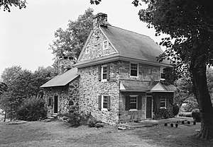
Collins Mansion, also known as the Joseph Collins House, is a historic home located in West Goshen Township, Chester County, Pennsylvania. It was built in 1727, and is a 2+1⁄2-story stone dwelling with a serpentine stone facade and fieldstone sidewalls. It was extensively renovated in 1758–1760.
Barclay House (West Chester, Pennsylvania)
Historic house in Pennsylvania, United States
Distance: Approx. 1542 meters
Latitude and longitude: 39.96694444,-75.60944444
Barclay House, also known as the Joshua Hartshorne Estate, North Hill, and The Barclay, is a historic home located in West Chester, Chester County, Pennsylvania. The original section was built in 1866–67, and believed to have been designed by architect Addison Hutton (1834–1916). It was a 2+1⁄2-story, brick dwelling in the Italianate style.
West Chester Boarding School for Boys
United States historic place
Distance: Approx. 1690 meters
Latitude and longitude: 39.96472222,-75.605
The West Chester Boarding School for Boys, also known as Square House, is an historic, American boarding school and national historic district located in West Chester, Chester County, Pennsylvania. The building was listed on the National Register of Historic Places in 1990.
Sharples Separator Works
United States historic place
Distance: Approx. 1648 meters
Latitude and longitude: 39.965,-75.6025
The Sharples Separator Works, also known as the Gumas Warehouse and Kauffman Warehouse, is an historic, American factory complex that is located in West Chester, Chester County, Pennsylvania. It was listed on the National Register of Historic Places in 1984.

Chester County Hospital
Hospital in West Chester, Pennsylvania
Distance: Approx. 937 meters
Latitude and longitude: 39.97138889,-75.60222222
Chester County Hospital is a private, non-profit, 329-bed teaching hospital located primarily in West Chester, Pennsylvania. Opened in 1892, the hospital joined University of Pennsylvania Health System in 2013. The hospital's main campus is located in both West Chester and West Goshen Township, with satellite locations located in West Goshen, Jennersville, Exton, New Garden, and Kennett Square.

United States Post Office (West Chester, Pennsylvania)
Historic post office in Pennsylvania
Distance: Approx. 2062 meters
Latitude and longitude: 39.9613,-75.6038
US Post Office-West Chester, also called the Robert J. Thompson Post Office Building, is a historic post office located in West Chester, Chester County, Pennsylvania. It was designed by architect James Knox Taylor for the Office of the Supervising Architect, and built in 1907 in the neoclassical style. It was constructed with Cockeysville Marble taken from a quarry near Avondale, Pennsylvania.
Weather in this IP's area
clear sky
-10 Celsius
-10 Celsius
-12 Celsius
-9 Celsius
1022 hPa
77 %
1022 hPa
1005 hPa
10000 meters
0.45 m/s
0.89 m/s
339 degree
6 %


