192.88.255.132 - IP Lookup: Free IP Address Lookup, Postal Code Lookup, IP Location Lookup, IP ASN, Public IP
Country:
Region:
City:
Location:
Time Zone:
Postal Code:
ISP:
ASN:
language:
User-Agent:
Proxy IP:
Blacklist:
IP information under different IP Channel
ip-api
Country
Region
City
ASN
Time Zone
ISP
Blacklist
Proxy
Latitude
Longitude
Postal
Route
db-ip
Country
Region
City
ASN
Time Zone
ISP
Blacklist
Proxy
Latitude
Longitude
Postal
Route
IPinfo
Country
Region
City
ASN
Time Zone
ISP
Blacklist
Proxy
Latitude
Longitude
Postal
Route
IP2Location
192.88.255.132Country
Region
pennsylvania
City
coraopolis
Time Zone
America/New_York
ISP
Language
User-Agent
Latitude
Longitude
Postal
ipdata
Country
Region
City
ASN
Time Zone
ISP
Blacklist
Proxy
Latitude
Longitude
Postal
Route
Popular places and events near this IP address

Coraopolis, Pennsylvania
Borough in Pennsylvania, United States
Distance: Approx. 2320 meters
Latitude and longitude: 40.51581667,-80.16279167
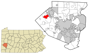
Coraopolis () is a borough in Allegheny County, Pennsylvania, United States, along the Ohio River. The population was 5,559 at the 2020 census. Coraopolis is located west of Pittsburgh along the Ohio River and to the east of the Pittsburgh International Airport.

Carnot-Moon, Pennsylvania
Census-designated place in Pennsylvania, United States
Distance: Approx. 2478 meters
Latitude and longitude: 40.51777778,-80.21166667
Carnot-Moon is a census-designated place (CDP) in central Moon Township, Allegheny County, Pennsylvania, United States. The population was 13,151 at the 2020 census.

Robert Morris University
Private university in Moon Township, Pennsylvania, U.S.
Distance: Approx. 2595 meters
Latitude and longitude: 40.5206,-80.2107
Robert Morris University (RMU) is a private university in Moon Township, Pennsylvania, United States. It was founded in 1921 and is named after Robert Morris, known as the "financier of the American Revolution". It enrolls nearly 5,000 students and offers 60 bachelor's degree programs and 35 master's and doctoral programs.

Moon Area School District
School district in western Pennsylvania
Distance: Approx. 1671 meters
Latitude and longitude: 40.493,-80.197
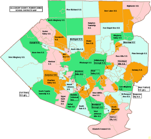
The Moon Area School District is located about 16 miles northwest of Pittsburgh, Pennsylvania. It serves a portion of the West Hills/Airport Area and comprises Crescent and Moon townships, which include unincorporated villages such as Glenwillard, Wireton, Coraopolis Heights, Thorn Hollow, West Coraopolis, Carnot, Thorn Run Valley, and Mooncrest. Moon Area School District encompasses approximately 31 square miles.
Our Lady of the Sacred Heart High School (Coraopolis)
Private, coeducational school in Coraopolis, , Pennsylvania, United States
Distance: Approx. 2568 meters
Latitude and longitude: 40.50222222,-80.15694444
Our Lady of the Sacred Heart High School is a private Catholic high school in Moon Township, Pennsylvania. Located in the Roman Catholic Diocese of Pittsburgh, it is a ministry of the Felician Sisters. Among students and in colloquial terms, it is referred to as OLSH .

Cornell School District (Allegheny County, Pennsylvania)
School district in Pennsylvania, USA
Distance: Approx. 2038 meters
Latitude and longitude: 40.507915,-80.162968
Cornell School District is a diminutive, suburban public school district in Allegheny County, Pennsylvania. The district encompasses approximately 2 square miles. According to 2000 federal census data, it serves a resident population of 7,363.

Coraopolis station
Disused train station in Pennsylvania, US
Distance: Approx. 2426 meters
Latitude and longitude: 40.51888889,-80.16388889
Coraopolis station is a disused train station in Coraopolis, Pennsylvania. The train station was built in 1896 by the Pittsburgh and Lake Erie Railroad, and designed by architects Shepley, Rutan and Coolidge in Richardsonian Romanesque style.

Coraopolis Armory
United States historic place
Distance: Approx. 2148 meters
Latitude and longitude: 40.51945278,-80.16883889
Coraopolis Armory is an armory located at 835 5th Avenue in Coraopolis, Pennsylvania. It was built in 1938, and was added to the National Register of Historic Places on November 14, 1991. It houses the Headquarters Company, 28th Signal Battalion, Pennsylvania National Guard Army Reserve.

899 Old Thorn Run Road
Historic site in Pennsylvania, United States
Distance: Approx. 1513 meters
Latitude and longitude: 40.517175,-80.19687778
899 Old Thorn Run Road in Moon Township, Pennsylvania, was built in 1814. The house was added to the List of Pittsburgh History and Landmarks Foundation Historic Landmarks in 1988.

Cornell High School
School
Distance: Approx. 1980 meters
Latitude and longitude: 40.51105,-80.16451
Cornell High School is a public high school located in the borough of Coraopolis, Pennsylvania, a suburb of Pittsburgh in Allegheny County in the state of Pennsylvania. Cornell High School serves students from the borough of Coraopolis, as well as Neville Township or Neville Island as it is more commonly called. The school's mascot are the Raiders, and the colors are blue and gold.

Mooncrest Historic District
Historic district in Pennsylvania, United States
Distance: Approx. 2038 meters
Latitude and longitude: 40.52402222,-80.19027778
Mooncrest Historic District is a historic district in Moon Township, Pennsylvania, USA. This community was built during World War II as housing for defense workers. Mooncrest residents produced armor plate, munitions, and ships at the nearby Dravo Corporation on Neville Island. The district was listed on the National Register of Historic Places on September 18, 2013.
North Athletic Complex
Distance: Approx. 2610 meters
Latitude and longitude: 40.519083,-80.212405
The North Athletic Complex is a softball, soccer, and basketball venue in Pittsburgh, Pennsylvania, United States. It is home to the Robert Morris Colonials softball and soccer teams of the NCAA Division I Northeast Conference. The venue has a capacity of 500.
Weather in this IP's area
clear sky
-18 Celsius
-25 Celsius
-19 Celsius
-17 Celsius
1037 hPa
72 %
1037 hPa
993 hPa
10000 meters
3.09 m/s
300 degree