192.74.215.42 - IP Lookup: Free IP Address Lookup, Postal Code Lookup, IP Location Lookup, IP ASN, Public IP
Country:
Region:
City:
Location:
Time Zone:
Postal Code:
ISP:
ASN:
language:
User-Agent:
Proxy IP:
Blacklist:
IP information under different IP Channel
ip-api
Country
Region
City
ASN
Time Zone
ISP
Blacklist
Proxy
Latitude
Longitude
Postal
Route
db-ip
Country
Region
City
ASN
Time Zone
ISP
Blacklist
Proxy
Latitude
Longitude
Postal
Route
IPinfo
Country
Region
City
ASN
Time Zone
ISP
Blacklist
Proxy
Latitude
Longitude
Postal
Route
IP2Location
192.74.215.42Country
Region
california
City
berkeley
Time Zone
America/Los_Angeles
ISP
Language
User-Agent
Latitude
Longitude
Postal
ipdata
Country
Region
City
ASN
Time Zone
ISP
Blacklist
Proxy
Latitude
Longitude
Postal
Route
Popular places and events near this IP address

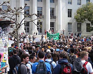
Sproul Plaza
Distance: Approx. 220 meters
Latitude and longitude: 37.869597,-122.25885
Sproul Plaza (pronounced [spraʊɫ]) is one center of student activity at the University of California, Berkeley. It is divided into two sections: Upper Sproul and Lower Sproul. They are vertically separated by twelve feet (3.7 m) and linked by a set of stairs.

University of California, Berkeley student housing
Distance: Approx. 188 meters
Latitude and longitude: 37.8678,-122.2552
Housing at the University of California, Berkeley, includes student housing facilities run by the office of Residential and Student Service Programs (RSSP). Housing is also offered by off-campus entities such as fraternities and sororities and the Berkeley Student Cooperative (BSC).

Southside, Berkeley, California
Neighborhood of Berkeley, California, US
Distance: Approx. 277 meters
Latitude and longitude: 37.8678,-122.259
Southside, also known by the older names South of Campus or South Campus, is a neighborhood in Berkeley, California. Southside is located directly south of and adjacent to the University of California, Berkeley campus. Because of the large student presence in the neighborhood, proximity to Sproul Plaza, and history of the area, Southside is the neighborhood most closely associated with the university.
Miller Institute
Distance: Approx. 168 meters
Latitude and longitude: 37.86795,-122.257468
The Miller Institute for Basic Research in Science was established on the University of California, Berkeley, campus in 1955 after Adolph C. Miller and his wife, Mary Sprague Miller, made a donation to the university. It was their wish that the donation be used to establish an institute "dedicated to the encouragement of creative thought and conduct of pure science". The Miller Institute sponsors Miller Research Professors, Visiting Miller Professors and Miller Research Fellows.

UC Berkeley School of Law
Public law school in Berkeley, California
Distance: Approx. 275 meters
Latitude and longitude: 37.86986,-122.25339
The University of California, Berkeley School of Law (Berkeley Law) is the law school of the University of California, Berkeley. The school was commonly referred to as "Boalt Hall" for many years, although it was never the official name. This came from its initial building, the Boalt Memorial Hall of Law, named for John Henry Boalt.

California Field
College football stadium in Berkeley, California
Distance: Approx. 77 meters
Latitude and longitude: 37.8697,-122.257
California Field was an outdoor college football stadium on the west coast of the United States, located on the campus of the University of California in Berkeley. It served as the home field for the California Golden Bears from 1904 through 1922.
Berkeley APEC Study Center
Research center at the University of California
Distance: Approx. 166 meters
Latitude and longitude: 37.87,-122.258
The Berkeley APEC Study Center (BASC) is a research center at the University of California, Berkeley. Created in 1996 in response to an initiative by U.S. President Bill Clinton, the center undertakes research, disseminates information and facilitates discussion on issue related to APEC (Asia-Pacific Economic Cooperation) involving political, economic and business trends in the Asia-Pacific region. The Berkeley center is part of the APEC Study Centers Consortium (ASCC), a network of over a hundred research institutions and university centers across twenty APEC member economies.

Graduate Berkeley
Hotel in Berkeley, California
Distance: Approx. 134 meters
Latitude and longitude: 37.868,-122.2563
The Graduate by Hilton Berkeley is a historic boutique hotel located in Berkeley, California in the United States. It is located in downtown Berkeley, just off campus of the University of California, Berkeley. The hotel is listed on the Berkeley register of historic places.
George and Mary Foster Anthropology Library
Distance: Approx. 121 meters
Latitude and longitude: 37.869843,-122.255285
The George and Mary Foster Anthropology Library is one of the subject specialty libraries at University of California, Berkeley, and is one of only three anthropology libraries at American research universities. The library supports the University of California, Berkeley anthropology department.
College Women's Club
United States historic place
Distance: Approx. 78 meters
Latitude and longitude: 37.869222,-122.255514
The College Women's Club was a women's club founded in 1920 based in Berkeley, California. It organized Berkeley's first cooperative day nursery and established scholarships.

Moses Hall
Building at U.C. Berkeley
Distance: Approx. 249 meters
Latitude and longitude: 37.871,-122.25809
Moses Hall, formerly known as Eshelman Hall, is a historic building on the campus of the University of California, Berkeley in Berkeley, California. It was built in 1931, and designed in the Tudor Revival and Gothic Revival styles by architect George W. Kelham. It was first named for John Morton Eshleman, and it was renamed for Bernard Moses in 1963.

Hearst Gymnasium for Women
Historic place in Berkeley, California
Distance: Approx. 42 meters
Latitude and longitude: 37.8694,-122.2568
Hearst Gymnasium for Women, now called the Hearst Memorial Gymnasium, is a historical building in Berkeley, California. The Hearst Gymnasium for Women was built in 1927. The building and it site was listed on the National Register of Historic Places on March 25, 1982.
Weather in this IP's area
mist
8 Celsius
7 Celsius
6 Celsius
9 Celsius
1022 hPa
86 %
1022 hPa
1014 hPa
2414 meters
1.54 m/s
90 degree
40 %
