192.67.166.114 - IP Lookup: Free IP Address Lookup, Postal Code Lookup, IP Location Lookup, IP ASN, Public IP
Country:
Region:
City:
Location:
Time Zone:
Postal Code:
IP information under different IP Channel
ip-api
Country
Region
City
ASN
Time Zone
ISP
Blacklist
Proxy
Latitude
Longitude
Postal
Route
Luminati
Country
ASN
Time Zone
America/Chicago
ISP
MCFASSOC
Latitude
Longitude
Postal
IPinfo
Country
Region
City
ASN
Time Zone
ISP
Blacklist
Proxy
Latitude
Longitude
Postal
Route
IP2Location
192.67.166.114Country
Region
new hampshire
City
canaan
Time Zone
America/New_York
ISP
Language
User-Agent
Latitude
Longitude
Postal
db-ip
Country
Region
City
ASN
Time Zone
ISP
Blacklist
Proxy
Latitude
Longitude
Postal
Route
ipdata
Country
Region
City
ASN
Time Zone
ISP
Blacklist
Proxy
Latitude
Longitude
Postal
Route
Popular places and events near this IP address

Canaan, New Hampshire
Town in New Hampshire, United States
Distance: Approx. 1901 meters
Latitude and longitude: 43.64666667,-72.01027778
Canaan is a town in Grafton County, New Hampshire, United States. The population was 3,794 at the 2020 census. It is the location of Mascoma State Forest.

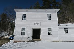
Orange, New Hampshire
Town in New Hampshire, United States
Distance: Approx. 2770 meters
Latitude and longitude: 43.65388889,-71.97138889
Orange is a town in Grafton County, New Hampshire, United States. The population was 277 at the 2020 census, down from 331 at the 2010 census.
Canaan Street Lake
Lake in Grafton County, New Hampshire
Distance: Approx. 2643 meters
Latitude and longitude: 43.66666667,-72.03583333
Canaan Street Lake is a 291-acre (118 ha) water body located in Grafton County in western New Hampshire, United States, in the town of Canaan. It is part of the Mascoma River watershed, a tributary of the Connecticut River. A peninsula on the north side of the lake is occupied by the Cardigan Mountain School.
Indian River (New Hampshire)
River in New Hampshire, United States
Distance: Approx. 5032 meters
Latitude and longitude: 43.64833333,-72.0625
The Indian River is a 12.8-mile-long (20.6 km) river in western New Hampshire in the United States. It is a tributary of the Mascoma River, which in turn flows to the Connecticut River and ultimately Long Island Sound. The Indian River rises in the southern corner of the town of Dorchester and flows south in a broad valley to the west of Mount Cardigan.

Cardigan Mountain School
Private boarding school in New Hampshire, US
Distance: Approx. 3315 meters
Latitude and longitude: 43.67583333,-72.04055556
Cardigan Mountain School, also called Cardigan or CMS, for short, is an all-boys independent boarding school for grades six through nine, located on 62 Alumni Drive, Canaan, New Hampshire, United States. It was founded in 1945 on land provided by Dartmouth College. It is a member of the National Association of Independent Schools (NAIS), the Association of Boarding Schools (TABS), the Junior Boarding Schools Association (JBSA), and the Independent Schools Association of Northern New England (ISANNE).
Noyes Academy
Racially integrated school in New Hampshire, est. 1835
Distance: Approx. 1344 meters
Latitude and longitude: 43.656,-72.017
The Noyes Academy was a racially integrated school, which also admitted women, founded by New England abolitionists in 1835 in Canaan, New Hampshire, near Dartmouth College, whose then-abolitionist president, Nathan Lord, was "the only seated New England college president willing to admit black students to his college".: 264 The school was unpopular with many local residents who opposed having blacks in the town. After some months, several hundred white men of Canaan and neighboring towns demolished the academy. They replaced it with Canaan Union Academy, restricted to whites.

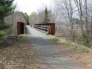
Northern Rail Trail (New Hampshire)
Rail trail from Lebanon to Boscawen, New Hampshire, USA
Distance: Approx. 7051 meters
Latitude and longitude: 43.65027778,-72.08916667
The Northern Recreational Rail Trail, also known as the Northern Rail Trail, is a 58-mile (93 km) multi-use rail trail in western New Hampshire, USA, running from Lebanon to Boscawen. It uses the right-of-way of the Boston and Maine Railroad's former Northern Line, which was acquired by the State of New Hampshire in 1996. The trail is managed by the New Hampshire Bureau of Trails.
Canaan Meetinghouse
Historic church in New Hampshire, United States
Distance: Approx. 3181 meters
Latitude and longitude: 43.66527778,-72.04277778
The Canaan Meetinghouse is a historic meeting house on Canaan Street in Canaan, New Hampshire. Built in 1794, with some subsequent alterations, it is a good example of a Federal period meeting house, serving as a center of town civic and religious activity for many years. The building was listed on the National Register of Historic Places in 1972, and included in the Canaan Street Historic District the following year.
Canaan (CDP), New Hampshire
Census-designated place in New Hampshire, United States
Distance: Approx. 1951 meters
Latitude and longitude: 43.64638889,-72.01111111
Canaan is a census-designated place (CDP) and the main village in the town of Canaan in Grafton County, New Hampshire, United States. The population of the CDP was 442 at the 2020 census, out of 3,794 in the entire town.
Canaan Street Historic District
Historic district in New Hampshire, United States
Distance: Approx. 3138 meters
Latitude and longitude: 43.6656,-72.0422
The Canaan Street Historic District encompasses the historic original town center of Canaan, New Hampshire. It is a basically linear district, running along Canaan Street roughly from Prospect Hill Road in the north to Moss Flower Lane in the south. The town flourished first as a stagecoach stop, and then as a resort colony in the late 19th century.
Canaan Motor Club
American race track
Distance: Approx. 1499 meters
Latitude and longitude: 43.64972222,-72.00027778
The Canaan Motor Club (CMC) is a race track in Canaan, New Hampshire, in the United States. The CMC is a 1.3-mile-long (2.1 km) technically challenging road course with extensive runoff areas to promote a safe environment for all track users. The track may be run in both directions to give a total of 2.6 miles (4.2 km) with nine major turns.
Mascoma State Forest
State Forest in Grafton County, New Hampshire
Distance: Approx. 4798 meters
Latitude and longitude: 43.67583333,-72.06027778
Mascoma State Forest is an area of forested land in Canaan in Grafton County, New Hampshire, on the west side of the Mascoma River. As of 2007, the tract covers 216 acres (87 ha). The forest borders the 900-acre Bear Pond Natural Area.
Weather in this IP's area
overcast clouds
-8 Celsius
-15 Celsius
-10 Celsius
-7 Celsius
1001 hPa
66 %
1001 hPa
965 hPa
10000 meters
7.43 m/s
15.15 m/s
310 degree
98 %

