192.62.209.218 - IP Lookup: Free IP Address Lookup, Postal Code Lookup, IP Location Lookup, IP ASN, Public IP
Country:
Region:
City:
Location:
Time Zone:
Postal Code:
ISP:
ASN:
language:
User-Agent:
Proxy IP:
Blacklist:
IP information under different IP Channel
ip-api
Country
Region
City
ASN
Time Zone
ISP
Blacklist
Proxy
Latitude
Longitude
Postal
Route
db-ip
Country
Region
City
ASN
Time Zone
ISP
Blacklist
Proxy
Latitude
Longitude
Postal
Route
IPinfo
Country
Region
City
ASN
Time Zone
ISP
Blacklist
Proxy
Latitude
Longitude
Postal
Route
IP2Location
192.62.209.218Country
Region
florida
City
hudson
Time Zone
America/New_York
ISP
Language
User-Agent
Latitude
Longitude
Postal
ipdata
Country
Region
City
ASN
Time Zone
ISP
Blacklist
Proxy
Latitude
Longitude
Postal
Route
Popular places and events near this IP address

Bayonet Point, Florida
CDP in Florida, United States
Distance: Approx. 4700 meters
Latitude and longitude: 28.32277778,-82.68388889
Bayonet Point is a census-designated place (CDP) in Pasco County, Florida, United States. As of the 2010 Census, the population was 23,467.

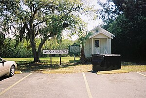
Hudson, Florida
CDP in Florida, United States
Distance: Approx. 679 meters
Latitude and longitude: 28.36111111,-82.68722222
Hudson is a census-designated place (CDP) located at the westernmost end of Pasco County, Florida, United States, and is included in the Tampa-St. Petersburg-Clearwater, Florida Metropolitan Statistical Area. As of the 2020 census, Hudson's population was 12,944.

Jasmine Estates, Florida
CDP in Florida, United States
Distance: Approx. 7859 meters
Latitude and longitude: 28.29361111,-82.69166667
Jasmine Estates is a census-designated place (CDP) in Pasco County, Florida, United States. The population was 18,989 according to the 2010 census.

Hudson Beach, Florida
Unincorporated community in Florida, U.S.
Distance: Approx. 36 meters
Latitude and longitude: 28.364448,-82.693434
Hudson Beach is a small unincorporated beach community, west of U.S. Route 19 in Pasco County, Florida, United States. The community has canals crisscrossing it, and the residences have canals in their backyard. It is just north of Port Richey.

Werner-Boyce Salt Springs State Park
State park in Florida, United States
Distance: Approx. 5678 meters
Latitude and longitude: 28.31694444,-82.715
Werner-Boyce Salt Springs State Park is a Florida state park located in Pasco County, Florida near Port Richey, Florida, along the Gulf of Mexico on the Atlantic coastal plain. An entrance to this park is at the intersection of Scenic Drive and Cinema Drive, one mile west of the intersection of Cinema Drive/Ridge Manor Blvd. and U.S. Highway 19.
Hudson High School (Florida)
Public high school in Hudson, Florida , United States
Distance: Approx. 4685 meters
Latitude and longitude: 28.366201,-82.645421
Hudson High School (HHS) is a public high school in Hudson, Florida, located between Hudson Academy and Hudson Primary Academy. The school opened in 1973 with grades 9 through 12; the first graduating class was in 1974. The current principal is Alondra Beatty-Woodall.

Aripeka, Florida
Census-designated place & Unincorporated Community in Florida, United States
Distance: Approx. 8088 meters
Latitude and longitude: 28.43222222,-82.66416667
Aripeka is an unincorporated community and census-designated place (CDP) in the U.S. state of Florida, along the coast of the Gulf of Mexico at the border dividing Pasco and Hernando counties. The ZIP Code for the community is 34679, but it was originally assigned as 33502. As of the 2020 census, the population was 320.
Fivay, Florida
Human settlement in Florida
Distance: Approx. 4540 meters
Latitude and longitude: 28.33111111,-82.66611111
Fivay was a settlement in Florida, midway between present-day Land O’ Lakes and Hudson. Fivay existed as a company town for a lumber mill for less than a decade, and it started out being known as Five A’s. Its designation came from the owners of the sawmill, whose names all started with “A.” Martin Amorous, Preston Arkwright, Henry Atkinson, Gordon Abbott, and Charles Ayer.
Fivay High School
Public school in the United States
Distance: Approx. 4834 meters
Latitude and longitude: 28.333617,-82.658169
Fivay High School is a public high school located in Pasco County, Florida, located on State Road 52. Opened on August 16, 2010, the school was built for 1,870 students from Hudson High School, Ridgewood High School, and River Ridge High School which had been experiencing overcrowding.
Aripeka Sandhills Preserve
Distance: Approx. 7176 meters
Latitude and longitude: 28.42,-82.6565
Aripeka Sandhills Preserve is a protected area of 209 acres (85 ha) west of US 19 near Aripeka and Hudson, Florida. It is managed by the Southwest Florida Water Management District and was purchased on November 8, 2007, as part of the 7,136-acre (2,888 ha) Weeki Wachee Preserve (now more than 11,200 acres (4,500 ha)). It is part of a group of conservation lands extending north to the Crystal River Buffer Preserve (now a Florida State Park), helping preserve the southernmost coastal hardwood hammock in western Florida.
Gulf View Square
Shopping mall in Florida, United States
Distance: Approx. 8101 meters
Latitude and longitude: 28.2935,-82.7128
Gulf View Square Mall is an enclosed mall in Port Richey, Florida. Opened in 1980, it is anchored by Best Buy & Dillard's Clearance Store and is owned by Namdar Realty Group.

Pasco County Library Cooperative
Distance: Approx. 1664 meters
Latitude and longitude: 28.3532,-82.6817
The Pasco County Library Cooperative (PCLC) is the public library system that serves all residents of Pasco County, Florida, and is a member of the Tampa Bay Library Consortium. The Pasco County Library System, as it was originally known, was established by county ordinance in 1980. In 1999, the Pasco County Public Library Cooperative was established as a result of an Interlocal Agreement between the Pasco County Board of County Commissioners and the Zephyrhills City Council.
Weather in this IP's area
clear sky
24 Celsius
25 Celsius
23 Celsius
27 Celsius
1022 hPa
71 %
1022 hPa
1021 hPa
10000 meters
3.75 m/s
3.34 m/s
280 degree