192.62.204.169 - IP Lookup: Free IP Address Lookup, Postal Code Lookup, IP Location Lookup, IP ASN, Public IP
Country:
 USA
USARegion:
City:
Location:
Time Zone:
Postal Code:
ISP:
ASN:
language:
User-Agent:
Proxy IP:
Blacklist:
IP information under different IP Channel
ip-api
Country
Region
City
ASN
Time Zone
ISP
Blacklist
Proxy
Latitude
Longitude
Postal
Route
db-ip
Country
Region
City
ASN
Time Zone
ISP
Blacklist
Proxy
Latitude
Longitude
Postal
Route
IPinfo
Country
Region
City
ASN
Time Zone
ISP
Blacklist
Proxy
Latitude
Longitude
Postal
Route
IP2Location
192.62.204.169Country
usRegion
california
City
wasco
Time Zone
America/Los_Angeles
ISP
Language
User-Agent
Latitude
Longitude
Postal
ipdata
Country
Region
City
ASN
Time Zone
ISP
Blacklist
Proxy
Latitude
Longitude
Postal
Route
Popular places and events near this IP address
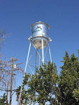
Wasco, California
City in California, United States
Distance: Approx. 3439 meters
Latitude and longitude: 35.595,-119.38388889
Wasco (formerly, Dewey and Deweyville) is a city in the San Joaquin Valley, in Kern County, California, United States. Wasco is located 24 miles (39 km) northwest of Bakersfield, at an elevation of 328 feet (100 m). The population was 25,545 at the 2010 census, up from 21,263 at the 2000 census.

Wasco Airport
Airport in Wasco, California
Distance: Approx. 2904 meters
Latitude and longitude: 35.61972222,-119.35361111
Wasco Airport (FAA LID: L19), also known as Wasco-Kern County Airport, is a public airport located two miles (3.2 km) northwest of Wasco, serving Kern County, California, USA. This general aviation airport covers 158 acres (64 ha) and has one runway.
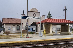
Wasco station
Distance: Approx. 1268 meters
Latitude and longitude: 35.5941,-119.3319
Wasco station is an Amtrak station on the San Joaquins line located in Wasco, California, United States. The station has one platform on the west side of a single track.

KERN
Radio station in Wasco-Greenacres, California
Distance: Approx. 3245 meters
Latitude and longitude: 35.57138889,-119.32388889
KERN (1180 AM) is a commercial radio station licensed to Wasco-Greenacres, California, and serving the Bakersfield metropolitan area. The station is owned by American General Media. The radio studios and offices are in the American General Media complex at 1400 Easton Drive, STE 134 in Bakersfield.
Wasco Union High School
Public school in Wasco, California, United States
Distance: Approx. 48 meters
Latitude and longitude: 35.59472222,-119.34555556
Wasco Union High School (WUHS) is a public American senior high school in Wasco, California. The school is part of the Wasco Union High School District and takes in incoming freshmen from the Wasco Union School District, Maple School District, Lost Hills Union School District, Semitropic School District, St. John's Catholic School, and North Kern Christian School.

Wasco State Prison
American prison in California
Distance: Approx. 5685 meters
Latitude and longitude: 35.5939,-119.4087
Wasco State Prison-Reception Center (WSP) is a 634-acre (257 ha) state prison located in Wasco in Kern County, California. The Wasco facility was the first of two reception centers in Kern County. The primary mission is to provide short term housing necessary to process, classify, and evaluate new inmates physically and mentally, to determine their security level, program requirements, and appropriate institutional placement.

Shafter Research Station
United States historic place
Distance: Approx. 9348 meters
Latitude and longitude: 35.53111111,-119.27805556
Shafter Research Station is an agricultural research station near Shafter, Kern County, California, in the San Joaquin Valley. The station was established in 1922 by the U.S. Department of Agriculture (USDA) as Shafter Cotton Research Station. It was built to provide California with high-quality cotton.

Shafter Cotton Research Station
Historic site in Kern County, California
Distance: Approx. 9235 meters
Latitude and longitude: 35.53245,-119.278067
The Shafter Cotton Research Station is a California Historical Landmark, located at 17053 Shafter Avenue just north of the town of Shafter, California. Built in 1922 by the U.S. Department of Agriculture (USDA), the station became California Historical Landmark No. 1022 on March 3, 1997.
Weather in this IP's area
overcast clouds
4 Celsius
4 Celsius
4 Celsius
4 Celsius
1021 hPa
75 %
1021 hPa
1008 hPa
10000 meters
100 %