Country:
 USA
USARegion:
City:
Latitude and Longitude:
Time Zone:
Postal Code:
IP information under different IP Channel
ip-api
Country
Region
City
ASN
Time Zone
ISP
Blacklist
Proxy
Latitude
Longitude
Postal
Route
IPinfo
Country
Region
City
ASN
Time Zone
ISP
Blacklist
Proxy
Latitude
Longitude
Postal
Route
MaxMind
Country
Region
City
ASN
Time Zone
ISP
Blacklist
Proxy
Latitude
Longitude
Postal
Route
Luminati
Country
USRegion
hi
City
kapolei
ASN
Time Zone
Pacific/Honolulu
ISP
TWC-20001-PACWEST
Latitude
Longitude
Postal
db-ip
Country
Region
City
ASN
Time Zone
ISP
Blacklist
Proxy
Latitude
Longitude
Postal
Route
ipdata
Country
Region
City
ASN
Time Zone
ISP
Blacklist
Proxy
Latitude
Longitude
Postal
Route
Popular places and events near this IP address
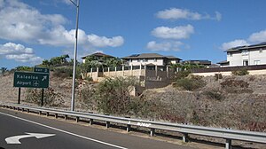
Kalaeloa, Hawaii
Census-designated place in Hawaii, United States
Distance: Approx. 2336 meters
Latitude and longitude: 21.32444444,-158.08305556
Kalaeloa (Hawaiian pronunciation: [kəlɐe̯ˈlowə]) is a census-designated place (CDP) in Honolulu County, Hawaii, United States. The population was 2,364 at the 2020 census. The community occupies the location of the former Naval Air Station Barbers Point, which was closed in 1999 and subsequently transferred to the State of Hawaiʻi.

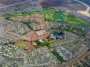
Makakilo, Hawaii
Census-designated place in Hawaii, United States
Distance: Approx. 1071 meters
Latitude and longitude: 21.35277778,-158.09083333
Makakilo (Hawaiian pronunciation: [məkəˈtilo]) or Makakilo City is a census-designated place and residential area located in the ʻEwa District on the island of Oʻahu in the City & County of Honolulu, United States. In Hawaiian, maka kilo means "observing eyes". As of the 2020 census, the CDP had a population of 19,877.
Kapolei, Hawaii
Census-designated place in Hawaii, United States
Distance: Approx. 1239 meters
Latitude and longitude: 21.33472222,-158.08083333
Kapolei (Hawaiian pronunciation: [kəpoˈlej]) is a planned community in the City and County of Honolulu, Hawaiʻi, United States, on the island of Oʻahu. It is colloquially known as the "second city" of Oʻahu, in relation to Honolulu. For statistical purposes, the United States Census Bureau has defined Kapolei as a census-designated place (CDP) within the consolidated city-county of Honolulu.

University of Hawaiʻi – West Oʻahu
Public university in Kapolei, Hawaii, US
Distance: Approx. 3082 meters
Latitude and longitude: 21.3552,-158.0564
The University of Hawaiʻi – West Oʻahu (UHWO) is a public college in Kapolei, Hawaii. It is part of the University of Hawaiʻi system. It offers baccalaureate degrees in liberal arts and professional studies.
Hawaii College of Pharmacy
Unaccredited Pharm.D. school in Hawaii, US
Distance: Approx. 1256 meters
Latitude and longitude: 21.3344,-158.0815
The Hawaii College of Pharmacy (HICP) was an unaccredited Pharm.D. school in Hawaii owned and operated by Pacific Educational Services. After an investigation by the State of Hawaii's department for consumer protection for not following its regulations on non-accredited schools, it was shut down and its owners prohibited from running any business in Hawaii again. It is alleged that the college did not follow requirements for disclosure on not being accredited.
Wet'n'Wild Hawaii
Water park in Kapolei, Oahu, Hawaii
Distance: Approx. 1216 meters
Latitude and longitude: 21.335,-158.08777778
Wet'n'Wild Hawaii (formerly Hawaiian Waters Adventure Park) is a Hawaiian water park, located in Kapolei in the City and County of Honolulu on Oahu. The park occupies 29 acres (120,000 m2) of land and has more than 25 rides and attractions. It is currently the only water park in the state of Hawaii.

Island Pacific Academy
Private, independent, college-prep school in the United States
Distance: Approx. 1433 meters
Latitude and longitude: 21.333083,-158.080194
Island Pacific Academy (IPA) is a private, independent, co-educational, college-preparatory school serving grades K-12, with a current enrollment of approximately 550 students. Located in Kapolei, Hawaii, IPA was founded in 2004 and enrolled its first students in September 2004. IPA's team name is the Navigators.
Kapolei High School
Public, co-educational school in Kapolei, Hawaii, United States
Distance: Approx. 3192 meters
Latitude and longitude: 21.33504167,-158.05549
Kapolei High School, located in Kapolei community, in the City and County of Honolulu, Hawaii, United States, on the Island of Oahu, is a public high school. It is a part of the Hawaii Department of Education. On July 24, 2000, Kapolei opened with first-year students.

Hawaii Tokai International College
Two-year college in Kapolei, Hawaii, U.S.
Distance: Approx. 3047 meters
Latitude and longitude: 21.357985,-158.058105
Hawaii Tokai International College (HTIC) is an American two-year liberal arts college located in Kapolei, Hawaii. It was established in Honolulu on May 22, 1992, in the Mo‘ili‘ili community neighboring Waikiki. Initially called "Tokai International College," its first academic term began on October 8, 1992.
Ko Olina Resort
Census-designated place in the United States
Distance: Approx. 3675 meters
Latitude and longitude: 21.3375,-158.11861111
Ko Olina Resort is a 642-acre (2.60 km2) master-planned vacation and residential community on the leeward coast of Oahu, 17 miles (27 km) west of Honolulu. Ko Olina has 2 miles (3.2 km) of coastal frontage and includes three natural and four man-made lagoons with white-sand beaches. The master-planned resort community, owned by Honolulu-based The Resort Group, is home to four hotel and vacation-club resorts: Aulani, a Disney Resort & Spa, Marriott's Ko Olina Beach Club, the Beach Villas at Ko Olina and The Four Seasons Resort O'ahu at Ko Olina, and villa homes at Ko Olina Kai, Kai Lani, Coconut Plantation, and Hillside.
Naval Air Museum Barbers Point
Military museum
Distance: Approx. 3506 meters
Latitude and longitude: 21.3148,-158.0762
Naval Air Museum Barbers Point was a military museum in Kapolei, Hawaii. The museum preserved the history of the co-located Naval Air Station Barbers Point. Its exhibits included former U.S. Navy, U.S. Coast Guard, and U.S. Marine Corps aircraft including the McDonnell Douglas F-4 Phantom II, Douglas A-4 Skyhawk, Lockheed P-3C Orion, and Sikorsky UH-3H Sea King, among others.
Kualakaʻi station
Honolulu Skyline station
Distance: Approx. 3383 meters
Latitude and longitude: 21.345555,-158.051569
Kualakaʻi station (also known as East Kapolei station) is an elevated Skyline metro station in East Kapolei, Hawaiʻi. The station is located alongside Kualakaʻi Parkway above its intersection with Keahumoa Parkway. The station opened on June 30, 2023, and serves as the western terminus of the line.
Weather in this IP's area
few clouds
28 Celsius
29 Celsius
26 Celsius
28 Celsius
1013 hPa
59 %
1013 hPa
1000 hPa
10000 meters
5.66 m/s
50 degree
20 %
06:17:42
18:42:54