Country:
 USA
USARegion:
City:
Latitude and Longitude:
Time Zone:
Postal Code:
IP information under different IP Channel
ip-api
Country
Region
City
ASN
Time Zone
ISP
Blacklist
Proxy
Latitude
Longitude
Postal
Route
IPinfo
Country
Region
City
ASN
Time Zone
ISP
Blacklist
Proxy
Latitude
Longitude
Postal
Route
MaxMind
Country
Region
City
ASN
Time Zone
ISP
Blacklist
Proxy
Latitude
Longitude
Postal
Route
Luminati
Country
USRegion
hi
City
honolulu
ASN
Time Zone
Pacific/Honolulu
ISP
TWC-20001-PACWEST
Latitude
Longitude
Postal
db-ip
Country
Region
City
ASN
Time Zone
ISP
Blacklist
Proxy
Latitude
Longitude
Postal
Route
ipdata
Country
Region
City
ASN
Time Zone
ISP
Blacklist
Proxy
Latitude
Longitude
Postal
Route
Popular places and events near this IP address
ʻIolani School
Private, independent preparatory school in Honolulu, Hawaii, United States
Distance: Approx. 760 meters
Latitude and longitude: 21.2865,-157.82456667
ʻIolani School is a private coeducational college preparatory school in Honolulu, Hawaiʻi. It serves over 2,200 students with a boarding program for grades 9 - 12 as well as a summer boarding program for middle school grades. Founded in 1863 by Father William R. Scott, it was the principal school of the former Anglican Church of Hawaiʻi.
Honolulu Stadium
Stadium in Honolulu
Distance: Approx. 21 meters
Latitude and longitude: 21.293,-157.827
Honolulu Stadium was a multi-purpose stadium located in the Moʻiliʻili district of Honolulu, Hawai'i, at the corner of King and Isenberg Streets. Opened in 1926, it was the primary sports venue in Hawaiʻi preceding Aloha Stadium. During its final years, the stadium could hold about 25,000 fans; it was demolished in 1976.
University Laboratory School
Public charter school, college-prep school in Honolulu, Hawaiʻi, United States
Distance: Approx. 762 meters
Latitude and longitude: 21.297866,-157.821635
University Laboratory School (ULS) is a charter school in Honolulu, Hawai‘i, United States, and it serves students from grades K-12. Prior to 2002, the school was known as the Education Laboratory School or University High School (for grades 9 through 12) when it was a part of the College of Education at the University of Hawaiʻi at Mānoa.
Oahu Interscholastic Association
Distance: Approx. 513 meters
Latitude and longitude: 21.2919,-157.822
The Oahu Interscholastic Association (OIA) is an athletic conference composed of all public secondary schools on the island of Oahu, Hawaii, U.S.A. The OIA was first founded in 1940 as the Rural Oahu Interscholastic Association (ROIA). The five founding schools were Castle High School, Kahuku High School, Leilehua High School, Waialua High & Intermediate School and Waipahu High School. The OIA originally comprised all the rural schools on Oahu, which were all of the schools that were not situated in the main city of Honolulu.

Mōʻiliʻili, Hawaii
Neighborhood of Honolulu, Hawaii, United States
Distance: Approx. 525 meters
Latitude and longitude: 21.29166667,-157.82194444
Mōʻiliʻili, Hawaii is a neighborhood of Honolulu CDP, City and County of Honolulu, Hawaii, on the island of Oahu. Its name means “pebble lizard” in Hawaiian. The commercial district at South King Street and University Avenue in Mōʻiliʻili is the closest such district to the University of Hawaiʻi at Mānoa.
Lutheran High School of Hawaii
Private school in the United States
Distance: Approx. 644 meters
Latitude and longitude: 21.29583333,-157.82138889
Lutheran High School of Hawaii (LHSH) was a Lutheran High School located on the grounds of Our Redeemer Lutheran Church at 1404 University Avenue in Honolulu on Oahu, Hawaii. LHSH was accredited by the Western Association of Schools and Colleges (WASC), the Hawaii Association of Independent Schools (HAIS), and National Lutheran School Accreditation (NLSA), and was a member of the Interscholastic League of Honolulu (ILH) and PAC-5 sports programs. The school announced its closing at the end of the 2015-16 school year.
Church of the Crossroads
Historic church in Hawaii, United States
Distance: Approx. 700 meters
Latitude and longitude: 21.29888889,-157.82444444
The Church of the Crossroads building at 1212 University Avenue in Honolulu, Hawaii was designed in 1935 by Claude A. Stiehl, who combined features of Asian, European, and Hawaiian architecture. It was listed on the National Register of Historic Places in 1992. The buildings on the attractively landscaped 2.25-acre (9,100 m2) lot are built of wood, stucco, and stone with decorative elements.
Varsity International School
Private school in Hawaii, United States
Distance: Approx. 575 meters
Latitude and longitude: 21.29168,-157.821445
Varsity International School is an independent, private co-educational high school in Honolulu, Hawaii. The school is nonsectarian.

Hiroshima to Honolulu Friendship Torii
Half-size replica of the torii at Itsukushima Shrine
Distance: Approx. 405 meters
Latitude and longitude: 21.292602,-157.822914
The Hiroshima to Honolulu Friendship Torii is a half-size replica of the torii at Itsukushima Shrine (Japanese: 厳島神社 Itsukushima-jinja) located in the Mōʻiliʻili Triangle Park of Honolulu, Hawaii. The replica torii was presented as a gift from Honolulu's sister-city, Hiroshima, where the original torii is located. Although intended as an offering of friendship, this torii caused controversy for using state funds to pay for a religious monument.

Marco Polo condo fire
2017 condominium fire in Honolulu, Hawaii, US
Distance: Approx. 637 meters
Latitude and longitude: 21.28749722,-157.82848056
The Marco Polo condo fire was a high-rise fire that occurred at 2:17 p.m. on July 14, 2017, in the 36-story Marco Polo condominium building at 2333 Kapiolani Boulevard in the McCully-Mōʻiliʻili neighborhood of Honolulu, Hawaii. 4 people were killed, and 13 others (including 1 firefighter) were injured.

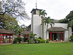
Japanese Cultural Center of Hawaii
Cultural and community center for Japanese-Americans in Hawaii
Distance: Approx. 362 meters
Latitude and longitude: 21.293955,-157.823466
The Japanese Cultural Center of Hawaii (JCCH, Japanese: ハワイ日本文化センター, Hawai Nihon Bunka Sentā) is a cultural center and history museum in Moiliili, Hawaii that focuses on the Japanese-American experience in Hawaii, especially internment.
Honolulu Japanese Chamber of Commerce
Distance: Approx. 348 meters
Latitude and longitude: 21.294056,-157.823643
The Honolulu Japanese Chamber of Commerce (ホノルル日本人商工会議所) is a business organization that promotes economic growth in Hawaii and Japan.
Weather in this IP's area
scattered clouds
28 Celsius
30 Celsius
27 Celsius
29 Celsius
1013 hPa
61 %
1013 hPa
1012 hPa
10000 meters
5.66 m/s
50 degree
40 %
06:16:42
18:41:50