Country:
Region:
City:
Latitude and Longitude:
Time Zone:
Postal Code:
IP information under different IP Channel
ip-api
Country
Region
City
ASN
Time Zone
ISP
Blacklist
Proxy
Latitude
Longitude
Postal
Route
Luminati
Country
Region
ca
City
hemet
ASN
Time Zone
America/Los_Angeles
ISP
TWC-20001-PACWEST
Latitude
Longitude
Postal
IPinfo
Country
Region
City
ASN
Time Zone
ISP
Blacklist
Proxy
Latitude
Longitude
Postal
Route
db-ip
Country
Region
City
ASN
Time Zone
ISP
Blacklist
Proxy
Latitude
Longitude
Postal
Route
ipdata
Country
Region
City
ASN
Time Zone
ISP
Blacklist
Proxy
Latitude
Longitude
Postal
Route
Popular places and events near this IP address

Hemet, California
City in California, United States
Distance: Approx. 5161 meters
Latitude and longitude: 33.7475,-116.97194444
Hemet is a city in the San Jacinto Valley in Riverside County, California. It covers a total area of 29.3 square miles (76 km2), about half of the valley, which it shares with the neighboring city of San Jacinto. The population was 89,833 at the 2020 census.

Area code 951
Area code for western Riverside County, California
Distance: Approx. 1935 meters
Latitude and longitude: 33.73333333,-117.01666667
Area code 951 is a telephone area code in the North American Numbering Plan for western Riverside County in the southern part of the U.S. state of California. It was assigned in 2004 to a new numbering plan area that was created by an area code split of area code 909.

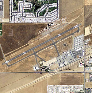
Hemet-Ryan Airport
Airport
Distance: Approx. 1654 meters
Latitude and longitude: 33.73388889,-117.0225
Hemet-Ryan Airport (IATA: HMT, ICAO: KHMT, FAA LID: HMT) is three miles (6 km) southwest of Hemet, in Riverside County, California. Hemet-Ryan is a main Cal Fire Air Attack Base, also used for civil purposes, Civil Air Patrol meetings, and more. It is home to a Riverside County Sheriff's Office aviation unit and a Mercy Air air ambulance.
Hemet Public Library
Library in Hemet, CA
Distance: Approx. 5395 meters
Latitude and longitude: 33.74972222,-116.96944444
The Hemet Public Library is a public library in Hemet, California, United States which opened its current building in July 2003.

Reinhardt Canyon
Distance: Approx. 2914 meters
Latitude and longitude: 33.75888889,-117.05638889
Reinhardt Canyon is located in the Lakeview Mountains, just west of Hemet in Riverside County, California. The prehistoric petroglyph known as the Hemet Maze Stone, California Historical Landmark No. 557, is located in the canyon.
West Valley High School (Hemet, California)
Public high school in Hemet, California, United States
Distance: Approx. 3610 meters
Latitude and longitude: 33.71944444,-117.00944444
West Valley High School is a high school that serves around 1,800 students on the western side of Hemet, California. The school is accredited by the WASC Accrediting Commission for Schools and also has become an AVID Demonstration School. The West Valley High School mascot is a Mustang.

Hemet Maze Stone
Petroglyph in California, United States
Distance: Approx. 4564 meters
Latitude and longitude: 33.7814,-117.05646944
The Hemet Maze Stone is a prehistoric petroglyph. It is just outside Hemet, in Reinhardt Canyon, within the Lakeview Mountains, in Riverside County, California. On April 16, 1956, Mr.
Tahquitz High School
Public school in California, United States
Distance: Approx. 2357 meters
Latitude and longitude: 33.768,-117.019
Established in August 2007, Tahquitz High School (Tah-quitz) is a high school of approximately 1700 students on the northwestern side of Hemet, California operated by the Hemet Unified School District. The high school's mascot is a 'titan warrior' school colors are green and gold. Kari McGowan was the school principal at the start of the 2023-2024 school year.

Western Science Center
Museum in Hemet, California, United States
Distance: Approx. 5746 meters
Latitude and longitude: 33.70527778,-116.99305556
The Western Science Center (WSC), formerly the Western Center for Archaeology & Paleontology, is a museum located near Diamond Valley Lake in Hemet, California. The WSC is home to a large collection of Native American artifacts and Ice Age fossils that were unearthed at Diamond Valley Lake, including "Max", the largest mastodon found in the western United States, and "Xena", a Columbian mammoth, as well as dinosaur fossils recovered from New Mexico. Opened in 2006, the museum has been designed to provide world-class facilities for the research, curation, and presentation of the nearly one million specimens discovered during the development of Diamond Valley Lake in Hemet.

Domenigoni Mountains
Mountain range in California
Distance: Approx. 5886 meters
Latitude and longitude: 33.6953,-117.0311375
The Domenigoni Mountains are a mountain range in Riverside County, California. They lie north of the Menifee Valley and south of the Perris Valley and San Jacinto Valley, west and north of Diamond Valley and north of Domenigoni Valley. The Domenigoni Mountains are composed primarily of metamorphic rock of the Triassic - Jurassic French Valley formation within Searls Ridge and the 1967 foot summit across the saddle to the west of it.

Green Acres, California
Census-designated place in California, United States
Distance: Approx. 4909 meters
Latitude and longitude: 33.735,-117.07833333
Green Acres is a census-designated place in Riverside County, California. Green Acres sits at an elevation of 1,555 feet (474 m). The 2010 United States census reported Green Acres's population was 1,805.
Hemet Valley Mall
Shopping mall in Hemet, California, United States
Distance: Approx. 2963 meters
Latitude and longitude: 33.7487,-116.9957
Hemet Valley Mall is a small enclosed shopping mall in Hemet, California. It is located on West Florida Avenue (California State Route 74) between North Kirby Street and North Gilmore Street. It is anchored by J.C. Penney and Hobby Lobby, with one vacant anchor last occupied by Sears.
Weather in this IP's area
scattered clouds
11 Celsius
9 Celsius
9 Celsius
15 Celsius
1014 hPa
35 %
1014 hPa
960 hPa
10000 meters
0.5 m/s
0.61 m/s
47 degree
25 %
06:15:08
16:48:57