Country:
 USA
USARegion:
City:
Latitude and Longitude:
Time Zone:
Postal Code:
IP information under different IP Channel
ip-api
Country
Region
City
ASN
Time Zone
ISP
Blacklist
Proxy
Latitude
Longitude
Postal
Route
IPinfo
Country
Region
City
ASN
Time Zone
ISP
Blacklist
Proxy
Latitude
Longitude
Postal
Route
MaxMind
Country
Region
City
ASN
Time Zone
ISP
Blacklist
Proxy
Latitude
Longitude
Postal
Route
Luminati
Country
USRegion
ca
City
sandiego
ASN
Time Zone
America/Los_Angeles
ISP
TWC-20001-PACWEST
Latitude
Longitude
Postal
db-ip
Country
Region
City
ASN
Time Zone
ISP
Blacklist
Proxy
Latitude
Longitude
Postal
Route
ipdata
Country
Region
City
ASN
Time Zone
ISP
Blacklist
Proxy
Latitude
Longitude
Postal
Route
Popular places and events near this IP address

Westview High School (San Diego)
Public school in San Diego, California
Distance: Approx. 2696 meters
Latitude and longitude: 32.96711944,-117.14903611
Westview High School is a public high school in Torrey Highlands, a community of San Diego, California, United States. It is part of the Poway Unified School District. Westview uses a 4 by 4 block schedule for each school year.

Black Mountain Open Space Park
Open space park and nature area in San Diego, CA, USA
Distance: Approx. 1773 meters
Latitude and longitude: 32.981712,-117.116422
Black Mountain Open Space Park is a city park in the suburbs of San Diego, California.
Mt. Carmel High School (San Diego)
High school in San Diego, California
Distance: Approx. 106 meters
Latitude and longitude: 32.96666667,-117.12111111
Mt. Carmel High School (MCHS) is a public high school in Rancho Peñasquitos, a community of San Diego, California, United States. It is part of the Poway Unified School District.

Rancho Peñasquitos, San Diego
Community of San Diego in California, United States
Distance: Approx. 862 meters
Latitude and longitude: 32.9594,-117.115575
Rancho Peñasquitos is a suburban community in northeastern San Diego, California. It is named after the first Mexican land grant in San Diego County, Rancho Santa Maria de Los Peñasquitos. (Peñasquitos is Spanish for "little cliffs".) The community abuts Los Peñasquitos Canyon Preserve, an open space preserve that offers hiking, biking, and equestrian trails.

Black Mountain Ranch, San Diego
Community of San Diego in California
Distance: Approx. 4146 meters
Latitude and longitude: 33.002041,-117.131853
Black Mountain Ranch is a suburban community in the northern part of San Diego, California. Black Mountain Ranch encompasses 5,100 acres (21 km2) and is located north of Rancho Peñasquitos and Torrey Highlands, south of the Santa Fe Valley, east of Fairbanks Ranch and Rancho Santa Fe, and west of 4S Ranch. The development of Black Mountain Ranch took over 17 years to complete and was led by Fred Maas, a local San Diego businessman with a background in politics and sustainable building practices.
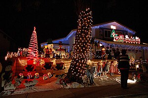
Christmas Card Lane
Holiday light display in San Diego, California
Distance: Approx. 925 meters
Latitude and longitude: 32.96825,-117.12977
Christmas Card Lane is a holiday light display in San Diego, California in the community of Rancho Penasquitos. It is one of the most famous holiday displays in San Diego. Residents erect giant plywood greetings in their front yards depicting cartoon characters, religious images, or Christmas themes.

Carmel Mountain Ranch, San Diego
Community of San Diego in California
Distance: Approx. 4043 meters
Latitude and longitude: 32.97785278,-117.07923889
Carmel Mountain Ranch, sometimes shortened to simply Carmel Mountain, or abbreviated to CMR by local residents and organizations, is a community of San Diego, California, United States, in the northeastern part of the city. Despite its name, Carmel Mountain Ranch is actually in the shadow of Black Mountain. Carmel Mountain proper is about 10 miles west of the Carmel Mountain Ranch neighborhood.

Sabre Springs, San Diego
Community of San Diego in California
Distance: Approx. 2676 meters
Latitude and longitude: 32.952,-117.097
Sabre Springs is a community in San Diego, California, located in the northeastern part of the city. It is bounded by the city limits of Poway on the east, Ted Williams Parkway on the north, Interstate 15 on the west, and the community of Miramar Ranch North to the south. Sabre Springs is bisected north-south by Poway Road.

Torrey Highlands, San Diego
Community of San Diego in California
Distance: Approx. 3617 meters
Latitude and longitude: 32.96841111,-117.15882778
Torrey Highlands is a primarily residential community in northern San Diego, California. Most of the community has been developed from 2000 to present.
Rancho Santa Maria de Los Peñasquitos
Historic ranch in San Diego, California
Distance: Approx. 3192 meters
Latitude and longitude: 32.938,-117.127
Rancho Santa Maria de Los Peñasquitos was a 8,486-acre (34.34 km2) Mexican land grant in present-day southwestern San Diego County, California, given in 1823 to Francisco María Ruiz. The name means "Saint Mary of the Little Cliffs". It encompassed the present-day communities of Mira Mesa, Carmel Valley, and Rancho Peñasquitos in northern San Diego, and was inland from the Torrey Pines State Natural Preserve bluffs.

Los Peñasquitos Creek Arch Bridge
Bridge in California, USA
Distance: Approx. 2687 meters
Latitude and longitude: 32.94430556,-117.10783333
The Los Peñasquitos Creek Arch Bridge is a pair of road bridges in San Diego, California. Completed in 1949, the original bridge is a reinforced concrete open-spandrel arch-bridge with an overall length of 434 feet (132 m), and arch span of 220 feet (67 m). It now serves as a service road and bike path.
Fairway Village
Community of San Diego in California
Distance: Approx. 4043 meters
Latitude and longitude: 32.97785278,-117.07923889
Fairway Village is a neighborhood division of Carmel Mountain Ranch, located along Stoney Gate Place, parallel to Ted Williams Parkway and crossed by Shoal Creek Drive, in San Diego, California.
Weather in this IP's area
clear sky
15 Celsius
15 Celsius
14 Celsius
16 Celsius
1010 hPa
87 %
1010 hPa
988 hPa
10000 meters
3.09 m/s
200 degree
06:55:16
18:11:25