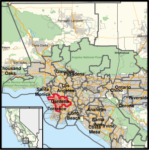
Country:
 USA
USARegion:
City:
Latitude and Longitude:
Time Zone:
Postal Code:
IP information under different IP Channel
ip-api
Country
Region
City
ASN
Time Zone
ISP
Blacklist
Proxy
Latitude
Longitude
Postal
Route
IPinfo
Country
Region
City
ASN
Time Zone
ISP
Blacklist
Proxy
Latitude
Longitude
Postal
Route
MaxMind
Country
Region
City
ASN
Time Zone
ISP
Blacklist
Proxy
Latitude
Longitude
Postal
Route
Luminati
Country
USRegion
ca
City
lawndale
ASN
Time Zone
America/Los_Angeles
ISP
TWC-20001-PACWEST
Latitude
Longitude
Postal
db-ip
Country
Region
City
ASN
Time Zone
ISP
Blacklist
Proxy
Latitude
Longitude
Postal
Route
ipdata
Country
Region
City
ASN
Time Zone
ISP
Blacklist
Proxy
Latitude
Longitude
Postal
Route
Popular places and events near this IP address

Alondra Park, California
Census designated place in California, United States
Distance: Approx. 1203 meters
Latitude and longitude: 33.89083333,-118.33416667
Alondra Park (), also known as El Camino Village, is a census designated place (CDP) in the South Bay region of Los Angeles County, California, United States. It is the unincorporated area north of Alondra Community Regional Park and El Camino College. It is east of Lawndale, south of Hawthorne, west of Gardena, and north of Torrance.
Lawndale, California
City in California, United States
Distance: Approx. 664 meters
Latitude and longitude: 33.88666667,-118.35361111
Lawndale is a city in Los Angeles County, California, United States. The population was 32,769 at the 2010 census, up from 31,712 according to the 2000 census. The city is in the South Bay region of the Greater Los Angeles Area.
El Camino College
Community college in Alondra Park, California, US
Distance: Approx. 1568 meters
Latitude and longitude: 33.885881,-118.330457
El Camino College (Elco or ECC) is a public community college in Los Angeles County, California. Most of it is in Alondra Park, while a section is in the city limits of Torrance. It consists of 37 buildings spanning an area of roughly 26 acres (11 ha).
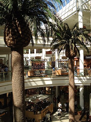
South Bay Galleria
Shopping mall in Redondo Beach, California
Distance: Approx. 2124 meters
Latitude and longitude: 33.87111111,-118.355
South Bay Galleria, formerly named Galleria at South Bay, is a shopping mall located in Redondo Beach, California, United States. It is anchored by Macy's, Kohl's, Q, Wonder of Dinosaurs, and a 16-screen AMC Theatres multiplex.
California's 43rd congressional district
U.S. House district for California
Distance: Approx. 1846 meters
Latitude and longitude: 33.90305556,-118.33638889
California's 43rd congressional district is a congressional district in the U.S. state of California that is currently represented by Democrat Maxine Waters. The district is centered in the southern part of Los Angeles County, and includes portions of the cities of Los Angeles (including LAX) and Torrance. It includes the entirety of the cities of Hawthorne, Lawndale, Gardena, Inglewood, and Lomita.
Lawndale High School
School in Lawndale, California, United States
Distance: Approx. 1644 meters
Latitude and longitude: 33.89583333,-118.36277778
Lawndale High School is one of three high schools in Lawndale, California, United States. The school was closed in 1981, and reopened in 1998. It is one of three schools in the Centinela Valley Union High School District.
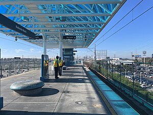
Redondo Beach station
Los Angeles Metro Rail station
Distance: Approx. 2156 meters
Latitude and longitude: 33.8947,-118.3693
Redondo Beach station is an elevated light rail station on the C Line of the Los Angeles Metro Rail system. It is located over Marine Avenue in the city of Redondo Beach, California, after which the station is named. It opened with the commencement of Green Line service on August 12, 1995.
Environmental Charter High School
School in Lawndale, California, United States
Distance: Approx. 1082 meters
Latitude and longitude: 33.882024,-118.355155
Environmental Charter High School, abbreviated to ECHS, is a 9th through 12th grade public charter high school in Lawndale, California. It was founded in 2002. Prior to its founding, there was another high school at the same location that was named “Victory”.

Rancho Sausal Redondo
Pre-statehood California land grant
Distance: Approx. 1715 meters
Latitude and longitude: 33.9,-118.36
Rancho Sausal Redondo (Round Willow-grove Ranch) was a 22,458-acre (91 km2) Mexican land grant in present day Los Angeles County, California given in 1837 to Antonio Ygnacio Ávila by Juan Alvarado Governor of Alta California. Rancho Sausal Redondo covered the area that now includes Playa Del Rey, El Segundo, Manhattan Beach, Lawndale, Hermosa Beach, Inglewood, Hawthorne, and Redondo Beach.
Featherstone Field
College sports stadium in California, U.S
Distance: Approx. 1457 meters
Latitude and longitude: 33.88444444,-118.33222222
Featherstone Field, previously known as Murdock Stadium is a stadium on the campus of El Camino College in Torrance, California. Built in 1958 the stadium seats around 12,127 on wood-backed bleacher seats. It was home to the North American Soccer League's Los Angeles Aztecs for two years (1975–1976), the American Soccer League's Southern California Lazers for a single season in 1978, as well as several United States men's national soccer team FIFA World Cup qualification matches.
Redondo Beach Transit Center
Transport hub in Redondo Beach, California
Distance: Approx. 2483 meters
Latitude and longitude: 33.8682,-118.3567
The Redondo Beach Transit Center is a bus station in Redondo Beach, California. The station consists of one large island platform with 11 bus bays and a 320-space park and ride parking lot located next to the transit center. The transit center opened in early 2023, replacing a nearby bus terminal at the South Bay Galleria dating to 1987.
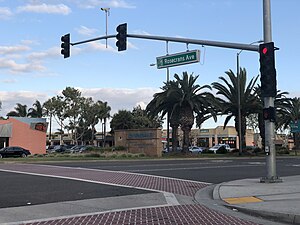
Gardena Cinema
Movie theater in Gardena, California
Distance: Approx. 2069 meters
Latitude and longitude: 33.89597222,-118.32625
Gardena Cinema is an 800-seat, single-screen movie theater located on Crenshaw Boulevard, Gardena, California in the US. It was built in the 1940s.
Weather in this IP's area
clear sky
16 Celsius
15 Celsius
14 Celsius
17 Celsius
1011 hPa
73 %
1011 hPa
1009 hPa
10000 meters
3.6 m/s
260 degree
07:01:04
18:15:26