Country:
 USA
USARegion:
City:
Latitude and Longitude:
Time Zone:
Postal Code:
IP information under different IP Channel
ip-api
Country
Region
City
ASN
Time Zone
ISP
Blacklist
Proxy
Latitude
Longitude
Postal
Route
IPinfo
Country
Region
City
ASN
Time Zone
ISP
Blacklist
Proxy
Latitude
Longitude
Postal
Route
MaxMind
Country
Region
City
ASN
Time Zone
ISP
Blacklist
Proxy
Latitude
Longitude
Postal
Route
Luminati
Country
USRegion
ca
City
gardena
ASN
Time Zone
America/Los_Angeles
ISP
TWC-20001-PACWEST
Latitude
Longitude
Postal
db-ip
Country
Region
City
ASN
Time Zone
ISP
Blacklist
Proxy
Latitude
Longitude
Postal
Route
ipdata
Country
Region
City
ASN
Time Zone
ISP
Blacklist
Proxy
Latitude
Longitude
Postal
Route
Popular places and events near this IP address

Gardena, California
City in California, United States
Distance: Approx. 1559 meters
Latitude and longitude: 33.89361111,-118.30777778
Gardena is a city located in the South Bay region of Los Angeles County, California, United States. The population was 58,829 at the 2010 census, up from 57,746 at the 2000 census. Until 2014, the U.S. census cited the City of Gardena as the place with the highest percentage of Japanese Americans in California.
Hustler Casino
Cardroom in Gardena, California
Distance: Approx. 390 meters
Latitude and longitude: 33.891946,-118.292826
Larry Flynt's Hustler Casino is a cardroom in Gardena, California, approximately 15 miles (25 km) south of Downtown Los Angeles. It is owned by El Dorado LF, LLC. the successor company after founder Larry Flynt's death. It has been in operation since June 22, 2000.
American College of Medical Technology
Distance: Approx. 688 meters
Latitude and longitude: 33.893,-118.284
The American College of Medical Technology was a for-profit non-degree-granting occupational institution. The college was founded by Donald Harrison in 1974 as the American School of X-Ray. In July 1996, Daniel Dorim Kim purchased the school and changed the name to the American College of Medical Technology (ACMT).

Rosecrans station
Bus rapid transit station in Los Angeles, California
Distance: Approx. 859 meters
Latitude and longitude: 33.9019,-118.28661
Rosecrans station is a busway station located in Los Angeles, California. It is situated between the Harbor Freeway station and the Harbor Gateway Transit Center on the J Line, a bus rapid transit route which runs between El Monte, Downtown Los Angeles and San Pedro as part of the Metro Busway system. The station consists of two side platforms in the center of Interstate 110 under Rosecrans Avenue.
Harbor Gateway Transit Center
Public transit hub in Los Angeles, California
Distance: Approx. 2839 meters
Latitude and longitude: 33.86973,-118.2879
Harbor Gateway Transit Center, formerly Artesia Transit Center, is a large bus station at the southern end of the Harbor Transitway that serves as a transport hub (known locally as a transit center) for the South Bay region of Los Angeles County including the Harbor Gateway neighborhood of Los Angeles and cities of Carson, Gardena, and Torrance. The station consists of one large island platform with 12 bus bays and a 980 space park and ride parking lot located in the southwest corner of Interstate 110 (Harbor Freeway) and California State Route 91 (Gardena Freeway). The station is one of the stops on J Line, a bus rapid transit route which runs between El Monte, Downtown Los Angeles and San Pedro as part of the Metro Busway system.
Queen of Angels Academy (Compton, California)
Private, all-female school in Compton, California, United States
Distance: Approx. 2689 meters
Latitude and longitude: 33.8956,-118.2619
Queen of Angels Academy was a private Catholic high school for girls in Compton, California.
Junípero Serra High School (Gardena, California)
Private, coeducational school in Gardena, , California, United States
Distance: Approx. 2455 meters
Latitude and longitude: 33.89666667,-118.3175
Established in 1950, Junípero Serra High School is a four-year, private, Roman Catholic, coeducational, college preparatory school in Gardena, California, with an alumni body of more than 6,000 located throughout the United States and abroad. Honored as a California State School of the Year, Serra is operated by the Roman Catholic Archdiocese of Los Angeles.
Gardena Police Department
Law enforcement agency in California, US
Distance: Approx. 2010 meters
Latitude and longitude: 33.88333333,-118.3075
The Gardena Police Department is the principal law enforcement agency responsible for the city of Gardena, California, in the United States. The current Chief of Police is Michael Saffell, appointed in 2019. Chief Saffell is a 30 year veteran of the Gardena Police Department.
Gardena Office of Economic Development
Distance: Approx. 1921 meters
Latitude and longitude: 33.8837,-118.3066
The Gardena Office of Economic Development's purpose is to attract new business, and to stimulate job creation by providing services to businesses and industries relocating to or expanding within Gardena, California.

Larry Flynt's Lucky Lady Casino
Casino in Gardena, California, United States
Distance: Approx. 838 meters
Latitude and longitude: 33.90238,-118.29329
Larry Flynt's Lucky Lady Casino is a cardroom located in Gardena, California. It replaced Normandie Casino. In 1940, the Western Club opened on Western Avenue.
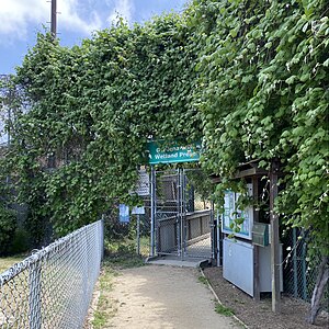
Gardena Willows Wetland Preserve
Remnant of Dominguez Slough
Distance: Approx. 2245 meters
Latitude and longitude: 33.875,-118.293
The Gardena Willows Wetland Preserve occupies 13.6 acres (55,000 m2) of land owned by the City of Gardena, in Los Angeles County, California. The preserve is the last intact remnant of the former Dominguez Slough, an important vernal marsh and riparian forest with riparian zones that once covered as much as 400 acres (1,600,000 m2) of this area, known as the South Bay region. The preserve has 9.4 acres (38,000 m2) of wetland and 4.2 acres (17,000 m2) of upland.

Dominguez Slough
Former wetland in California
Distance: Approx. 2320 meters
Latitude and longitude: 33.8743,-118.2925
Dominguez Slough (American English pronunciation: slew or slu) was an endorheic lake and wetland in present-day Gardena, Los Angeles County, California, United States. Known for much of the late 19th century and early 20th century as Nigger Slough, it was renamed Lagunas de los Dominguez in 1938 in reference to the rancho-era Dominguez family.
Weather in this IP's area
clear sky
26 Celsius
26 Celsius
24 Celsius
32 Celsius
1008 hPa
64 %
1008 hPa
1006 hPa
10000 meters
06:31:32
19:10:48