Country:
 USA
USARegion:
City:
Latitude and Longitude:
Time Zone:
Postal Code:
IP information under different IP Channel
ip-api
Country
Region
City
ASN
Time Zone
ISP
Blacklist
Proxy
Latitude
Longitude
Postal
Route
IPinfo
Country
Region
City
ASN
Time Zone
ISP
Blacklist
Proxy
Latitude
Longitude
Postal
Route
MaxMind
Country
Region
City
ASN
Time Zone
ISP
Blacklist
Proxy
Latitude
Longitude
Postal
Route
Luminati
Country
USRegion
ca
City
brea
ASN
Time Zone
America/Los_Angeles
ISP
TWC-20001-PACWEST
Latitude
Longitude
Postal
db-ip
Country
Region
City
ASN
Time Zone
ISP
Blacklist
Proxy
Latitude
Longitude
Postal
Route
ipdata
Country
Region
City
ASN
Time Zone
ISP
Blacklist
Proxy
Latitude
Longitude
Postal
Route
Popular places and events near this IP address

Brea, California
City in California, United States
Distance: Approx. 1220 meters
Latitude and longitude: 33.92333333,-117.88888889
Brea (; Spanish for 'tar') is a city in northern Orange County, California. The population as of the 2010 census was 39,282. It is 33 miles (53 km) southeast of Los Angeles.

Brea Mall
Shopping mall in California, United States
Distance: Approx. 2052 meters
Latitude and longitude: 33.91548,-117.88627
The Brea Mall is an enclosed shopping mall located in the Orange County city of Brea, California. Since 1998, the mall has been owned and operated by the Simon Property Group. It is home to four major department stores, 179 specialty shops and boutiques, and a food court.

Brea Olinda High School
Public 4-year school in Brea, California, United States
Distance: Approx. 878 meters
Latitude and longitude: 33.933244,-117.875925
Brea Olinda High School is a 9th–12th grade public high school located in Brea, California. Established in 1927, the school was originally located across the street from the Brea Mall. In 1989, the school moved to its current location on the northern hills of Brea.

Brea-Olinda Unified School District
School district in California
Distance: Approx. 1891 meters
Latitude and longitude: 33.917163,-117.888913
Brea Olinda Unified School District is the school district serving the City of Brea in Orange County, California, United States. It also serves portions of the nearby cities of Fullerton, Yorba Linda and La Habra.
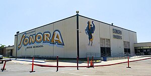
Sonora High School (La Habra, California)
Public secondary school in La Habra, California, USA
Distance: Approx. 3777 meters
Latitude and longitude: 33.9275,-117.92555556
Sonora High School (SOHS) is a public high school located at 401 S. Palm Street in La Habra, north Orange County, California. One of seven high schools in the Fullerton Joint Union High School District, Sonora served over 1,944 students in the 2012-2013 school year. The school has an International Baccalaureate program, honors, and Advanced Placement (AP) options available for certain classes and is accredited by the Western Association of Schools and Colleges (WASC).

George Key Ranch
United States historic place
Distance: Approx. 4434 meters
Latitude and longitude: 33.89694444,-117.8675
The George Key Ranch Historic District, also known simply as Key Ranch, is a historic ranch and Victorian ranch house located in Placentia, Orange County, California Two acres of the former ranch is now the George Key Ranch Historic Park operated by Orange County Parks. It includes the historic house museum, a collection of farm equipment and hand tools, a one-acre orange grove, and 3/4-acre verse garden. The George Key Ranch Historic District was listed on the National Register of Historic Places in 1975.

Brea City Hall and Park
United States historic place
Distance: Approx. 2647 meters
Latitude and longitude: 33.91416667,-117.90138889
Brea City Hall Park, in Brea, California, was listed on the National Register of Historic Places in 1984. The Brea City Hall, designed by architect Allen Ruott, is combination of Art Deco and Spanish Colonial Revival in styling and was built in 1928. It included a public library as well as the site for the Brea Police Department and jail.

Olinda, Brea, California
Neighborhood of Brea in Orange County, California, United States
Distance: Approx. 3650 meters
Latitude and longitude: 33.92414785,-117.84767461
Olinda is a neighborhood in Brea, California, located on Carbon Canyon Road east of the rest of the city. The original village was founded in the 1890s and grew when petroleum was discovered at the adjacent Brea-Olinda Oil Field. In February 1917, Olinda Village and the nearby town of Randolph were incorporated as the city of Brea.
KGBN
Radio station in Anaheim, California
Distance: Approx. 2472 meters
Latitude and longitude: 33.945,-117.86222222
KGBN (1190 kHz) is a Korean Christian brokered time AM radio station licensed to Anaheim, California. It serves Orange County and Greater Los Angeles. Rev.

Brea-Olinda Oil Field
Oil field in Orange and Los Angeles Counties, California, United States
Distance: Approx. 2134 meters
Latitude and longitude: 33.9337,-117.8623
The Brea-Olinda Oil Field is a large oil field in northern Orange County and Los Angeles County, California, along the southern edge of the Puente Hills, about four miles (6 km) northeast of Fullerton, and adjacent to the city of Brea. Discovered in 1880, the field is the sixteenth largest in California by cumulative production, and was the first of California's largest 50 oil fields to be found. It has produced over 430 million barrels of oil in the 130 years since it was first drilled, and retains approximately 20 million barrels in reserve recoverable with current technology.

Olinda Elementary
Public elementary school in Brea, Orange County, California, United States
Distance: Approx. 3309 meters
Latitude and longitude: 33.91910317,-117.85433499
Olinda Elementary is an elementary-level school located in Brea, California.

2014 La Habra earthquake
Earthquake in California, U.S.
Distance: Approx. 2828 meters
Latitude and longitude: 33.933,-117.916
The 2014 La Habra earthquake was a magnitude 5.1 earthquake that occurred on March 28, 2014, at 9:09:42 p.m. PDT. Although given the name "La Habra" it was centered in Brea, a city in northern Orange County. Despite its moderate magnitude, it had a maximum Mercalli intensity of VII (Very strong), and caused a total of $10.8 million in damage.
Weather in this IP's area
clear sky
28 Celsius
28 Celsius
24 Celsius
32 Celsius
1008 hPa
47 %
1008 hPa
987 hPa
10000 meters
06:29:53
19:09:12