Country:
 USA
USARegion:
City:
Latitude and Longitude:
Time Zone:
Postal Code:
IP information under different IP Channel
ip-api
Country
Region
City
ASN
Time Zone
ISP
Blacklist
Proxy
Latitude
Longitude
Postal
Route
IPinfo
Country
Region
City
ASN
Time Zone
ISP
Blacklist
Proxy
Latitude
Longitude
Postal
Route
MaxMind
Country
Region
City
ASN
Time Zone
ISP
Blacklist
Proxy
Latitude
Longitude
Postal
Route
Luminati
Country
USRegion
ca
City
bellflower
ASN
Time Zone
America/Los_Angeles
ISP
TWC-20001-PACWEST
Latitude
Longitude
Postal
db-ip
Country
Region
City
ASN
Time Zone
ISP
Blacklist
Proxy
Latitude
Longitude
Postal
Route
ipdata
Country
Region
City
ASN
Time Zone
ISP
Blacklist
Proxy
Latitude
Longitude
Postal
Route
Popular places and events near this IP address

Bellflower, California
City in California, United States
Distance: Approx. 491 meters
Latitude and longitude: 33.88805556,-118.1275
Bellflower is a city located in southeast Los Angeles County, California, in the Los Angeles metropolitan area. It was founded in 1906 and incorporated on September 3, 1957. As of the 2020 census, the city had a total population of 79,190, up from 76,616 at the 2010 census.

Cerritos College
Public community college in Norwalk, California
Distance: Approx. 2919 meters
Latitude and longitude: 33.8857,-118.0946
Cerritos College is a public community college in Norwalk, California. It offers degrees and certificates in 87 areas of study in nine divisions.
St. John Bosco High School
Private school in California, United States
Distance: Approx. 2581 meters
Latitude and longitude: 33.90694444,-118.12444444
St. John Bosco High School (SJBHS) is a Salesian all-boys college preparatory high school located in Bellflower, California, and is operated by the San Francisco Province of the order. The school is named after the order's founder, John Bosco, an Italian saint known for his dedication to educating and advocating for youth and for his "Home-School-Church-Playground" model of education.
Bellwood General Hospital
Hospital in California, United States
Distance: Approx. 1512 meters
Latitude and longitude: 33.87285556,-118.11640556
Bellwood General Hospital was a hospital in Bellflower, California. It was closed April 6, 2003.
College Hospital
Hospital in California, United States
Distance: Approx. 2141 meters
Latitude and longitude: 33.88432,-118.10294
College Hospital is an acute psychiatric hospital in Cerritos, California. College Hospital has been open since 1973 and has specialty programs in dealing with geriatric, adolescent and pediatric mental health issues. There is also a program specifically created to address problems in the Latino community with the services of Spanish speaking and bi-cultural psychiatrists, psychologists, social workers and counselors.
Bellflower High School
Public high school
Distance: Approx. 1455 meters
Latitude and longitude: 33.89295,-118.11485
Bellflower High School is a six-year public high school located in Bellflower, California, as part of the Bellflower Unified School District (BUSD).
Somerset High School (Bellflower, California)
Public High School in Bellflower, California
Distance: Approx. 992 meters
Latitude and longitude: 33.88222222,-118.13666667
Somerset High School is a continuation school located in Bellflower, California, as part of the Bellflower Unified School District (BUSD). As of 2004, Somerset had 17 regular educations teachers and 16 classrooms serving 353 students from the communities of Lakewood and Bellflower. Average class size is 12.7 students.
St. Joseph High School (Lakewood, California)
Private, all-female school in Lakewood, California, United States
Distance: Approx. 2699 meters
Latitude and longitude: 33.86055556,-118.11777778
Saint Joseph High School is a private Catholic all-girls high school located in Lakewood, California. It is located in the Roman Catholic Archdiocese of Los Angeles and sponsored by the Sisters of St. Joseph of Carondelet.
Valley Christian Schools (Los Angeles County, California)
School in Cerritos, Los Angeles County, California, United States
Distance: Approx. 2535 meters
Latitude and longitude: 33.87131,-118.10316
Valley Christian Schools (VCS) is a private Christian K-12 school located in Los Angeles County, California. It is one of the largest in Los Angeles and Orange Counties. It was founded in 1935 and has 4 campuses (preschool, elementary, middle and high school) enrolling more than 1,300 students.

Mayfair High School
California public school
Distance: Approx. 2368 meters
Latitude and longitude: 33.8644,-118.1156
Mayfair High School is a middle and high school in the Bellflower Unified School District in the city of Lakewood, California. The school first opened in 1959. The student population is approximately 2,500 in grades 7 through 12.
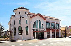
Los Angeles County Fire Museum
Distance: Approx. 285 meters
Latitude and longitude: 33.886025,-118.12458
The Los Angeles County Fire Museum is a public museum dedicated to the history of the Los Angeles County Fire Department in Los Angeles County, California. The museum has 60 antique fire engines in its collection, including fire engines from the 1860s through just-retired apparatus. Its location for public exhibits is at 16400 Bellflower Blvd, Bellflower, CA, on the ground floor of the Bellflower Mayne Events Center.
Bellflower station
Planned Los Angeles Metro Rail light rail station
Distance: Approx. 226 meters
Latitude and longitude: 33.885662,-118.125117
Bellflower station is a planned light rail station in the Los Angeles Metro Rail system. It is part of the Southeast Gateway Line project. The segment of the corridor is expected to begin operations in 2035.
Weather in this IP's area
mist
15 Celsius
15 Celsius
14 Celsius
17 Celsius
1009 hPa
91 %
1009 hPa
1007 hPa
9656 meters
1.54 m/s
60 degree
07:00:11
18:14:33