Country:
Region:
City:
Latitude and Longitude:
Time Zone:
Postal Code:
IP information under different IP Channel
ip-api
Country
Region
City
ASN
Time Zone
ISP
Blacklist
Proxy
Latitude
Longitude
Postal
Route
IPinfo
Country
Region
City
ASN
Time Zone
ISP
Blacklist
Proxy
Latitude
Longitude
Postal
Route
MaxMind
Country
Region
City
ASN
Time Zone
ISP
Blacklist
Proxy
Latitude
Longitude
Postal
Route
Luminati
Country
Region
ca
City
whittier
ASN
Time Zone
America/Los_Angeles
ISP
TWC-20001-PACWEST
Latitude
Longitude
Postal
db-ip
Country
Region
City
ASN
Time Zone
ISP
Blacklist
Proxy
Latitude
Longitude
Postal
Route
ipdata
Country
Region
City
ASN
Time Zone
ISP
Blacklist
Proxy
Latitude
Longitude
Postal
Route
Popular places and events near this IP address

Whittier College
Private liberal arts college in Whittier, California, US
Distance: Approx. 2665 meters
Latitude and longitude: 33.978,-118.0296
Whittier College is a private liberal arts college in Whittier, California. It is a Hispanic Serving Institution (HSI) and, as of spring 2024, had 815 undergraduate and graduate students. It was founded in 1887.

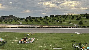
Rose Hills Memorial Park
Cemetery in California
Distance: Approx. 1614 meters
Latitude and longitude: 34.01,-118.02388889
Rose Hills Memorial Park is a cemetery and mortuary located in Whittier, California. It is an affiliate of Service Corporation International (formerly Loewen Group) and is the largest cemetery in North America.

Whittier High School
Public school in Whittier, California, United States
Distance: Approx. 2365 meters
Latitude and longitude: 33.9805,-118.04431
Whittier High School (WHS) is a high school located in Whittier, California. It was the original school of the Whittier Union High School District. It is the alma mater of President Richard Nixon (class of 1930) and John Lasseter (class of 1975), founder of Pixar.
Rio Hondo College
Public community college in Whittier, California.
Distance: Approx. 2025 meters
Latitude and longitude: 34.01888889,-118.03361111
Río Hondo College is a public community college in Whittier, California. The college is named after the Rio Hondo. Founded in 1960, it mainly serves the cities of Whittier, Pico Rivera, Santa Fe Springs, El Monte, and South El Monte.
Hoover Hotel
Historic hotel in Whittier, Los Angeles County, Southern California, US
Distance: Approx. 2558 meters
Latitude and longitude: 33.97805556,-118.03611111
Hoover Hotel is a historic hotel in Whittier, Los Angeles County, Southern California.
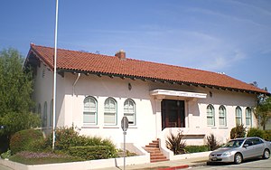
Standard Oil Building (Whittier, California)
Historic building in Whittier, California
Distance: Approx. 2805 meters
Latitude and longitude: 33.97582,-118.03634
Standard Oil Building is a historic building in Whittier, California. Built in 1914, it was designed by Rea & Garstang in the Spanish Colonial Revival architectural style. The building was built for the Standard Oil Company, which had begun successfully drilling for oil in 1910 in the area.
National Bank of Whittier Building
Historic building in Whittier, California, USA
Distance: Approx. 2465 meters
Latitude and longitude: 33.97888889,-118.03611111
National Bank of Whittier Building is a historic commercial building in uptown Whittier, California. Built in 1923 by John and David Parkinson in the Beaux Arts Neoclassical architecture style, the building was added to the National Register of Historic Places in 1982. The current building is the best remaining example of the Beaux Arts style in the City.

Jonathan Bailey House (Whittier, California)
Historic house in California, United States
Distance: Approx. 1901 meters
Latitude and longitude: 33.98472222,-118.03138889
Formerly known as "The Old Ranch House", the Jonathan Bailey House is a historic site in Whittier, California. The Bailey House was built around 1868–1869 by Jacob Gerkens. In 1887, the house was occupied by Quakers Jonathan Bailey and his wife, Rebecca.

Rose Hills, California
Census-designated place in California, United States
Distance: Approx. 994 meters
Latitude and longitude: 34.00916667,-118.04194444
Rose Hills (also known as North Whittier) is a census-designated place in Los Angeles County, California. Rose Hills sits at an elevation of 518 feet (158 m) above sea level. The 2010 United States census reported Rose Hills's population was 2,803.

Turnbull Canyon
Distance: Approx. 2337 meters
Latitude and longitude: 33.99305556,-118.01416667
Turnbull Canyon is a 4-mile loop trail located near Whittier, California, and is part of Puente Hills Preserve. It lies in the northern-central part of the preserve, and is an east–west canyon with relatively steep drainage. The canyon has a creek at its bottom that supports a narrow strip of riparian woodland dominated by sycamore trees, while the slopes are covered in coastal sage and native and non-native grasses.

San Jose Creek
Distance: Approx. 2534 meters
Latitude and longitude: 34.01861111,-118.055
San Jose Creek is an intermittent, tributary stream of the San Gabriel River in Los Angeles County, California. The mouth of San Jose Creek is at an elevation of 194 feet (59 meters) at its confluence with the San Gabriel River, 3.5 miles (5.6 km) southwest of Bassett, California. Its source is at 960 feet near the Los Angeles County Fairplex, at 34°04′50″N 117°45′38″W, where it has its confluence with Thompson Wash, actually a continuation of the creek into the San Gabriel Mountains.

North Whittier, California
Unincorporated community in California, United States
Distance: Approx. 1529 meters
Latitude and longitude: 34.01111111,-118.02638889
North Whittier is an unincorporated community in Los Angeles County in the U.S. state of California. The population was 4,351 according to the 2000 census. North Whittier is home to Rio Hondo College and Rose Hills Memorial Park, which claims to be the largest cemetery in North America.
Weather in this IP's area
scattered clouds
14 Celsius
14 Celsius
13 Celsius
16 Celsius
1009 hPa
87 %
1009 hPa
984 hPa
10000 meters
40 %
06:59:56
18:14:05


