Country:
 USA
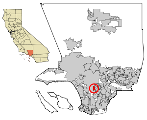
USARegion:
City:
Latitude and Longitude:
Time Zone:
Postal Code:
IP information under different IP Channel
ip-api
Country
Region
City
ASN
Time Zone
ISP
Blacklist
Proxy
Latitude
Longitude
Postal
Route
IPinfo
Country
Region
City
ASN
Time Zone
ISP
Blacklist
Proxy
Latitude
Longitude
Postal
Route
MaxMind
Country
Region
City
ASN
Time Zone
ISP
Blacklist
Proxy
Latitude
Longitude
Postal
Route
Luminati
Country
USRegion
ca
City
losangeles
ASN
Time Zone
America/Los_Angeles
ISP
TWC-20001-PACWEST
Latitude
Longitude
Postal
db-ip
Country
Region
City
ASN
Time Zone
ISP
Blacklist
Proxy
Latitude
Longitude
Postal
Route
ipdata
Country
Region
City
ASN
Time Zone
ISP
Blacklist
Proxy
Latitude
Longitude
Postal
Route
Popular places and events near this IP address

Florence-Graham, California
Census-designated place in Huntington Park, California
Distance: Approx. 2508 meters
Latitude and longitude: 33.96944444,-118.24388889
Florence-Graham (Also known as Florence-Firestone) is a census-designated place in Los Angeles County, California. The population was 61,983 at the 2020 census, down from 63,387 at the 2010 census. The census area includes separate communities of Florence, Firestone Park, and Graham.

John C. Fremont High School
Public school located in Los Angeles, California
Distance: Approx. 1342 meters
Latitude and longitude: 33.96963889,-118.26780556
John C. Fremont High School is a Title 1 co-educational public high school located in South Los Angeles, California, United States. Fremont serves several Los Angeles neighborhoods and the unincorporated community of Florence-Graham; some sections of Florence-Graham are jointly zoned to Fremont and David Starr Jordan High School. The Avalon Gardens public housing complex is zoned to Fremont.

Firestone station
Los Angeles Metro Rail station
Distance: Approx. 2212 meters
Latitude and longitude: 33.9599,-118.2432
Firestone station is an elevated light rail station on the A Line of the Los Angeles Metro Rail system. The station is located between Graham Avenue and the Union Pacific freight railroad's Wilmington Subdivision (the historic route of the Pacific Electric Railway), and elevated over the intersection of Firestone Boulevard, after which the station is named, in the unincorporated Los Angeles County community of Firestone Park.
Locke High School
American public charter high school
Distance: Approx. 2423 meters
Latitude and longitude: 33.93583333,-118.26694444
Alain Leroy Locke College Preparatory Academy (formerly Locke High School) is a Title 1 co-educational charter high school located in Los Angeles, California, United States, and is part of the Los Angeles Unified School District/Green Dot Public Schools. It is named after Alain LeRoy Locke. Locke is located in South Los Angeles near Watts.
Florence, California
Unincorporated community in California, United States
Distance: Approx. 2564 meters
Latitude and longitude: 33.97444444,-118.24805556
Florence is an unincorporated community in California. It is often considered part of South Los Angeles. It is serviced by area code 323 and has a ZIP Code of 90001.

Manchester station (Los Angeles Metro)
Bus rapid transit station in Los Angeles, California
Distance: Approx. 1310 meters
Latitude and longitude: 33.960126,-118.280852
Manchester station is a busway station located in Los Angeles, California. It is situated between the Slauson and Harbor Freeway stations on the J Line, a bus rapid transit route which runs between El Monte, Downtown Los Angeles and San Pedro as part of the Los Angeles Metro Busway system. The station consists of two side platforms in the center of Interstate 110 above Manchester Avenue.
Animo Locke Technology High School
Public school in Los Angeles, California , United States
Distance: Approx. 2610 meters
Latitude and longitude: 33.934867,-118.260097
Animo Locke Technology High School is a public high school in Los Angeles, California, US. The school opened on September 4, 2007, and is part of the Green Dot Public Schools.

Florence, Los Angeles
Neighborhood of Los Angeles in California, United States
Distance: Approx. 2580 meters
Latitude and longitude: 33.9746,-118.248
Florence is a neighborhood in Los Angeles, California. The neighborhood, part of the South Los Angeles region, is home to over 46,000 residents.

Broadway-Manchester, Los Angeles
Neighborhood of Los Angeles in California, United States
Distance: Approx. 1918 meters
Latitude and longitude: 33.9417,-118.275
Broadway-Manchester is a 1.5-square-mile neighborhood in Los Angeles, California. The neighborhood, part of the South Los Angeles area, is home to over 23,000 residents.

Green Meadows, Los Angeles
Neighborhood of Los Angeles in California, United States
Distance: Approx. 400 meters
Latitude and longitude: 33.95458,-118.269346
Green Meadows is a neighborhood in South Los Angeles, California, with a population of more than thirty thousand people. Green Meadows is within the South Los Angeles Community Plan area and is the home of Locke College Preparatory Academy.
Broadway Community Hospital
Hospital in California, United States
Distance: Approx. 1285 meters
Latitude and longitude: 33.950194,-118.277681
Broadway Community Hospital was a 56-bed hospital located at 9500 South Broadway, in the Broadway-Manchester district of Los Angeles, California. The hospital was abruptly closed by its staff (and its 17 patients transferred elsewhere quietly) on Friday March 19, 1982. The next day, state and county health authorities arrived to shut the hospital down, only to find that it had already been locked down and emptied.
Broadway & 87th Street shopping center
Distance: Approx. 1073 meters
Latitude and longitude: 33.95805556,-118.27861111
The Broadway & 87th Street shopping center designed by Wisstein Bros. and Surval, was one of the earliest shopping centers in Los Angeles, built in stages between 1936 and 1939 at 8701–8765 South Broadway between 87th and 88th streets, in what is now termed the Broadway-Manchester neighborhood. Researcher and author Richard Longstreth calls it the first true neighborhood shopping center.
Weather in this IP's area
mist
15 Celsius
15 Celsius
14 Celsius
17 Celsius
1011 hPa
72 %
1011 hPa
1006 hPa
10000 meters
3.6 m/s
260 degree
07:00:49
18:15:03