Country:
 USA
USARegion:
City:
Latitude and Longitude:
Time Zone:
Postal Code:
IP information under different IP Channel
ip-api
Country
Region
City
ASN
Time Zone
ISP
Blacklist
Proxy
Latitude
Longitude
Postal
Route
IPinfo
Country
Region
City
ASN
Time Zone
ISP
Blacklist
Proxy
Latitude
Longitude
Postal
Route
MaxMind
Country
Region
City
ASN
Time Zone
ISP
Blacklist
Proxy
Latitude
Longitude
Postal
Route
Luminati
Country
USRegion
ca
City
losangeles
ASN
Time Zone
America/Los_Angeles
ISP
TWC-20001-PACWEST
Latitude
Longitude
Postal
db-ip
Country
Region
City
ASN
Time Zone
ISP
Blacklist
Proxy
Latitude
Longitude
Postal
Route
ipdata
Country
Region
City
ASN
Time Zone
ISP
Blacklist
Proxy
Latitude
Longitude
Postal
Route
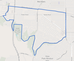
Popular places and events near this IP address

Mid City, Los Angeles
Neighborhood of Los Angeles in California, United States of America
Distance: Approx. 1453 meters
Latitude and longitude: 34.0459,-118.3453
Mid City (also Mid-City) is a neighborhood in Central Los Angeles, California. Attractions include restaurants and a post office named for singer Ray Charles, who had his recording studio in Mid City. The neighborhood hosts eleven public and private schools.
KFOX (AM)
Korean-language radio station in Torrance, California, United States
Distance: Approx. 1686 meters
Latitude and longitude: 34.01944444,-118.34472222
KFOX (1650 kHz) is a Korean language AM radio station, licensed to Torrance, California and serving the Los Angeles metropolitan area.
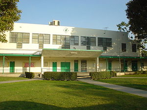
Susan Miller Dorsey High School
Public high school in Los Angeles, California, United States
Distance: Approx. 1289 meters
Latitude and longitude: 34.0228,-118.3462
Susan Miller Dorsey High School, commonly referred to as Dorsey High School, is a secondary public school located in the Baldwin Hills area of Los Angeles, California. It is a part of the Los Angeles Unified School District.
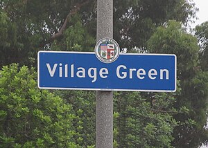
Village Green, Los Angeles
United States historic place
Distance: Approx. 1806 meters
Latitude and longitude: 34.01972222,-118.36083333
Village Green, originally named Baldwin Hills Village, is a neighborhood at the foot of Baldwin Hills, within the city of Los Angeles, California. Village Green consists of a large condominium complex that is both a Los Angeles Historic-Cultural Monument and a National Historic Landmark. Designed in the late 1930s and completed by 1942, it is one of the oldest planned communities of its type in the nation.

Rancho La Ciénega ó Paso de la Tijera
Pre-statehood California land grant
Distance: Approx. 1527 meters
Latitude and longitude: 34.02,-118.35
Rancho La Ciénega ó Paso de la Tijera was a 4,219-acre (17.07 km2) Mexican land grant in present day Los Angeles County, California given in 1843 by Governor Manuel Micheltorena to Vicente Sánchez. "La Cienega" is derived from the Spanish word ciénega, which means swamp or marshland and refers to the natural springs and wetlands in the area between Beverly Hills and Park La Brea and the Baldwin Hills range. "Paso de la Tijera" appears in c1860 maps where a path crosses a stream, at today's intersection of Crenshaw Blvd.
Farmdale station
Los Angeles Metro Rail station
Distance: Approx. 1171 meters
Latitude and longitude: 34.024,-118.346
Farmdale station is an at-grade light rail station on the E Line of the Los Angeles Metro Rail system. The station is located in the center median of Exposition Boulevard at its intersection with Farmdale Avenue, after which the station is named, in the West Adams neighborhood of Los Angeles. It is located between Expo/La Brea station to the west and Expo/Crenshaw station to the east.

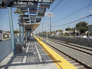
Expo/La Brea station
Los Angeles Metro Rail station
Distance: Approx. 1067 meters
Latitude and longitude: 34.0248,-118.3552
Expo/La Brea station is an elevated light rail station on the E Line of the Los Angeles Metro Rail system. The station is located over the intersection of Exposition Boulevard and La Brea Avenue, after which the station is named, in the West Adams neighborhood of Los Angeles. The official name of the station changed to Expo/La Brea/Ethel Bradley on October 10, 2015, in honor of Ethel Bradley, the wife of former Los Angeles mayor Tom Bradley.

Wellington Square, Los Angeles
Neighborhood of Los Angeles in California, United States of America
Distance: Approx. 1543 meters
Latitude and longitude: 34.038,-118.335
Wellington Square is a neighborhood in Mid-City Los Angeles, California at the western edge of the West Adams District.
Baldwin Hills/Crenshaw, Los Angeles
Neighborhood of Los Angeles in California, United States
Distance: Approx. 1609 meters
Latitude and longitude: 34.02004167,-118.35661389
Baldwin Hills/Crenshaw is a neighborhood in the south region of the city of Los Angeles defined by the Mapping L.A. project of the Los Angeles Times in 2009. The Times combines two city-designated neighborhoods: the upscale, principally home-owning Baldwin Hills residential district to the south and the more concentrated apartment area of the Crenshaw district to the north.

Mid-City Heights, Los Angeles
Neighborhood of Los Angeles in California, United States
Distance: Approx. 664 meters
Latitude and longitude: 34.036854,-118.344787
Mid-City Heights is a neighborhood in Los Angeles, California. It lies within the larger Mid-City area of Los Angeles.

Ebony Repertory Theatre
Theatre company in Los Angeles, California
Distance: Approx. 1047 meters
Latitude and longitude: 34.0395836,-118.3420399
Ebony Repertory Theatre (ERT) is a non-profit theatre company founded in June 2007 by Wren T. Brown and the late Israel Hicks. ERT is the resident company and operator of the Nate Holden Performing Arts Center, a 400-seat regional theatre in Los Angeles, California's Mid-City community. ERT, whose award-winning theatre is its cornerstone, is the only African American professional theatre company (Actors Equity) in Los Angeles.

Michelle and Barack Obama Sports Complex
Sports complex in Baldwin Hills, LA, USA
Distance: Approx. 1265 meters
Latitude and longitude: 34.02235856,-118.35170583
The Michelle and Barack Obama Sports Complex, previously known as the Rancho Cienega Recreation Center, is a multibuilding sports complex in Baldwin Hills, Los Angeles. The complex is named after Michelle and Barack Obama, where Barack Obama held a rally at the center in 2007. The complex neighbors Susan Miller Dorsey High School, who is partnered with them for its use in school events.
Weather in this IP's area
clear sky
15 Celsius
15 Celsius
13 Celsius
17 Celsius
1010 hPa
82 %
1010 hPa
1006 hPa
10000 meters
2.06 m/s
260 degree
07:01:13
18:15:19