192.56.241.217 - IP Lookup: Free IP Address Lookup, Postal Code Lookup, IP Location Lookup, IP ASN, Public IP
Country:
Region:
City:
Location:
Time Zone:
Postal Code:
IP information under different IP Channel
ip-api
Country
Region
City
ASN
Time Zone
ISP
Blacklist
Proxy
Latitude
Longitude
Postal
Route
Luminati
Country
ASN
Time Zone
America/Chicago
ISP
ATGS-MMD-AS
Latitude
Longitude
Postal
IPinfo
Country
Region
City
ASN
Time Zone
ISP
Blacklist
Proxy
Latitude
Longitude
Postal
Route
IP2Location
192.56.241.217Country
Region
bayern
City
bayern
Time Zone
Europe/Berlin
ISP
Language
User-Agent
Latitude
Longitude
Postal
db-ip
Country
Region
City
ASN
Time Zone
ISP
Blacklist
Proxy
Latitude
Longitude
Postal
Route
ipdata
Country
Region
City
ASN
Time Zone
ISP
Blacklist
Proxy
Latitude
Longitude
Postal
Route
Popular places and events near this IP address
Traunstein (district)
District in Bavaria, Germany
Distance: Approx. 5207 meters
Latitude and longitude: 47.83,12.58
Traunstein is a Landkreis (district) in the southeastern part of Bavaria, Germany. Neighboring districts are (from the north clockwise) Mühldorf, Altötting, the Austrian states Upper Austria and Salzburg, the district Berchtesgadener Land, the Austrian states of Salzburg and Tyrol, and the district Rosenheim.

Grassau, Bavaria
Municipality in Bavaria, Germany
Distance: Approx. 6519 meters
Latitude and longitude: 47.77888889,12.45
Grassau is a market town in the district of Traunstein in Bavaria in Germany. It is located south of lake Chiemsee in the valley of the Tiroler Ache.

Übersee
Municipality in Bavaria, Germany
Distance: Approx. 5569 meters
Latitude and longitude: 47.81666667,12.46666667
Übersee is a municipality and a village in the rural district of Traunstein in upper Bavaria, Germany. It lies on the south shore of lake Chiemsee.
Bergen, Upper Bavaria
Municipality in Bavaria, Germany
Distance: Approx. 5506 meters
Latitude and longitude: 47.81666667,12.6
Bergen is a municipality in the district of Traunstein in Bavaria, Germany.

Staudach-Egerndach
Municipality in Bavaria, Germany
Distance: Approx. 3992 meters
Latitude and longitude: 47.78333333,12.48333333
Staudach-Egerndach is a municipality in the district of Traunstein in Bavaria, Germany.
Tüttensee
German lake
Distance: Approx. 6271 meters
Latitude and longitude: 47.84633889,12.56832778
The Tüttensee (Lake Tütten) is a small lake in the Chiemgau region, the Bavarian Alpine foothills of the Traunstein district, within the municipalities of Grabenstätt and Vachendorf. With an area of 10.8 ha (27 acres) and a maximum depth of 17.3 m (57 ft), it is one of many Kettle-Lakes in the alpine foothills, that resulted from remnants of dead ice after a glacier retreated. The lake is partly surrounded by well preserved Kame terraces and drains to the north west into the tiny Marwanger Creek to the Chiemsee.

Hochfelln
Mountain of Bavaria, Germany
Distance: Approx. 3379 meters
Latitude and longitude: 47.76666667,12.55
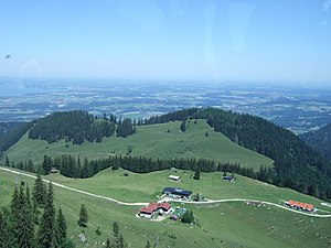
Hochfelln is a mountain of Bavaria, Germany located in the Chiemgau Alps. Its summit is 1,674 meters high. Hochfelln overlooks the lake Chiemsee.
Hochgern
Distance: Approx. 5171 meters
Latitude and longitude: 47.75,12.51666667
The Hochgern is a mountain found in the Bavarian district of Traunstein, in Germany. It is part of the Chiemgau Alps and has a height of 1748 meters above sea level. The Hochgern marks the junction of the municipalities of Unterwössen, Marquartstein and Ruhpolding, as well as the Urschlau Forest district.

Schnappenberg
Mountain in Bavaria, Germany
Distance: Approx. 4990 meters
Latitude and longitude: 47.76444444,12.485
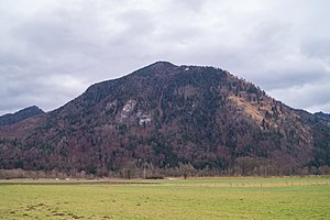
Schnappenberg is a mountain in Bavaria, Germany.

Burg Marquartstein
Distance: Approx. 6461 meters
Latitude and longitude: 47.7567,12.4689
Burg Marquartstein is an 11th-century castle in Marquartstein, Bavaria, Germany. The 40-bedroom castle was bought by the German art dealer and collector Konrad Bernheimer in 1987, to house his family's collection of art and antiques, as he had just sold the Bernheimer-Haus in Munich. It is listed for sale with Sotheby's International Realty as of November 2015, with "price upon request".

Bergen (Oberbayern) station
Railway station in Bavaria, Germany
Distance: Approx. 5552 meters
Latitude and longitude: 47.8252,12.5929
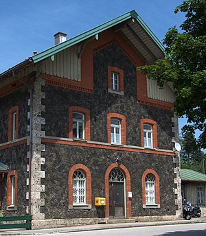
Bergen (Oberbayern) station is a railway station in the municipality of Bergen, located in the Traunstein district in Bavaria, Germany.
Übersee station
Railway station in Übersee, Germany
Distance: Approx. 4590 meters
Latitude and longitude: 47.822,12.4874
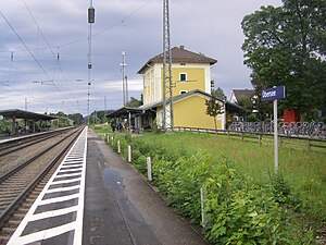
Übersee station is a railway station in the municipality of Übersee, located in the Traunstein district in Bavaria, Germany.
Weather in this IP's area
clear sky
3 Celsius
3 Celsius
3 Celsius
3 Celsius
1032 hPa
65 %
1032 hPa
934 hPa
10000 meters
1.09 m/s
0.83 m/s
325 degree
5 %


