192.56.110.57 - IP Lookup: Free IP Address Lookup, Postal Code Lookup, IP Location Lookup, IP ASN, Public IP
Country:
 USA
USARegion:
City:
Location:
Time Zone:
Postal Code:
ISP:
ASN:
language:
User-Agent:
Proxy IP:
Blacklist:
IP information under different IP Channel
ip-api
Country
Region
City
ASN
Time Zone
ISP
Blacklist
Proxy
Latitude
Longitude
Postal
Route
db-ip
Country
Region
City
ASN
Time Zone
ISP
Blacklist
Proxy
Latitude
Longitude
Postal
Route
IPinfo
Country
Region
City
ASN
Time Zone
ISP
Blacklist
Proxy
Latitude
Longitude
Postal
Route
IP2Location
192.56.110.57Country
usRegion
california
City
sacramento
Time Zone
America/Los_Angeles
ISP
Language
User-Agent
Latitude
Longitude
Postal
ipdata
Country
Region
City
ASN
Time Zone
ISP
Blacklist
Proxy
Latitude
Longitude
Postal
Route
Popular places and events near this IP address

1991 Sacramento hostage crisis
Fatal hostage crisis in California
Distance: Approx. 2916 meters
Latitude and longitude: 38.499852,-121.431832
On April 4, 1991, 41 employees and customers were taken hostage by four gunmen and held at a Good Guys! electronics store at the corner of 65th Street and Stockton Boulevard in Sacramento, California, near Florin Mall (now Florin Towne Centre) for approximately eight hours. Near the end of the hostage crisis, six were killed: three hostages and three of the four hostage-takers.
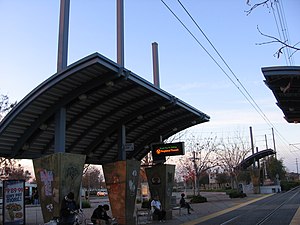
Meadowview station
Distance: Approx. 2233 meters
Latitude and longitude: 38.48321111,-121.46704167
Meadowview station is a side platformed Sacramento RT light rail station in Sacramento, California, United States. The station was opened on September 26, 2003, and is operated by the Sacramento Regional Transit District. It is served by the Blue Line and was its southern terminus until 2015.
Methodist Hospital of Sacramento
Hospital in California, United States
Distance: Approx. 2594 meters
Latitude and longitude: 38.4641,-121.4174
Methodist Hospital is a hospital located in the southern part of Sacramento, California. It is located just off Highway 99 by taking the Calvine Road/Consumnes River Boulevard exit 289. Its address is 7500 Hospital Drive.

Valley High School (Sacramento, California)
School in Sacramento, Sacramento County, California, United States of America
Distance: Approx. 2738 meters
Latitude and longitude: 38.45369,-121.42849
Valley High School is a 9th-12th-grade college preparatory high school located in Sacramento, California, near the city limits of Elk Grove, California. The school was established in 1977 as part of the Elk Grove Unified School District. Valley's mascot is the Viking and their cross town rivals are Elk Grove High School and Florin High School.
Masjid Annur Islamic Center
Mosque in Sacramento, California, the United States
Distance: Approx. 2736 meters
Latitude and longitude: 38.499689,-121.439569
Masjid Annur Islam Center in Sacramento, California is the largest mosque in the greater Sacramento area of Northern California. The Masjid Annur Islam Center offers classes on the Arabic language, the Qur'an, Tajweed and holds events regularly throughout the year. Masjid Annur is also home to one of the only Islamic high schools in Northern California.
Parkway, California
Census-designated place in California, United States
Distance: Approx. 2787 meters
Latitude and longitude: 38.49944444,-121.45194444
Parkway is a Census-designated place in Sacramento County, California. Parkway sits at an elevation of 20 feet (6.1 m). The 2010 United States census reported Parkway's population was 14,670.
Florin Towne Centre
Shopping mall in California, United States
Distance: Approx. 2624 meters
Latitude and longitude: 38.496,-121.4291
Florin Towne Centre (formerly Florin Mall and Florin Center) is an outdoor shopping center in the unincorporated area of Parkway-South Sacramento in Sacramento County, California, United States, in the Sacramento area. It opened in 2008 on the site of the old Florin Mall, which closed and was demolished in 2006. The 484,500 square feet (45,010 m2) center is anchored by AutoZone, Chuze Fitness, PetSmart, US Foods CHEF'STORE, and Walmart.

Luther Burbank High School (California)
Public school in Sacramento, California, United States of America
Distance: Approx. 2909 meters
Latitude and longitude: 38.49472222,-121.46583333
Luther Burbank High School (LBHS) is a high school in Sacramento, California, United States. It is a part of the Sacramento City Unified School District. As of 2002 the school offers a Hmong language class for native speakers of Hmong.
Center Parkway station (Sacramento)
Sacramento RT light rail station
Distance: Approx. 2193 meters
Latitude and longitude: 38.45875,-121.42986111
Center Parkway station is a side platformed Sacramento RT light rail station in Sacramento, California, United States. The station was opened on August 24, 2015, and is operated by the Sacramento Regional Transit District. It is served by the Blue Line.

Franklin station (Sacramento)
SacRT light rail station
Distance: Approx. 1431 meters
Latitude and longitude: 38.46308333,-121.44861111
Franklin station is a side platformed Sacramento RT light rail station in Sacramento, California, United States. The station was opened on August 24, 2015, and is operated by the Sacramento Regional Transit District. It is served by the Blue Line.

Morrison Creek station
SacRT light rail station
Distance: Approx. 1982 meters
Latitude and longitude: 38.46627778,-121.46311111
Morrison Creek station is a side platformed SacRT light rail station in Sacramento, California, United States. The station was opened on August 29, 2021, and is operated by the Sacramento Regional Transit District. It is served by the Blue Line and is the most recent station on the entire light rail system to open.
Killing of Stephon Clark
2018 fatal shooting by police in Sacramento, California
Distance: Approx. 2677 meters
Latitude and longitude: 38.48222222,-121.47292
In the late evening of March 18, 2018, Stephon Clark, a 22-year-old African-American man, was shot and killed in Meadowview, Sacramento, California by Terrence Mercadal and Jared Robinet, two officers of the Sacramento Police Department in the backyard of his grandmother's house while he had a phone in his hand. The encounter was filmed by police video cameras and by a Sacramento County Sheriff's Department helicopter which was involved in observing Clark on the ground and in directing ground officers to the point at which the shooting took place. The officers stated that they shot Clark, firing 20 rounds, believing that he had pointed a gun at them.
Weather in this IP's area
clear sky
-1 Celsius
-2 Celsius
-1 Celsius
1 Celsius
1017 hPa
91 %
1017 hPa
1016 hPa
10000 meters
1.54 m/s
210 degree