192.52.163.51 - IP Lookup: Free IP Address Lookup, Postal Code Lookup, IP Location Lookup, IP ASN, Public IP
Country:
Region:
City:
Location:
Time Zone:
Postal Code:
ISP:
ASN:
language:
User-Agent:
Proxy IP:
Blacklist:
IP information under different IP Channel
ip-api
Country
Region
City
ASN
Time Zone
ISP
Blacklist
Proxy
Latitude
Longitude
Postal
Route
db-ip
Country
Region
City
ASN
Time Zone
ISP
Blacklist
Proxy
Latitude
Longitude
Postal
Route
IPinfo
Country
Region
City
ASN
Time Zone
ISP
Blacklist
Proxy
Latitude
Longitude
Postal
Route
IP2Location
192.52.163.51Country
Region
pennsylvania
City
gastonville
Time Zone
America/New_York
ISP
Language
User-Agent
Latitude
Longitude
Postal
ipdata
Country
Region
City
ASN
Time Zone
ISP
Blacklist
Proxy
Latitude
Longitude
Postal
Route
Popular places and events near this IP address

Finleyville, Pennsylvania
Borough in Pennsylvania, United States
Distance: Approx. 833 meters
Latitude and longitude: 40.25277778,-80.00361111
Finleyville is a borough in Washington County, Pennsylvania, United States, named for John Finley. The population was 375 at the 2020 census. It was built at the junction of Brownsville Road (now Pennsylvania Route 88) and the 'Washington Road' from Cox's Fort to Catfish Camp, now Washington, Pennsylvania.

Gastonville, Pennsylvania
Census-designated place in Pennsylvania, United States
Distance: Approx. 633 meters
Latitude and longitude: 40.26027778,-80.0025
Gastonville is a census-designated place (CDP) in Washington County, Pennsylvania, United States. The population was 2,818 at the 2010 census.

South Park Township, Pennsylvania
Township in Pennsylvania, United States
Distance: Approx. 4576 meters
Latitude and longitude: 40.29833333,-80.00222222
South Park Township is a township in the southern part of Allegheny County, Pennsylvania, United States, near Pittsburgh. The population was 13,416 at the 2010 census. A large portion of the township consists of a county park of the same name.

Library station (Pittsburgh Regional Transit)
Distance: Approx. 3911 meters
Latitude and longitude: 40.2871,-80.0208
Library station is a station on Pittsburgh Regional Transit's light rail network, located in the Library neighborhood of South Park, Pennsylvania. It is the southern terminus of the Silver Line (formerly the Library branch of the Blue Line). A 430 space park and ride lot is located on the premises, drawing travelers from both South Park and Pittsburgh's suburbs in Washington County, located just to the south.
Library, Pennsylvania
Unincorporated community in Pennsylvania, United States
Distance: Approx. 3782 meters
Latitude and longitude: 40.2898,-80.0098
Library is an unincorporated community in South Park Township, Pennsylvania along Brownsville Road. Originally known as Loafer's Hollow, it was renamed Library by its residents in honor of the first library in the area, founded by John Moore in 1833. South of Library, the original course of Brownsville Road continues as Pennsylvania Route 88.

Mingo Creek Presbyterian Church and Churchyard
Historic church in Pennsylvania, United States
Distance: Approx. 3187 meters
Latitude and longitude: 40.22888889,-79.99722222
Mingo Creek Presbyterian Church and Churchyard is a church and historic location in Washington County, Pennsylvania. It is located at the junction of Pennsylvania Route 88 and Mingo Church Road in Union Township, Washington County, Pennsylvania, near Courtney, Pennsylvania. It is a member of the Washington Presbytery.

Dusmal House
Historic house in Pennsylvania, United States
Distance: Approx. 2662 meters
Latitude and longitude: 40.25277778,-79.96527778
Dusmal House is a historic building in Gastonville, Pennsylvania. It is a three-bay, 2+1⁄2-story house built in 1839. A one-story addition was added later in the nineteenth century.

Enoch Wright House
Historic house in Pennsylvania, United States
Distance: Approx. 2925 meters
Latitude and longitude: 40.24972222,-80.02888889
Enoch Wright House is a historic building in Peters Township, Washington County, Pennsylvania, United States. The house was built sometime around 1815 by Enoch Wright on land he inherited from his father, Joshua, who moved to the area c. 1772. Wright family members lived in the house until 1862, when they began to rent it out.

Lick Run (Peters Creek tributary)
River in U.S.A.
Distance: Approx. 4071 meters
Latitude and longitude: 40.27777778,-79.95611111
Lick Run is a 6.7-mile-long (10.8 km) urban stream in southern Allegheny County, Pennsylvania, a tributary of Peters Creek. The former Lick Run coal mine of the Pittsburgh Coal Company had its mouth near the stream, along the B&O Railroad line. Several stone arch bridges cross the stream.

Bridge in Jefferson Borough
Bridge in Allegheny County, Pennsylvania
Distance: Approx. 4510 meters
Latitude and longitude: 40.29291111,-79.97020833
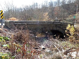
The Bridge in Jefferson Borough, which carries Cochran's Mill Road over Lick Run, in Allegheny County, Pennsylvania, is a single arch stone bridge built in 1901. It was listed on the National Register of Historic Places in 1988. Note, it is a different Cochran's Mill, in Armstrong County, which was the birthplace of Nellie Bly (Elizabeth Jane "Pink" Cochran).

Venetia, Pennsylvania
Unincorporated community in Pennsylvania, United States
Distance: Approx. 4153 meters
Latitude and longitude: 40.24666667,-80.04277778
Venetia is an unincorporated community in Peters Township, Washington County, Pennsylvania, United States. It has a post office with the ZIP code 15367, covering most of the area between McMurray and Gastonville. The population of this area was 8,731 at the 2010 census.
Bunola, Pennsylvania
Unincorporated community in Pennsylvania, United States
Distance: Approx. 4473 meters
Latitude and longitude: 40.23722222,-79.95055556
Bunola is an unincorporated community in Allegheny County, Pennsylvania, United States. The community is located along the Monongahela River, 14.2 miles (22.9 km) south of Pittsburgh. Bunola has a post office with ZIP code 15020, which opened on May 26, 1888.
Weather in this IP's area
few clouds
-10 Celsius
-17 Celsius
-11 Celsius
-9 Celsius
1032 hPa
52 %
1032 hPa
989 hPa
10000 meters
3.6 m/s
150 degree
20 %