192.5.212.149 - IP Lookup: Free IP Address Lookup, Postal Code Lookup, IP Location Lookup, IP ASN, Public IP
Country:
Region:
City:
Location:
Time Zone:
Postal Code:
IP information under different IP Channel
ip-api
Country
Region
City
ASN
Time Zone
ISP
Blacklist
Proxy
Latitude
Longitude
Postal
Route
Luminati
Country
ASN
Time Zone
America/Chicago
ISP
RADIANZ-NUTLEY
Latitude
Longitude
Postal
IPinfo
Country
Region
City
ASN
Time Zone
ISP
Blacklist
Proxy
Latitude
Longitude
Postal
Route
IP2Location
192.5.212.149Country
Region
minnesota
City
newport
Time Zone
America/Chicago
ISP
Language
User-Agent
Latitude
Longitude
Postal
db-ip
Country
Region
City
ASN
Time Zone
ISP
Blacklist
Proxy
Latitude
Longitude
Postal
Route
ipdata
Country
Region
City
ASN
Time Zone
ISP
Blacklist
Proxy
Latitude
Longitude
Postal
Route
Popular places and events near this IP address

South St. Paul, Minnesota
City in Minnesota, United States
Distance: Approx. 3718 meters
Latitude and longitude: 44.89194444,-93.03611111
South St. Paul is a city in Dakota County, Minnesota, United States, immediately south and southeast of St. Paul and east of West St.

Newport, Minnesota
City in Minnesota, United States
Distance: Approx. 675 meters
Latitude and longitude: 44.86638889,-93.00055556
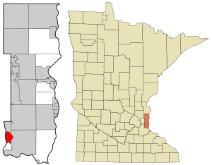
Newport is a city in Washington County, Minnesota, United States. The population was 3,797 at the 2020 census. According to 2023 census estimates, the city is estimated to have a population of 5,321.

St. Paul Park, Minnesota
City in Minnesota, United States
Distance: Approx. 3682 meters
Latitude and longitude: 44.83944444,-92.99166667
St. Paul Park or Saint Paul Park is a city in Washington County, Minnesota, United States. The population was 5,279 at the 2010 census.

Wakota Bridge
Bridge in Minnesota-Newport, Minnesota
Distance: Approx. 1799 meters
Latitude and longitude: 44.88305556,-93.015
The Wakota Bridge is a ten-lane bridge carrying Interstate 494 over the Mississippi River between South St. Paul and Newport, Minnesota, United States. It was completed in 2010, replacing a four-lane span built in 1959.

Mississippi National River and Recreation Area
National Park Service area in the United States
Distance: Approx. 1640 meters
Latitude and longitude: 44.8732995,-93.018826
The Mississippi National River and Recreation Area is a 72-mile (116 km) and 54,000-acre (22,000 ha) protected corridor along the Mississippi River through Minneapolis–Saint Paul in the U.S. state of Minnesota, from the cities of Dayton and Ramsey to just downstream of Hastings. This stretch of the upper Mississippi River includes natural, historical, recreational, cultural, scenic, scientific, and economic resources of national significance. This area is the only national park site dedicated exclusively to the Mississippi River.

Stockyards Exchange
United States historic place
Distance: Approx. 3742 meters
Latitude and longitude: 44.89333333,-93.035
The Stockyards Exchange is a building in South St. Paul, Minnesota, United States, built in 1887 by the recently formed Union Stock Yards Company of Omaha. The building housed businesses associated with the nearby stockyards, which later became the largest stockyards in the United States.

Serbian Home
United States historic place
Distance: Approx. 3406 meters
Latitude and longitude: 44.88472222,-93.0375
The Serbian Home is a two-story brick building, that was built in 1924 in South Saint Paul in the U.S. state of Minnesota. It was built as a community center for Serbian immigrants who worked in the meatpacking industry. It served as a museum respecting the multitude of ethnic groups who have made the city their home until 2020, when it was purchased and renovated by Serbian immigrant Aleksandar Stojmenovic to serve as an event center.

St. Stefan's Romanian Orthodox Church
Historic church in Minnesota, United States
Distance: Approx. 4136 meters
Latitude and longitude: 44.89555556,-93.03888889
St. Stefan's Romanian Orthodox Church is a historic church built in 1924 in South St. Paul, Minnesota, United States.
Tarek ibn Ziyad Academy
Charter school in the United States
Distance: Approx. 2820 meters
Latitude and longitude: 44.85333333,-93.02194444
Tarek ibn Ziyad Academy (TIZA) was a K-8 school in Inver Grove Heights, Minnesota named after Tarek ibn Ziyad, the muslim general of medieval Morocco who entered Gibraltar in 711 CE on behalf of the Umayyad Caliphate and defeated the Visigoths. The school is sponsored by Islamic Relief USA. The school has a primarily Muslim student body and has been embroiled in a number of controversies regarding the separation of church and state. The school has a waiting list of 1,500 students.
Rock Island Swing Bridge
Bridge in St. Paul Park, Minnesota
Distance: Approx. 2266 meters
Latitude and longitude: 44.85333333,-93.00888889
The Rock Island Swing Bridge was a swing bridge that spanned the Mississippi River between Inver Grove Heights, Minnesota, and St. Paul Park, Minnesota. It was also known as the Newport Rail Bridge, as it had a spur to Newport, Minnesota, and J.A.R. bridge, after previous owners Joan and Al Roman of Chicago.
New Life Academy of Woodbury
Distance: Approx. 3248 meters
Latitude and longitude: 44.89388889,-92.97055556
New Life Academy of Woodbury is a private Christian school located in Woodbury, Minnesota, United States. The school is available for preschool through 12th grade and there are about 750 students. New Life Academy of Woodbury, along with New Life Church of Woodbury, was founded in 1977 by Pastor Dick and Patti Wiens.
Carver Lake (Washington County, Minnesota)
Lake in the state of Minnesota, United States
Distance: Approx. 4028 meters
Latitude and longitude: 44.90638889,-92.98138889
Carver Lake is a lake in Ramsey and Washington counties, in the U.S. state of Minnesota. Carver Lake was named for a pioneer who settled there.
Weather in this IP's area
mist
-1 Celsius
-6 Celsius
-1 Celsius
1 Celsius
1021 hPa
91 %
1021 hPa
992 hPa
10000 meters
5.14 m/s
150 degree
100 %
