192.5.159.182 - IP Lookup: Free IP Address Lookup, Postal Code Lookup, IP Location Lookup, IP ASN, Public IP
Country:
 USA
USARegion:
City:
Location:
Time Zone:
Postal Code:
ISP:
ASN:
language:
User-Agent:
Proxy IP:
Blacklist:
IP information under different IP Channel
ip-api
Country
Region
City
ASN
Time Zone
ISP
Blacklist
Proxy
Latitude
Longitude
Postal
Route
db-ip
Country
Region
City
ASN
Time Zone
ISP
Blacklist
Proxy
Latitude
Longitude
Postal
Route
IPinfo
Country
Region
City
ASN
Time Zone
ISP
Blacklist
Proxy
Latitude
Longitude
Postal
Route
IP2Location
192.5.159.182Country
usRegion
pennsylvania
City
university park
Time Zone
America/New_York
ISP
Language
User-Agent
Latitude
Longitude
Postal
ipdata
Country
Region
City
ASN
Time Zone
ISP
Blacklist
Proxy
Latitude
Longitude
Postal
Route
Popular places and events near this IP address

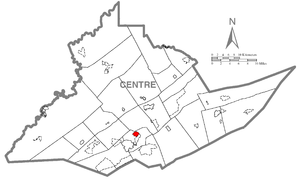
Centre County, Pennsylvania
County in Pennsylvania, United States
Distance: Approx. 4606 meters
Latitude and longitude: 40.91,-77.82
Centre County is a county in the Commonwealth of Pennsylvania, United States. As of the 2020 census, the population was 158,172. Its county seat is Bellefonte.
Houserville, Pennsylvania
Census-designated place in Pennsylvania, United States
Distance: Approx. 4694 meters
Latitude and longitude: 40.82805556,-77.82833333
Houserville is an unincorporated community and census-designated place (CDP) in Centre County, Pennsylvania, United States. It is part of the State College, Pennsylvania Metropolitan Statistical Area. The population was 1,814 at the 2010 census.

WRSC-FM
Radio station in Bellefonte–State College, Pennsylvania
Distance: Approx. 3550 meters
Latitude and longitude: 40.89311111,-77.86305556
WRSC-FM (95.3 MHz) is a radio station licensed to Bellefonte, Pennsylvania, serving the State College area. It currently airs a news/talk format.

WNLI (FM)
Radio station in State College, Pennsylvania
Distance: Approx. 3488 meters
Latitude and longitude: 40.90111111,-77.83888889
WNLI (94.5 MHz) is a radio station licensed to serve State College, Pennsylvania. The station is owned by Educational Media Foundation.
Pennsylvania statistical areas
Distance: Approx. 3033 meters
Latitude and longitude: 40.8781,-77.7996
The United States Commonwealth of Pennsylvania currently has 48 statistical areas that have been delineated by the Office of Management and Budget (OMB). On July 21, 2023, the OMB delineated 12 combined statistical areas, 16 metropolitan statistical areas, and 20 micropolitan statistical areas in Pennsylvania. As of 2023, the largest of these is the Philadelphia-Reading-Camden, PA-NJ-DE-MD CSA, comprising the area around the state's largest city of Philadelphia in the southeast region of the state.
Innovation Park (Pennsylvania State University)
Distance: Approx. 4422 meters
Latitude and longitude: 40.831,-77.844
Innovation Park at Pennsylvania State University is a business and research park covering 118 acres (0.48 km2) in State College, Pennsylvania, adjacent to the Penn State campus near the junction of Interstate 99/U.S. Route 220 and U.S. Route 322.

Brockerhoff Mill
United States historic place
Distance: Approx. 4452 meters
Latitude and longitude: 40.90027778,-77.79944444
Brockerhoff Mill, also known as Roopsburg Mill, is a historic grist mill located at Benner Township, Centre County, Pennsylvania. It was built about 1862, and is a four-story brick building on a limestone foundation. It measures 56 feet by 40 feet, and has a gable roof.

State Correctional Institution – Benner Township
Prison in Centre County, Pennsylvania, USA
Distance: Approx. 4856 meters
Latitude and longitude: 40.859221,-77.778106
State Correctional Institution – Benner Township, commonly referred to as SCI Benner, is a Medium-Security correctional facility for males located in Benner Township, Centre County, Pennsylvania. It is one of twenty six state-level correctional institutions of the Pennsylvania Department of Corrections System. SCI Benner sits adjacent to SCI Rockview.
Fishermans Paradise, Pennsylvania
Fishing area in Pennsylvania, United States
Distance: Approx. 3663 meters
Latitude and longitude: 40.88055556,-77.79277778
Fishermans Paradise is a fishing area in Centre County, Pennsylvania, United States. Fishermans Paradise is located on the east bank of Spring Creek. The Bellefonte Fish Culture Station is located on the west bank.

Bellefonte Airport
Airport in Bellefonte, Pennsylvania
Distance: Approx. 2295 meters
Latitude and longitude: 40.88555556,-77.81611111
Bellefonte Airport (FAA LID N96) is a privately owned and operated airport in Bellefonte, Pennsylvania. It serves as a general aviation airport in the State College metropolitan area.
Continental Courts, Pennsylvania
Census-designated place in Pennsylvania, United States
Distance: Approx. 2753 meters
Latitude and longitude: 40.87111111,-77.86666667
Continental Courts is a mobile home park and census-designated place (CDP) in Centre County, Pennsylvania, United States. It was first listed as a CDP prior to the 2020 census. The CDP is in central Centre County, in the west part of Benner Township.
Fillmore, Pennsylvania
Unincorporated community in Pennsylvania, United States
Distance: Approx. 3775 meters
Latitude and longitude: 40.85895,-77.87639167
Fillmore is a hamlet on the border line of Patton and Benner Township, Centre County, Pennsylvania, United States. It is part of Happy Valley and the larger Nittany Valley.
Weather in this IP's area
clear sky
-4 Celsius
-7 Celsius
-5 Celsius
-4 Celsius
1030 hPa
66 %
1030 hPa
977 hPa
10000 meters
2.06 m/s
290 degree