192.5.104.171 - IP Lookup: Free IP Address Lookup, Postal Code Lookup, IP Location Lookup, IP ASN, Public IP
Country:
Region:
City:
Location:
Time Zone:
Postal Code:
ISP:
ASN:
language:
User-Agent:
Proxy IP:
Blacklist:
IP information under different IP Channel
ip-api
Country
Region
City
ASN
Time Zone
ISP
Blacklist
Proxy
Latitude
Longitude
Postal
Route
db-ip
Country
Region
City
ASN
Time Zone
ISP
Blacklist
Proxy
Latitude
Longitude
Postal
Route
IPinfo
Country
Region
City
ASN
Time Zone
ISP
Blacklist
Proxy
Latitude
Longitude
Postal
Route
IP2Location
192.5.104.171Country
Region
pennsylvania
City
youngwood
Time Zone
America/New_York
ISP
Language
User-Agent
Latitude
Longitude
Postal
ipdata
Country
Region
City
ASN
Time Zone
ISP
Blacklist
Proxy
Latitude
Longitude
Postal
Route
Popular places and events near this IP address

Hunker, Pennsylvania
Borough in Pennsylvania, United States
Distance: Approx. 5101 meters
Latitude and longitude: 40.20444444,-79.61611111
Hunker is a borough which is located in Westmoreland County, Pennsylvania, United States. It has been part of the Pittsburgh metropolitan area since 1950. The population was 307 at the time of the 2020 census.

South Greensburg, Pennsylvania
Borough in Pennsylvania, United States
Distance: Approx. 4871 meters
Latitude and longitude: 40.27722222,-79.54861111
South Greensburg is a borough in Westmoreland County, Pennsylvania, United States. The population was 2,117 at the 2010 census.

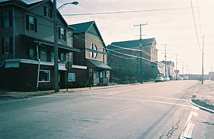
Youngwood, Pennsylvania
Borough in Pennsylvania, United States
Distance: Approx. 303 meters
Latitude and longitude: 40.23944444,-79.58055556
Youngwood is a borough in Westmoreland County, Pennsylvania, United States.

Westmoreland County Community College
Public college in Youngwood, Pennsylvania, US
Distance: Approx. 1128 meters
Latitude and longitude: 40.2331,-79.5664
Westmoreland County Community College is a public community college in Youngwood, Pennsylvania. It was founded in 1970 during an era of community college proliferation within the state. Its location on the suburban fringe was designed to attract students from both the Westmoreland County suburbs of Pittsburgh and the Monongahela Valley, then a still booming industrial center.
Hempfield Area High School
Public school
Distance: Approx. 5085 meters
Latitude and longitude: 40.281354,-79.600064
Hempfield Area High School is a high school for students in the Hempfield Township area of Westmoreland County, Pennsylvania.

Fort Allen (Westmoreland County, Pennsylvania)
Distance: Approx. 4607 meters
Latitude and longitude: 40.27905,-79.59163
Fort Allen (also known as "Truby's Blockhouse") was a military structure which was built in Hempfield Township, Westmoreland County in the Province of Pennsylvania by Colonel Christopher Truby of Pennsylvania's colonial militia. Erected in 1774 in response to a threatened attack by Indians upon German pioneers who had settled in the area, it became a frontier fort of Dunmore's War in 1774, and also was used as a fort during the American Revolution in which Truby also served as an officer with the Continental Army.
Central Westmoreland Career and Technology Center
Public, vocational-educational school in New Stanton, Pennsylvania
Distance: Approx. 2365 meters
Latitude and longitude: 40.229431,-79.601719
Central Westmoreland Career and Technology Center, or CWCTC, is located in New Stanton, Pennsylvania. CWCTC is a part-time Career and Technical Educational School with 10 sending school districts.

State Correctional Institution – Greensburg
Distance: Approx. 3488 meters
Latitude and longitude: 40.26888889,-79.56388889
State Correctional Institution – Greensburg was a Medium-Security prison, holding all male inmates. The facility is located directly off of U.S. Route 119 in Hempfield Township, about five miles South of downtown Greensburg. The institution is located about 30 miles east of Pittsburgh, in the western part of the commonwealth of Pennsylvania.
Armbrust, Pennsylvania
Unincorporated community in Pennsylvania, United States
Distance: Approx. 2802 meters
Latitude and longitude: 40.22361111,-79.55111111
Armbrust is an unincorporated community which is located in Hempfield Township, Westmoreland County, Pennsylvania, United States. The community is situated along Pennsylvania Route 819, 1.8 miles (2.9 km) southeast of Youngwood.
Wilson Run (Sewickley Creek tributary)
Stream in Pennsylvania, USA
Distance: Approx. 4099 meters
Latitude and longitude: 40.21,-79.60638889
Wilson Run is a 5.64 mi (9.08 km) long 2nd order tributary to Sewickley Creek in Westmoreland County, Pennsylvania.
Township Line Run
Stream in Pennsylvania, USA
Distance: Approx. 3027 meters
Latitude and longitude: 40.22305556,-79.54833333
Township Line Run is a 5.82 mi (9.37 km) long 2nd order tributary to Sewickley Creek in Westmoreland County, Pennsylvania. Township Line Run straddles to boundary between Unity and Hempfield Township and of Mount Pleasant and Hempfield Township. This is the only stream of this name in the United States.
Boyer Run (Sewickley Creek tributary)
Stream in Pennsylvania, USA
Distance: Approx. 4189 meters
Latitude and longitude: 40.21916667,-79.53527778
Boyer Run is a 2.98 mi (4.80 km) long 2nd order tributary to Sewickley Creek in Westmoreland County, Pennsylvania.
Weather in this IP's area
light snow
-10 Celsius
-16 Celsius
-10 Celsius
-10 Celsius
1023 hPa
96 %
1023 hPa
977 hPa
3.01 m/s
6.88 m/s
291 degree
100 %