Country:
 Finland
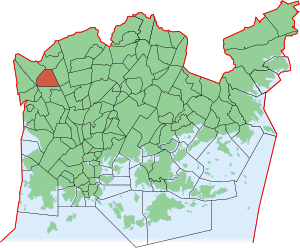
Region:
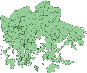
City:
Latitude and Longitude:
Time Zone:
Postal Code:
IP information under different IP Channel
ip-api
Country
Region
City
ASN
Time Zone
ISP
Blacklist
Proxy
Latitude
Longitude
Postal
Route
IPinfo
Country
Region
City
ASN
Time Zone
ISP
Blacklist
Proxy
Latitude
Longitude
Postal
Route
MaxMind
Country
Region
City
ASN
Time Zone
ISP
Blacklist
Proxy
Latitude
Longitude
Postal
Route
Luminati
Country
FIASN
Time Zone
Europe/Helsinki
ISP
Elisa Oyj
Latitude
Longitude
Postal
db-ip
Country
Region
City
ASN
Time Zone
ISP
Blacklist
Proxy
Latitude
Longitude
Postal
Route
ipdata
Country
Region
City
ASN
Time Zone
ISP
Blacklist
Proxy
Latitude
Longitude
Postal
Route
Popular places and events near this IP address
Huopalahti railway station
Railway station in Helsinki, Finland
Distance: Approx. 1802 meters
Latitude and longitude: 60.21777778,24.89527778
Huopalahti railway station (Finnish: Huopalahden rautatieasema, Swedish: Hoplax järnvägsstation) is a railway station on the Helsinki commuter rail network located in western Helsinki, Finland. It is located about 6 kilometres (4 mi) north/northwest of Helsinki Central railway station. Huopalahti station is situated in the district of Etelä-Haaga, but it was named for the municipality of Huopalahti, which was annexed to the city of Helsinki in 1946.

Valimo railway station
Railway station in Helsinki, Finland
Distance: Approx. 1578 meters
Latitude and longitude: 60.22222222,24.87611111
Valimo railway station (Finnish: Valimon rautatieasema, Swedish: Gjuteriets järnvägsstation) is a station on the Helsinki commuter rail network located in the western part of Helsinki, Finland, between Huopalahti and Pitäjanmäki stations. It is located about 7 kilometres (4.3 mi) to the northwest/west of Helsinki Central railway station, in the core of the Pitäjänmäki industrial area.

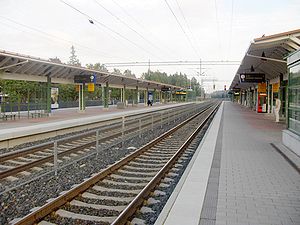
Pohjois-Haaga railway station
Railway station in Helsinki, Finland
Distance: Approx. 639 meters
Latitude and longitude: 60.23027778,24.88333333
Pohjois-Haaga railway station (Finnish: Pohjois-Haagan rautatieasema, Swedish: Norra Haga järnvägsstation) is a railway station on the Helsinki commuter rail network located in northern Helsinki, Finland. It is located about eight kilometres to the north/northwest of Helsinki Central railway station. The Pohjois-Haaga station is located in the district of Lassila, between the stations of Huopalahti and Kannelmäki.

Kannelmäki railway station
Railway station in Helsinki, Finland
Distance: Approx. 1092 meters
Latitude and longitude: 60.23972222,24.87638889
Kannelmäki railway station (Finnish: Kannelmäen rautatieasema, Swedish: Gamlas järnvägsstation) is a railway station on the Helsinki commuter rail network located in northern Helsinki, Finland. It is located approximately nine kilometres to the north/northwest of Helsinki Central railway station. The station is located in the district of Kannelmäki, between the stations of Pohjois-Haaga and Malminkartano, serving the I/P commuter line between Central Helsinki and Vantaankoski.
Kannelmäki
Helsinki Subdivision in Uusimaa, Finland
Distance: Approx. 1252 meters
Latitude and longitude: 60.24416667,24.88305556
Kannelmäki (Swedish: Gamlas, Helsinki slang: Kantsu) is a sub-neighbourhood of the neighbourhood of Kaarela in Helsinki, Finland. Kannelmäki is located a bit more than ten kilometres from the centre of Helsinki, and is bounded by Kehä I in the south, Hämeenlinnanväylä in the east, and the Mätäjoki river in the west and north. It is a part of the Western major district.

Pohjois-Haaga
Helsinki Subdivision in Uusimaa, Finland
Distance: Approx. 500 meters
Latitude and longitude: 60.23333333,24.88333333
Pohjois-Haaga (Finnish), Norra Haga (Swedish, translates as Northern Haaga) is a neighborhood of Helsinki, Finland. On east it borders with Hämeenlinna's highway. Etelä-Haaga (Southern Haaga) is in its southern side, separated by park areas and road Metsäläntie.

Marttila, Helsinki
Helsinki Subdivision in Uusimaa, Finland
Distance: Approx. 1495 meters
Latitude and longitude: 60.228,24.868
Marttila (Swedish: Martas) is a neighbourhood located in Pitäjänmäki, Western Helsinki, Finland. As of 2008, Marttila has 357 inhabitants living in a 0.38 km2 area.

Pitäjänmäki industrial area
Helsinki Subdivision in Uusimaa, Finland
Distance: Approx. 1667 meters
Latitude and longitude: 60.222,24.874
The Pitäjänmäki industrial area (Finnish: Pitäjänmäen yritysalue, Swedish: Sockenbacka företagsområde) is a western neighborhood of Helsinki, Finland. It is located in Pitäjänmäki district. As of 2008, the Pitäjänmäki industrial area, has 2,415 inhabitants living in an area of 1.38 km2.
Pirkkola
Neighborhood of Helsinki in Uusimaa, Southern Finland, Finland
Distance: Approx. 1348 meters
Latitude and longitude: 60.23333333,24.91666667
Pirkkola (Finnish), Britas (Swedish) is a northern neighborhood of Helsinki, Finland. Sports club Helsingin Palloseura has its home ground in Pirkkola.
HUMAK University of Applied Sciences
Distance: Approx. 1426 meters
Latitude and longitude: 60.222015,24.901931
Humak University of Applied Sciences (Finnish: Humanistinen ammattikorkeakoulu, i.e. "Humanist"; HUMAK) is a university of applied sciences (a polytechnic) in Finland. Humak is a leading educator in the humanities, pedagogy, and cultural management in Finland.

Haaga Rhododendron Park
Public park in Helsinki, Finland
Distance: Approx. 1337 meters
Latitude and longitude: 60.2219,24.8932
The Haaga Rhododendron Park (Finnish: Haagan Alppiruusupuisto; Swedish: Alprosparken i Haga) is a public park containing various varieties of rhododendron, located in the district of Haaga in Helsinki, Finland. Although originally used for breeding and research purposes, the park is now a popular attraction among locals. The first rhododendrons were planted in 1975 by the University of Helsinki's selective breeding program; this included the construction of a series of wooden walkways, allowing travel by visitors without disturbing the plants.

Pohjois-Haaga mass grave
Mass grave in Lassila, Helsinki, Finland
Distance: Approx. 856 meters
Latitude and longitude: 60.22805556,24.88222222
The Pohjois-Haaga mass grave is a grave in Lassila, Helsinki, Finland, near the Pohjois-Haaga railway station that dates to the time of the Finnish Civil War in 1918. 28 men of the Red Guards or civilians thought to have been affiliated with them executed by the German Baltic Sea Division soldiers are buried at the site.
Weather in this IP's area
clear sky
15 Celsius
15 Celsius
13 Celsius
16 Celsius
1031 hPa
90 %
1031 hPa
1026 hPa
10000 meters
2.57 m/s
210 degree
06:58:07
19:30:18