192.44.95.172 - IP Lookup: Free IP Address Lookup, Postal Code Lookup, IP Location Lookup, IP ASN, Public IP
Country:
Region:
City:
Location:
Time Zone:
Postal Code:
IP information under different IP Channel
ip-api
Country
Region
City
ASN
Time Zone
ISP
Blacklist
Proxy
Latitude
Longitude
Postal
Route
Luminati
Country
ASN
Time Zone
America/Chicago
ISP
PANDG
Latitude
Longitude
Postal
IPinfo
Country
Region
City
ASN
Time Zone
ISP
Blacklist
Proxy
Latitude
Longitude
Postal
Route
IP2Location
192.44.95.172Country
Region
ohio
City
cincinnati
Time Zone
America/New_York
ISP
Language
User-Agent
Latitude
Longitude
Postal
db-ip
Country
Region
City
ASN
Time Zone
ISP
Blacklist
Proxy
Latitude
Longitude
Postal
Route
ipdata
Country
Region
City
ASN
Time Zone
ISP
Blacklist
Proxy
Latitude
Longitude
Postal
Route
Popular places and events near this IP address

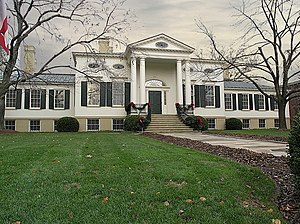
Taft Museum of Art
Historic house in Ohio, United States
Distance: Approx. 581 meters
Latitude and longitude: 39.1025,-84.50333333
The Taft Museum of Art is a fine art collection in Cincinnati, Ohio. It occupies the 200-year-old historic house at 316 Pike Street. The house – the oldest domestic wooden structure in downtown Cincinnati – was built about 1820 and housed several prominent Cincinnatians, including Martin Baum, Nicholas Longworth, David Sinton, Anna Sinton Taft and Charles Phelps Taft.

Mount Adams Incline
Former funicular railway
Distance: Approx. 97 meters
Latitude and longitude: 39.10658333,-84.49961111
The Mount Adams Incline was a funicular, or inclined railway, located in the Cincinnati neighborhood of Mount Adams. It was the third of the city's five inclines to open, beginning operations in 1876, and the last to close down in 1948. It has since been demolished.
The Verdin Company
American bell foundry and clock maker
Distance: Approx. 605 meters
Latitude and longitude: 39.109805,-84.506541
The Verdin Company is a manufacturer of bronze bells, clocks and towers based in Cincinnati, Ohio in the United States. The company has been making, restoring, and repairing bells for use in bell and clock towers, peals, chimes, and carillons since 1842. The company also manufactures electronic carillons, street clocks, glockenspiels, and monuments.

Mount Adams, Cincinnati
Neighborhood of Cincinnati in Ohio, United States
Distance: Approx. 430 meters
Latitude and longitude: 39.10916667,-84.49611111
Mount Adams is one of the 52 neighborhoods of Cincinnati, Ohio. Located on a hill immediately east of downtown Cincinnati, it is south of Walnut Hills, southwest of East Walnut Hills, and west of the East End. The population was 1,578 at the 2020 census.

Immaculata Church
Church in Ohio, United States
Distance: Approx. 330 meters
Latitude and longitude: 39.1076,-84.49661389
The Church of the Immaculata, or Immaculata Church, is a Roman Catholic church atop Mt. Adams, a neighborhood in Cincinnati, Ohio. The church commemorates the Immaculate Conception and serves the Holy Cross–Immaculata Parish in the Archdiocese of Cincinnati.

Cincinnati Playhouse in the Park
Regional theatre in the United States
Distance: Approx. 504 meters
Latitude and longitude: 39.11122778,-84.49774444
The Cincinnati Playhouse in the Park is a regional theatre in the United States. It was founded in 1959 by college student Gerald Covell and was one of the first regional theatres in the United States. Located in Eden Park, the first play that premiered at the Playhouse on October 10, 1960, was Meyer Levin's Compulsion.

Holy Cross Monastery and Church
United States historic place
Distance: Approx. 165 meters
Latitude and longitude: 39.10743056,-84.49851111
Holy Cross Monastery and Church is a registered historic building complex in Cincinnati, Ohio, listed in the National Register on September 13, 1978. Closed in 1977, it is now the corporate headquarters of a property management company, and an event space.

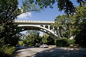
Ida Street Viaduct
United States historic place
Distance: Approx. 212 meters
Latitude and longitude: 39.10886111,-84.49919444
Ida Street Viaduct is a registered historic structure in Cincinnati, Ohio, listed in the National Register on November 28, 1980. The reinforced concrete bridge is located in the hilltop neighborhood of Mount Adams. The Ida Street Viaduct, constructed in 1931 in the Art Deco style, replaced a wooden trestle that carried Cincinnati streetcars.

Mount Adams Public School
United States historic place
Distance: Approx. 266 meters
Latitude and longitude: 39.1086,-84.4979
Mount Adams Public School is a registered historic building in Cincinnati, Ohio, listed in the National Register on November 24, 1980. It was the first home of the School for Creative and Performing Arts from 1973 to 1975.

Pilgrim Presbyterian Church
United States historic place
Distance: Approx. 338 meters
Latitude and longitude: 39.11,-84.49888889
Pilgrim Presbyterian Church is a historic church building in the Mount Adams neighborhood of Cincinnati, Ohio, United States, near the Ida Street Viaduct. Built in 1886, it is a Gothic Revival structure built primarily of brick. Constructed by Mount Adams architect and builder Charles E. Iliff, the church features a two-story rectangular floor plan with a prominent central bell tower.

Rookwood Pottery Company
United States historic place
Distance: Approx. 38 meters
Latitude and longitude: 39.10722222,-84.50083333
Rookwood Pottery is an American ceramics company that was founded in 1880 and closed in 1967, before being revived in 2004. It was initially located in the Over-the-Rhine neighborhood in Cincinnati, Ohio, and has now returned there. In its heyday from about 1890 to the 1929 Crash, it was an important manufacturer, mostly of decorative American art pottery made in several fashionable styles and types of pieces.
Hard Rock Casino Cincinnati
American casino
Distance: Approx. 533 meters
Latitude and longitude: 39.107948,-84.506493
Hard Rock Casino Cincinnati (formerly Jack Cincinnati Casino and Horseshoe Cincinnati) is a casino in Cincinnati, Ohio, owned by Vici Properties and operated by Hard Rock International. It opened in 2013.
Weather in this IP's area
light rain
3 Celsius
-1 Celsius
2 Celsius
4 Celsius
1014 hPa
88 %
1014 hPa
987 hPa
10000 meters
3.6 m/s
200 degree
100 %