192.40.242.3 - IP Lookup: Free IP Address Lookup, Postal Code Lookup, IP Location Lookup, IP ASN, Public IP
Country:
Region:
City:
Location:
Time Zone:
Postal Code:
IP information under different IP Channel
ip-api
Country
Region
City
ASN
Time Zone
ISP
Blacklist
Proxy
Latitude
Longitude
Postal
Route
Luminati
Country
Region
on
City
waterloo
ASN
Time Zone
America/Toronto
ISP
MEGAWIRE
Latitude
Longitude
Postal
IPinfo
Country
Region
City
ASN
Time Zone
ISP
Blacklist
Proxy
Latitude
Longitude
Postal
Route
IP2Location
192.40.242.3Country
Region
ontario
City
kitchener
Time Zone
America/Toronto
ISP
Language
User-Agent
Latitude
Longitude
Postal
db-ip
Country
Region
City
ASN
Time Zone
ISP
Blacklist
Proxy
Latitude
Longitude
Postal
Route
ipdata
Country
Region
City
ASN
Time Zone
ISP
Blacklist
Proxy
Latitude
Longitude
Postal
Route
Popular places and events near this IP address

Kitchener, Ontario
City in Ontario, Canada
Distance: Approx. 3205 meters
Latitude and longitude: 43.41861111,-80.47277778
Kitchener is a city in the Canadian province of Ontario, about 100 km (62 mi) west of Toronto. It is one of three cities that make up the Regional Municipality of Waterloo and is the regional seat. Kitchener was known as Berlin until a 1916 referendum changed its name.

St. Mary's General Hospital
Hospital in Ontario, Canada
Distance: Approx. 1583 meters
Latitude and longitude: 43.437807,-80.50174
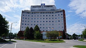
St. Mary's General Hospital is a 197-bed adult acute-care facility in Kitchener, Ontario, Canada serving Waterloo Region and surrounding area. St.
Forest Heights Collegiate Institute
Secondary school in Kitchener, Ontario, Canada
Distance: Approx. 804 meters
Latitude and longitude: 43.42568889,-80.52123889
Forest Heights Collegiate Institute (FHCI), shortened as Forest Heights or simply Forest, is a high school in Kitchener, Ontario, Canada that was established in 1964. It is run by the Waterloo Region District School Board (WRDSB). As of the 2024–2025 school year, Forest Heights has approximately 1200 students.

CKKW-FM
Radio station in Kitchener, Ontario
Distance: Approx. 2932 meters
Latitude and longitude: 43.40361111,-80.53166667
CKKW-FM (99.5 FM) is a Canadian radio station licensed to Kitchener, Ontario, with studios located in Waterloo while its transmitter is located near Ottawa Street South and Trussler Rd in Kitchener. The station is owned by Bell Media and airs an adult hits format branded on-air as Bounce 99.5.

Schneider Haus
House in Kitchener, Canada
Distance: Approx. 2528 meters
Latitude and longitude: 43.4446,-80.4946
The Schneider Haus National Historic Site, formerly Joseph Schneider Haus, is a museum in Kitchener, Ontario, Canada. Situated on some of the earliest land to be settled by non-Indigenous peoples in what would become Waterloo County, the museum includes the oldest remaining dwelling in the area and was named a National Historic Site of Canada in 1999.

Charles Street Transit Terminal
Bus terminal in Kitchener, Ontario
Distance: Approx. 3089 meters
Latitude and longitude: 43.44944444,-80.49222222
The Charles Street Transit Terminal is a former bus terminal in Kitchener, Ontario, Canada. It is the former downtown hub for local Grand River Transit (GRT) bus services for Kitchener and Waterloo, although the terminal now sits vacant and mostly abandoned. It was the largest public service facility run by GRT, with the Cambridge Ainslie Street terminal being the only other staffed bus station, as well as once serving a number of commuter and intercity bus routes with GO Transit, and Coach Canada.

Victoria Park, Kitchener
Urban park in Kitchener, Ontario, Canada
Distance: Approx. 2634 meters
Latitude and longitude: 43.447,-80.498
Victoria Park is the oldest park in Kitchener, Ontario, Canada, situated downtown. It is the site of numerous events and festivities.

Dominion Tire Plant
Manufacturing facility in Kitchener, Ontario, Canada
Distance: Approx. 2973 meters
Latitude and longitude: 43.45211,-80.51157
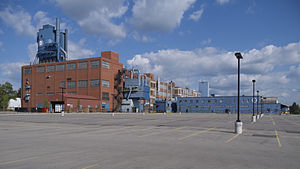
The Dominion Tire Plant, later known as the Uniroyal Tire Plant then the Uniroyal-Goodrich Tire Plant and today known as AirBoss Rubber Compounding is a rubber and tire company located on Glasgow Street in Kitchener, Ontario. It is the largest independent rubber mixing plant in North America.

Victoria Park station (Kitchener)
Light rail station in Kitchener, Ontario
Distance: Approx. 3108 meters
Latitude and longitude: 43.45016,-80.49354
Victoria Park is a stop on the Region of Waterloo's Ion rapid transit system. It is located alongside Charles Street, just west of Gaukel Street, in Kitchener. Its namesake, Victoria Park, has its eastern entrance about 100 metres (330 ft) south of the station along Gaukel.

Queen station (Kitchener)
Light rail station in Kitchener, Ontario
Distance: Approx. 3132 meters
Latitude and longitude: 43.44871,-80.48961
Queen is a stop on the Region of Waterloo's Ion rapid transit system. It is located alongside Charles Street, just east of Queen Street, in Kitchener. It opened in 2019.

Mill station
Light rail station in Kitchener, Ontario
Distance: Approx. 2826 meters
Latitude and longitude: 43.43395,-80.47839
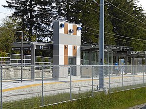
Mill is a stop on the Region of Waterloo's Ion rapid transit system. It is located southeast of the intersection of Ottawa and Mill Streets in Kitchener, alongside the CN Huron Subdivision. It opened on June 21, 2019.
Sunrise Centre
Bus terminal in Kitchener, Ontario
Distance: Approx. 1218 meters
Latitude and longitude: 43.415324,-80.517165
The Sunrise Centre Station is a bus station and terminal in Kitchener, Ontario, Canada. The station is a single platform with bus bays on each side. The platform has a heated shelter with seats inside, LED real-time displays and map boards.
Weather in this IP's area
overcast clouds
-2 Celsius
-4 Celsius
-3 Celsius
-2 Celsius
1031 hPa
89 %
1031 hPa
989 hPa
10000 meters
1.54 m/s
150 degree
100 %
