192.35.181.107 - IP Lookup: Free IP Address Lookup, Postal Code Lookup, IP Location Lookup, IP ASN, Public IP
Country:
Region:
City:
Location:
Time Zone:
Postal Code:
ISP:
ASN:
language:
User-Agent:
Proxy IP:
Blacklist:
IP information under different IP Channel
ip-api
Country
Region
City
ASN
Time Zone
ISP
Blacklist
Proxy
Latitude
Longitude
Postal
Route
db-ip
Country
Region
City
ASN
Time Zone
ISP
Blacklist
Proxy
Latitude
Longitude
Postal
Route
IPinfo
Country
Region
City
ASN
Time Zone
ISP
Blacklist
Proxy
Latitude
Longitude
Postal
Route
IP2Location
192.35.181.107Country
Region
north carolina
City
statesville
Time Zone
America/New_York
ISP
Language
User-Agent
Latitude
Longitude
Postal
ipdata
Country
Region
City
ASN
Time Zone
ISP
Blacklist
Proxy
Latitude
Longitude
Postal
Route
Popular places and events near this IP address

Iredell County, North Carolina
County in North Carolina, United States
Distance: Approx. 4732 meters
Latitude and longitude: 35.81,-80.87
Iredell County ( EYE-ər-del) is a county located in the U.S. state of North Carolina. As of the 2020 census, the population was 186,693. Its county seat is Statesville, and its largest community is Mooresville.
WSIC
Radio station in Statesville, North Carolina
Distance: Approx. 4813 meters
Latitude and longitude: 35.8025,-80.89166667
WSIC (1400 AM) is a commercial radio station in Statesville, North Carolina. The station carries a talk radio format and is owned by Real Talk Studios, LLC. Justin Ckezepis is the President and CEO. WSIC-TV is broadcast over-the-web via the internet and social media (local programming only). WSIC airs live programs from a radio/TV hybrid studio at 1117 Radio Road in Statesville.

Statesville Christian School
American private Christian school in North Carolina
Distance: Approx. 4439 meters
Latitude and longitude: 35.8057,-80.8934
Statesville Christian School in Statesville, North Carolina is a private, nondenominational K-12 Christian school for students in the greater Statesville area.

Ebenezer Academy, Bethany Presbyterian Church and Cemetery
Historic site in Iredell County, North Carolina
Distance: Approx. 5253 meters
Latitude and longitude: 35.86194444,-80.84472222
Ebenezer Academy, Bethany Presbyterian Church and Cemetery is a historic school building, Presbyterian church, and cemetery located six miles north of Statesville in Bethany Township, Iredell County, North Carolina. The log building was constructed in 1823 and housed Ebenezer Academy. The church building was built about 1855, and is a one-story, three bay by five bay, vernacular Greek Revival style frame building with a low gable roof.

Fort Dobbs (North Carolina)
United States historic place
Distance: Approx. 2658 meters
Latitude and longitude: 35.82166667,-80.895
Fort Dobbs was an 18th-century fort in the Yadkin–Pee Dee River Basin region of the Province of North Carolina, near what is now Statesville in Iredell County. Used for frontier defense during and after the French and Indian War, the fort was built to protect the American settlers of the western frontier of North Carolina, and served as a vital outpost for soldiers. Fort Dobbs' primary structure was a blockhouse with log walls, surrounded by a shallow ditch, and by 1759, a palisade.
McClelland-Davis House
Historic house in North Carolina, United States
Distance: Approx. 2790 meters
Latitude and longitude: 35.83083333,-80.92444444
McClelland-Davis House is a historic home located near Statesville, Iredell County, North Carolina. The house was built about 1830, and is a two-story, five bay by two bay, transitional Federal / Greek Revival style frame dwelling. It has a gable roof, one-story rear wing, and two single shoulder brick end chimneys.

Morrison-Mott House
Historic house in North Carolina, United States
Distance: Approx. 6300 meters
Latitude and longitude: 35.78916667,-80.89027778
Morrison-Mott House is a historic home located at Statesville, Iredell County, North Carolina. The house was built about 1904–1905, and is a two-story, three-bay, Classical Revival style frame dwelling. It features a two-story, center bay portico, one-story Ionic order wraparound porch, and porte-cochère.

East Broad Street–Davie Avenue Historic District
Historic district in North Carolina, United States
Distance: Approx. 6543 meters
Latitude and longitude: 35.78805556,-80.88277778
East Broad Street–Davie Avenue Historic District is a national historic district located at Statesville, Iredell County, North Carolina. It encompasses 65 contributing buildings in a predominantly residential section of Statesville. The district includes notable examples of Late Victorian architecture and were mainly built between about 1880 and 1930.
Bethany Township, Iredell County, North Carolina
Township in North Carolina, United States
Distance: Approx. 2531 meters
Latitude and longitude: 35.85555556,-80.87416667
Bethany Township is a non-functioning administrative division of Iredell County, North Carolina, United States. By the requirements of the North Carolina Constitution of 1868, the counties were divided into townships, which included Bethany township as one of sixteen townships in Iredell County.
Concord Presbyterian Church (North Carolina)
Church in North Carolina, US
Distance: Approx. 4699 meters
Latitude and longitude: 35.816315,-80.937058
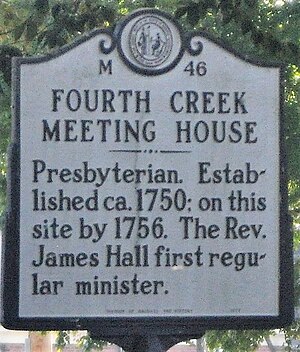
The Concord Presbyterian Church was founded as an offshoot of the Fourth Creek Congregation in 1775. It was located west of the Fourth Creek Congregation that later became the center of the city of Statesville, North Carolina.

James Hall (minister)
American colonial Presbyterian minister
Distance: Approx. 5253 meters
Latitude and longitude: 35.86194444,-80.84472222
Rev. James Hall, D.D. (August 22, 1744 – July 25, 1826) was a Presbyterian minister, chaplain in the Rowan County Regiment during the American Revolution, educator, and missionary in the Natchez area of the Mississippi Territory. He helped to found the Fourth Creek Congregation as its second minister.

Henry Fletcher and Carrie Allison Long House
Historic house in North Carolina, United States
Distance: Approx. 6328 meters
Latitude and longitude: 35.788857,-80.89091
The Henry Fletcher and Carrie Allison Long House, known locally as "Dr. Long's House," was listed in the National Register of Historic Places on April 26, 2021. The home is known as the dwelling of Dr.
Weather in this IP's area
clear sky
-9 Celsius
-13 Celsius
-10 Celsius
-8 Celsius
1035 hPa
58 %
1035 hPa
996 hPa
10000 meters
2.06 m/s
30 degree
