192.34.166.21 - IP Lookup: Free IP Address Lookup, Postal Code Lookup, IP Location Lookup, IP ASN, Public IP
Country:
Region:
City:
Location:
Time Zone:
Postal Code:
IP information under different IP Channel
ip-api
Country
Region
City
ASN
Time Zone
ISP
Blacklist
Proxy
Latitude
Longitude
Postal
Route
Luminati
Country
Region
wv
City
summersville
ASN
Time Zone
America/New_York
ISP
SHENTEL
Latitude
Longitude
Postal
IPinfo
Country
Region
City
ASN
Time Zone
ISP
Blacklist
Proxy
Latitude
Longitude
Postal
Route
IP2Location
192.34.166.21Country
Region
west virginia
City
summersville
Time Zone
America/New_York
ISP
Language
User-Agent
Latitude
Longitude
Postal
db-ip
Country
Region
City
ASN
Time Zone
ISP
Blacklist
Proxy
Latitude
Longitude
Postal
Route
ipdata
Country
Region
City
ASN
Time Zone
ISP
Blacklist
Proxy
Latitude
Longitude
Postal
Route
Popular places and events near this IP address

Nicholas County, West Virginia
County in West Virginia, United States
Distance: Approx. 4699 meters
Latitude and longitude: 38.29,-80.8
Nicholas County is a county located in the central region of U.S. state of West Virginia. As of the 2020 census, the population was 24,604. Its county seat is Summersville.

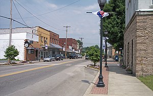
Summersville, West Virginia
City in West Virginia, United States
Distance: Approx. 774 meters
Latitude and longitude: 38.28333333,-80.84416667
Summersville is a city in Nicholas County, West Virginia, United States. The population was 3,459 at the 2020 census. It is the county seat of Nicholas County.
Nicholas County High School
Public secondary school in Summersville, West Virginia, United States
Distance: Approx. 4899 meters
Latitude and longitude: 38.32166667,-80.83055556
Nicholas County High School (NCHS) is a high school located in Summersville, West Virginia. The mascot for NCHS is a grizzly bear, and its school colors are Old Gold and Old Navy. Due to a steady decline in student enrollment, the school currently ranks as an AA school, down from AAA. As a result of flood damage to Richwood High School in June 2016, plans were made to consolidate RHS with NCHS on a new campus.
Gad, West Virginia
Ghost town in West Virginia, United States
Distance: Approx. 5379 meters
Latitude and longitude: 38.23972222,-80.88416667
Gad is an extinct town in Nicholas County, West Virginia, United States. The community was located on McKee's Creek, but was purchased by the US Army Corps of Engineers for the construction of Summersville Lake, which opened on September 3, 1956. The site of the town is now located under the lake near the marina.

Old Main (Nicholas County High School)
United States historic place
Distance: Approx. 430 meters
Latitude and longitude: 38.28083333,-80.8575
Old Main, the former Nicholas County High School, is a school building located in Summersville, West Virginia. The two-story stone Renaissance-style building was constructed in 1913 and graduated its first class in 1915. From 1915 to 1930, the school also served as the site of a State Normal School for teachers.

Nicholas County Courthouse
United States historic place
Distance: Approx. 2084 meters
Latitude and longitude: 38.2625,-80.85138889
The Nicholas County Courthouse in Summersville, West Virginia is a Neoclassical Revival building, designed in 1895 and not completed until 1898. The primary building material was locally quarried Lower Gilbert Sandstone. A jail was added in 1910.
Dr. Flavius Brown House
Historic house in West Virginia, United States
Distance: Approx. 525 meters
Latitude and longitude: 38.27694444,-80.85
Dr. Flavius Brown House is a historic home located at Summersville, Nicholas County, West Virginia. It was built in 1925, and is a two-story Classical Revival style frame dwelling with a hipped roof.
Martin Hamilton House
Historic house in West Virginia, United States
Distance: Approx. 948 meters
Latitude and longitude: 38.28722222,-80.86027778
Martin Hamilton House, also known as the Hamilton House Museum, is a historic home located at Summersville, Nicholas County, West Virginia. It was built in 1893, and is a simple one-story, frame dwelling with clapboard siding and a corrugated metal roof. An eight-foot addition was built in 1936.

Brock Hotel (Summersville, West Virginia)
United States historic place
Distance: Approx. 705 meters
Latitude and longitude: 38.28333333,-80.845
Brock Hotel, also known as the Brock House, is a historic hotel located at Summersville, Nicholas County, West Virginia. It was built about 1890, and is a large 2½-story, frame dwelling. It features broad, shady porches and high pitched twin gables in a vernacular Queen Anne style.

Nicholas County Bank
United States historic place
Distance: Approx. 160 meters
Latitude and longitude: 38.28083333,-80.85083333
Nicholas County Bank is a historic bank building located at Summersville, Nicholas County, West Virginia. It was built in 1923, and is a two-story, locally quarried sandstone building in the Classical Revival style. It has a rectangular plan, a flat roof, and a one-story entrance portico with Doric order columns.
Enon, West Virginia
Unincorporated community in West Virginia, United States
Distance: Approx. 4971 meters
Latitude and longitude: 38.30944444,-80.89666667
Enon is an unincorporated community in Nicholas County, West Virginia, United States. Its post office is closed. The community most likely was named after Ænon, in Palestine, where John the Baptist baptized the people.
Hominy Creek (West Virginia)
Stream in West Virginia, U.S.
Distance: Approx. 4923 meters
Latitude and longitude: 38.23972222,-80.83305556
Hominy Creek is a stream in the U.S. state of West Virginia. Hominy is a name derived from the Algonquian language meaning a type of meal prepared from corn.
Weather in this IP's area
overcast clouds
4 Celsius
4 Celsius
1 Celsius
5 Celsius
1025 hPa
75 %
1025 hPa
956 hPa
10000 meters
0.89 m/s
1.34 m/s
84 degree
97 %