Country:
Region:
City:
Latitude and Longitude:
Time Zone:
Postal Code:
IP information under different IP Channel
ip-api
Country
Region
City
ASN
Time Zone
ISP
Blacklist
Proxy
Latitude
Longitude
Postal
Route
Luminati
Country
ASN
Time Zone
America/Chicago
ISP
ROTH-NET
Latitude
Longitude
Postal
IPinfo
Country
Region
City
ASN
Time Zone
ISP
Blacklist
Proxy
Latitude
Longitude
Postal
Route
db-ip
Country
Region
City
ASN
Time Zone
ISP
Blacklist
Proxy
Latitude
Longitude
Postal
Route
ipdata
Country
Region
City
ASN
Time Zone
ISP
Blacklist
Proxy
Latitude
Longitude
Postal
Route
Popular places and events near this IP address

Newport Beach, California
City in Orange County, California
Distance: Approx. 1720 meters
Latitude and longitude: 33.61666667,-117.8975
Newport Beach is a coastal city of about 85,000 in southern Orange County, California, United States. Located about 40 miles (64 km) southeast of downtown Los Angeles, Newport Beach is known for its sandy beaches. The city's harbor once supported maritime industries.

Fashion Island
Shopping mall in California, U.S.
Distance: Approx. 746 meters
Latitude and longitude: 33.61591667,-117.87613889
Fashion Island is an outdoor regional shopping mall in Newport Beach, California. Opened in 1967 by The Irvine Company as the anchor to their master-planned Newport Center district, Fashion Island is anchored by Bloomingdale's, Macy's, Neiman Marcus, and Nordstrom.

Newport Center, Newport Beach, California
Business district of Newport Beach in California, United States
Distance: Approx. 740 meters
Latitude and longitude: 33.616,-117.8761
Newport Center is a business, shopping, and entertainment district located on a high bluff overlooking Newport Harbor in Newport Beach, California, centered around the Fashion Island regional shopping mall. It was created in the early 1960s as part of William Pereira's master plan for the Irvine Ranch. Newport Center was created as the unofficial "downtown" of the Irvine Ranch, which at the time extended all the way down to Pacific Coast Highway.

Corona del Mar High School
Public school in Newport Beach, California
Distance: Approx. 1342 meters
Latitude and longitude: 33.633537,-117.876686
Corona del Mar High School (CdM) is a public school located in the Eastbluff neighborhood of Newport Beach, California, and belongs to the Newport-Mesa Unified School District. It is a combination of a middle school (7th and 8th grades) and a high school (9th, 10th, 11th, and 12th grades). The school was founded in 1962 and has an enrollment of approximately 2,100 students.
California's 48th congressional district
U.S. House district for California
Distance: Approx. 835 meters
Latitude and longitude: 33.618408,-117.871971
California's 48th congressional district is a congressional district in the U.S. state of California that covers East County, San Diego as well as the Temecula Valley. Major cities in the district include Temecula, Murrieta, and portions of Escondido. It is currently represented by Republican Darrell Issa.
Hoag Classic
Golf tournament
Distance: Approx. 997 meters
Latitude and longitude: 33.613,-117.882
The Hoag Classic (formerly the Toshiba Classic) is a golf tournament on the PGA Tour Champions. The Hoag Classic is played annually in March in Newport Beach, California at the Newport Beach Country Club. Newport Beach Country Club was designed by William Francis Bell in 1954.
Buffalo Ranch
Distance: Approx. 1819 meters
Latitude and longitude: 33.629355,-117.862598
Buffalo Ranch was a tourist attraction which was operated on 115 acres (0.47 km2) in what is today Newport Beach, California by Gene Clark of the Irvine Company and the grandson of the famous Indian chief Geronimo. It was the first outside business to be allowed onto land owned by The Irvine Company. The ranch began with a herd of 72 buffalo, and this number quickly grew.
Newport Sports Museum
Newport Sports Museum, in Newport Beach, California, USA, was closed in 2014
Distance: Approx. 1043 meters
Latitude and longitude: 33.61271999,-117.877241
The Newport Sports Museum was a sports museum in Newport Beach, California, USA. It closed in 2014.
Newport Beach Civic Center and Park
Community park in Newport Beach, California
Distance: Approx. 1525 meters
Latitude and longitude: 33.60984,-117.87198
The Newport Beach Civic Center and Park is a civic center and community park located in Newport Beach, California. It is situated on a 16-acre lot that is bordered by Avocado Avenue and MacArthur Boulevard.
Palisades Tennis Club
Tennis club in Newport Beach, California
Distance: Approx. 698 meters
Latitude and longitude: 33.61888889,-117.88666667
The Palisades Tennis Club is a tennis club located in Newport Beach, California with an entrance at 1171 Jamboree Road. The club, originally called the John Wayne Tennis Club, opened in 1974. It has 16 tennis courts.

Peyton Company
Shipyard in Newport Beach, California, United States
Distance: Approx. 1456 meters
Latitude and longitude: 33.613271,-117.891901
The Peyton Company, also called Peyton Marine Service and Supplies, was a wooden shipbuilding and dry dock company in Newport Beach, California. The shipyard was started by J. W. Peyton (1875-?), born in Texas, and his wife Anabel Peyton (1886-?). The shipyard was later owned by his sons, C. R. Peyton (1911-?) and R. P. Peyton (1919-?), a naval architect.

Bunnyhenge
Sculpture in California
Distance: Approx. 1440 meters
Latitude and longitude: 33.6112,-117.8711
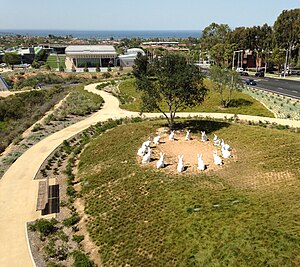
Bunnyhenge is a public sculpture in Newport Beach, California depicting fourteen large white rabbits (of the desert cottontail species) sitting on their haunches in a circle. Two larger, 8 ft (2.4 m) rabbits outside the circle are also a part of the sculpture. Made of concrete and placed in the city's civic center, the sculpture garnered controversy when first built due to its improper allocation of city finances, costing $221,000.
Weather in this IP's area
clear sky
23 Celsius
22 Celsius
21 Celsius
26 Celsius
1017 hPa
23 %
1017 hPa
1011 hPa
10000 meters
3.09 m/s
220 degree
06:17:23
16:53:18