192.244.14.28 - IP Lookup: Free IP Address Lookup, Postal Code Lookup, IP Location Lookup, IP ASN, Public IP
Country:
Region:
City:
Location:
Time Zone:
Postal Code:
IP information under different IP Channel
ip-api
Country
Region
City
ASN
Time Zone
ISP
Blacklist
Proxy
Latitude
Longitude
Postal
Route
Luminati
Country
ASN
Time Zone
Asia/Tokyo
ISP
Internet Initiative Japan Inc.
Latitude
Longitude
Postal
IPinfo
Country
Region
City
ASN
Time Zone
ISP
Blacklist
Proxy
Latitude
Longitude
Postal
Route
IP2Location
192.244.14.28Country
Region
akita
City
showa
Time Zone
Asia/Tokyo
ISP
Language
User-Agent
Latitude
Longitude
Postal
db-ip
Country
Region
City
ASN
Time Zone
ISP
Blacklist
Proxy
Latitude
Longitude
Postal
Route
ipdata
Country
Region
City
ASN
Time Zone
ISP
Blacklist
Proxy
Latitude
Longitude
Postal
Route
Popular places and events near this IP address

Ikawa, Akita
Town in Tōhoku, Japan
Distance: Approx. 5286 meters
Latitude and longitude: 39.91416667,140.08166667
Ikawa (井川町, Ikawa-machi) is a town located in Akita, Japan. As of 1 March 2023, the town had an estimated population of 4658 in 1740 households and a population density of 91 persons per km2. The total area of the town was 47.95 square kilometres (18.51 sq mi).

Ikawa-Sakura Station
Railway station in Ikawa, Akita Prefecture, Japan
Distance: Approx. 5067 meters
Latitude and longitude: 39.91186111,140.07591667
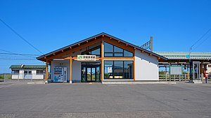
Ikawa-Sakura Station (井川さくら駅, Ikawa-Sakura-eki) is a railway station in the town of Ikawa, Akita Prefecture, Japan, operated by JR East.

Oiwake Station (Akita)
Railway station in Akita, Akita Prefecture, Japan
Distance: Approx. 6684 meters
Latitude and longitude: 39.80995,140.057745
Oiwake Station (追分駅, Oiwake-eki) is a junction railway station in the city of Akita, Akita Prefecture, Japan, operated by East Japan Railway Company (JR East).

Ugo-Iizuka Station
Railway station in Katagami, Akita Prefecture, Japan
Distance: Approx. 3716 meters
Latitude and longitude: 39.89922222,140.0735
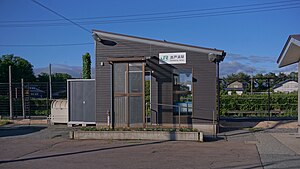
Ugo-Iizuka Station (羽後飯塚駅, Ugo-Iizuka eki) is a railway station in the city of Katagami, Akita, Japan, operated by JR East.

Ōkubo Station (Akita)
Railway station in Katagami, Akita Prefecture, Japan
Distance: Approx. 1797 meters
Latitude and longitude: 39.87134167,140.06315
Ōkubo Station (大久保駅, Ōkubo-eki) is a railway station in the city of Katagami, Akita, Japan, operated by East Japan Railway Company (JR East).

Detohama Station
Railway station in Katagami, Akita Prefecture, Japan
Distance: Approx. 5610 meters
Latitude and longitude: 39.84447778,140.02438056
Detohama Station (出戸浜駅, Detohama-eki) is a railway station in the city of Katagami, Akita, Japan, operated by JR East.

Kamifutada Station
Railway station in Katagami, Akita Prefecture, Japan
Distance: Approx. 6774 meters
Latitude and longitude: 39.86908333,140.00408333
Kamifutada Station (上二田駅, Kamifutada-eki) is a railway station in the city of Katagami, Akita Prefecture, Japan, operated by East Japan Railway Company (JR East).

Akita Prefectural Museum
Building in Akita Prefecture, Japan
Distance: Approx. 5700 meters
Latitude and longitude: 39.81722222,140.06611111
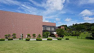
Akita Prefectural Museum (秋田県立博物館, Akita Kenritsu Hakubutsukan) is a prefectural museum in the city of Akita, Japan. It houses a comprehensive display of archaeological artifacts, crafts, biological and geological samples pertaining to the history and folklore of Akita Prefecture. The museum opened in May 1975 and reopened after renovations in April 2004.
Hokiden Tameike Dam
Dam in Akita Prefecture, Japan
Distance: Approx. 6242 meters
Latitude and longitude: 39.81638889,140.11555556
Hokiden Tameike is an earthfill dam located in Akita Prefecture in Japan. The dam is used for irrigation. The catchment area of the dam is 14.7 km2.
Hotta Tameike Dam
Dam in Akita Prefecture, Japan
Distance: Approx. 6653 meters
Latitude and longitude: 39.81333333,140.11833333
Hotta Tameike Dam is an earthfill dam located in Akita Prefecture in Japan. The dam is used for irrigation. The catchment area of the dam is 0.2 km2.
Sarutasawa Tameike Dam
Dam in Akita Prefecture, Japan
Distance: Approx. 7080 meters
Latitude and longitude: 39.80916667,140.11861111
Sarutasawa Tameike is an earthfill dam located in Akita Prefecture in Japan. The dam is used for irrigation. The catchment area of the dam is 0.8 km2.
Yoshida Tameike Dam
Dam in Akita Prefecture, Japan
Distance: Approx. 5856 meters
Latitude and longitude: 39.81666667,140.10444444
Yoshida Tameike is an earthfill dam located in Akita Prefecture in Japan. The dam is used for irrigation. The catchment area of the dam is 3.7 km2.
Weather in this IP's area
overcast clouds
9 Celsius
5 Celsius
9 Celsius
9 Celsius
1014 hPa
65 %
1014 hPa
1009 hPa
10000 meters
11.2 m/s
13.9 m/s
197 degree
100 %