Country:
Region:
City:
Latitude and Longitude:
Time Zone:
Postal Code:
IP information under different IP Channel
ip-api
Country
Region
City
ASN
Time Zone
ISP
Blacklist
Proxy
Latitude
Longitude
Postal
Route
Luminati
Country
Region
va
City
middleburg
ASN
Time Zone
America/New_York
ISP
BENEFITFOC
Latitude
Longitude
Postal
IPinfo
Country
Region
City
ASN
Time Zone
ISP
Blacklist
Proxy
Latitude
Longitude
Postal
Route
db-ip
Country
Region
City
ASN
Time Zone
ISP
Blacklist
Proxy
Latitude
Longitude
Postal
Route
ipdata
Country
Region
City
ASN
Time Zone
ISP
Blacklist
Proxy
Latitude
Longitude
Postal
Route
Popular places and events near this IP address

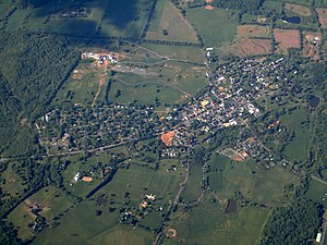
Middleburg, Virginia
Town in Virginia, United States
Distance: Approx. 456 meters
Latitude and longitude: 38.96833333,-77.7375
Middleburg is a town in Loudoun County, Virginia, United States, with a population of 673 as of the 2010 census. It is the southernmost town along Loudoun County's shared border with Fauquier County. Middleburg is known as the "Nation's Horse and Hunt Capital" for its foxhunting, steeplechases, and large estates.

Battle of Middleburg
Battle of the American Civil War
Distance: Approx. 1616 meters
Latitude and longitude: 38.96785,-77.75973
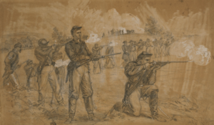
The Battle of Middleburg took place from June 17 to June 19, 1863, in Loudoun County, Virginia, as part of the Gettysburg Campaign of the American Civil War. Confederate Maj. Gen.
The Hill School (Virginia)
Private school in Middleburg, Virginia, US
Distance: Approx. 554 meters
Latitude and longitude: 38.9654,-77.7349
The Hill School is a private, K-8 co-educational day school in Middleburg, Virginia, United States.

National Sporting Library & Museum
Library and museum in Virginia, United States
Distance: Approx. 242 meters
Latitude and longitude: 38.966973,-77.73924
The National Sporting Library & Museum or NSLM (formerly the National Sporting Library) is a research library and art museum in Middleburg, Virginia, in the United States.

Gen. William Mitchell House
Historic house in Virginia, United States
Distance: Approx. 612 meters
Latitude and longitude: 38.96111111,-77.74555556
The Gen. William Mitchell House, also known as Boxwood or the Gen. Billy Mitchell House was the country estate and home of General Billy Mitchell (1879–1936) during the last ten years of his life, from 1926 through 1936.

Middleburg Historic District (Middleburg, Virginia)
Historic district in Virginia, United States
Distance: Approx. 605 meters
Latitude and longitude: 38.96888889,-77.73583333
The Middleburg Historic District comprises the historic center of Middleburg, Virginia. The district extends along the downtown section of Washington Street, and is flanked on the east by Independence Street and to the west by Constitution Street. The district's commercial area is along Washington and Madison Streets.

Much Haddam
Historic house in Virginia, United States
Distance: Approx. 166 meters
Latitude and longitude: 38.96666667,-77.7425
Much Haddam is a Federal style brick house, built about 1820 just outside Middleburg, Virginia by Richard Cochran. The two-story brick house is located on the Ashby's Gap Turnpike, near the west end of Middleburg, and is a prominent landmark to those approaching Middleburg from the west.
Waverly (Middleburg, Virginia)
Historic house in Virginia, United States
Distance: Approx. 3900 meters
Latitude and longitude: 38.93055556,-77.74444444
Waverly, also known as Waverley, is a historic house located near Middleburg, Fauquier County, Virginia. The original section was built about 1790, and later enlarged about 1830, and enlarged and remodeled in the 1850s. It is a single-pile, center-hall, two-story dwelling, a typical example of an I-house.

Burrland Farm Historic District
Place in Virginia, U.S.A.
Distance: Approx. 2753 meters
Latitude and longitude: 38.94361111,-77.75611111
Burrland Farm Historic District is a historic home and farm complex and national historic district located near Middleburg, Fauquier County, Virginia. The district encompasses 22 contributing buildings, 2 contributing sites, 14 contributing structures, and 1 contributing object on a 458-acre thoroughbred horse breeding and training farm. The buildings were built between 1927 and 1932, and include a Georgian Revival style training barn, a polo barn, a stallion barn, two broodmare barns, a yearling barn, a field shed, an equipment shed, a farm manager's house / office, a trainer's cottage, a mess hall quarters, a foreman's dwelling, three mash houses, five garages, a pumphouse, and a feed and storage warehouse.
Middleburg Virginia AVA
American Viticultural Area in Virginia
Distance: Approx. 702 meters
Latitude and longitude: 38.96666667,-77.73333333
The Middleburg Virginia AVA is an American Viticultural Area in the northern Piedmont region of Virginia, 50 miles (80 km) west of Washington, D.C. It is named for the town of Middleburg, Virginia and is bounded by the Potomac River to the north and by mountains in other directions. The hardiness zone of the AVA is 7a.

Red Fox Inn & Tavern
United States historic place
Distance: Approx. 1010 meters
Latitude and longitude: 38.96777778,-77.73
The Red Fox Inn & Tavern, also known as the Middleburg Inn and Beveridge House, is a historic inn and tavern located in Middleburg, Loudoun County, Virginia. According to the National Register of Historic Places placard on the building, the Red Fox Inn was established circa 1728. Some historic artifacts on the building date to about 1830, with additions and remodelings dating from the 1850s, 1890s, and the 1940s.

Little River Rural Historic District
Historic district in Virginia, United States
Distance: Approx. 3417 meters
Latitude and longitude: 38.97222222,-77.70277778
The Little River Rural Historic District encompasses a large rural landscape in northeastern Fauquier County. Covering some 23,000 acres (9,300 ha), the district extends from near The Plains in the south to near Middleburg in the north. On the east it is bounded by the Bull Run Mountains, and on the west by Cromwell's Run.
Weather in this IP's area
overcast clouds
8 Celsius
7 Celsius
7 Celsius
9 Celsius
1016 hPa
80 %
1016 hPa
997 hPa
10000 meters
1.79 m/s
3.58 m/s
351 degree
100 %
06:54:27
16:57:06