Country:
Region:
City:
Latitude and Longitude:
Time Zone:
Postal Code:
IP information under different IP Channel
ip-api
Country
Region
City
ASN
Time Zone
ISP
Blacklist
Proxy
Latitude
Longitude
Postal
Route
Luminati
Country
ASN
Time Zone
America/Chicago
ISP
WA-STATE-GOV
Latitude
Longitude
Postal
IPinfo
Country
Region
City
ASN
Time Zone
ISP
Blacklist
Proxy
Latitude
Longitude
Postal
Route
db-ip
Country
Region
City
ASN
Time Zone
ISP
Blacklist
Proxy
Latitude
Longitude
Postal
Route
ipdata
Country
Region
City
ASN
Time Zone
ISP
Blacklist
Proxy
Latitude
Longitude
Postal
Route
Popular places and events near this IP address

Olympia, Washington
Capital city of Washington, United States
Distance: Approx. 183 meters
Latitude and longitude: 47.03777778,-122.90083333
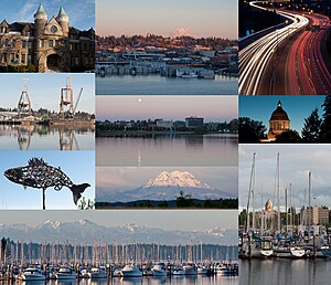
Olympia is the capital city of the U.S. state of Washington and the county seat of Thurston County. It had a population of 55,605 at the time of the 2020 census, making it the state of Washington's 23rd-most populous city. Olympia borders Lacey to the east and Tumwater to the south.

Washington Supreme Court
Highest court in the U.S. state of Washington
Distance: Approx. 230 meters
Latitude and longitude: 47.03694444,-122.905
The Washington Supreme Court is the highest court in the judiciary of the U.S. state of Washington. The court is composed of a chief justice and eight associate justices. Members of the court are elected to six-year terms.
Hands On Children's Museum
Children's museum in Washington, USA
Distance: Approx. 144 meters
Latitude and longitude: 47.03833333,-122.90111111
Hands On Children's Museum is a children's museum in Olympia, Washington, USA. It was founded in 1987 and received over 150,000 visitors a year at its old location near the Washington State Capitol. After moving to its new, permanent home on Olympia's East Bay, at 414 Jefferson Street on Olympia's East Bay, visitorship grew to over 300,000 in its first year (Nov 2012-Nov 2013). The New Hands On Children's Museum, geared for children ages 0–11, features 8 themed galleries focusing on science and nature, plus an enhanced Arts & Parts Studio.
Temple of Justice (Washington)
Government building in Olympia, Washington, United States
Distance: Approx. 221 meters
Latitude and longitude: 47.03696111,-122.90483611
The Temple of Justice is a government building in Olympia, Washington, where sessions of the Washington Supreme Court are convened. It also houses the state's official law library, and formerly housed the office of the Attorney-General of Washington.

Washington State Capitol Conservatory
Greenhouse in Washington, United States
Distance: Approx. 104 meters
Latitude and longitude: 47.0377,-122.9037
The Washington State Capitol Conservatory was a greenhouse on the grounds of the Washington State Capitol in Olympia, Washington. It was funded $25,000 in 1938, designed by architect Joseph Wohleb, and built in 1939 as a Works Project Administration project. In the 1990s it was noted the greenhouse was suffering foundation damage from soil settling of up to 65-foot (20 m) deep fill on which it was built.
World War II Memorial (Olympia, Washington)
War memorial in Olympia, Washington, U.S.
Distance: Approx. 116 meters
Latitude and longitude: 47.03775,-122.90193
The World War II Memorial by artist Simon Kogan is installed on the Washington State Capitol campus in Olympia, Washington, United States. The memorial, dedicated on May 28, 1999, is made of bronze, melted torpedo railings, granite, and stone.
Law Enforcement Memorial (Olympia, Washington)
Memorial in Olympia, Washington, U.S.
Distance: Approx. 184 meters
Latitude and longitude: 47.03743,-122.90485
The Law Enforcement Memorial is installed on the Washington State Capitol campus in Olympia, Washington, United States. The memorial was designed by John Swanson and dedicated on May 1, 2006.

POW–MIA Memorial (Olympia, Washington)
Memorial on the Washington State Capitol campus
Distance: Approx. 216 meters
Latitude and longitude: 47.036561,-122.90295
The POW–MIA Memorial is installed on the Washington State Capitol campus in Olympia, Washington, United States. The marble and granite memorial was originally dedicated as the Vietnam Veterans Memorial on November 11, 1982, and later rededicated to commemorate prisoners of war (POW) and people missing in action (MIA) on September 16, 1988 (National POW/MIA Recognition Day).

Medal of Honor Memorial (Olympia, Washington)
Monument in Olympia, Washington
Distance: Approx. 220 meters
Latitude and longitude: 47.036536,-122.902674
The Medal of Honor Memorial is installed on the Washington State Capitol campus in Olympia, Washington, United States. The granite obelisk was dedicated on November 7, 1976.

Tivoli Fountain (Olympia, Washington)
Fountain in Olympia, Washington, U.S.
Distance: Approx. 243 meters
Latitude and longitude: 47.03651,-122.90168
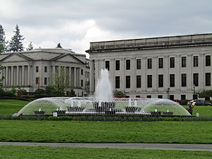
The Tivoli Fountain is installed on the Washington State Capitol campus in Olympia, Washington, United States. Dedicated on April 15, 1953, the copper and cement fountain is a replica of the Roman-style fountain in Copenhagen's Tivoli Park.

Vietnam Veterans Memorial (Olympia, Washington)
Vietname War memorial in Olympia, Washington, U.S.
Distance: Approx. 311 meters
Latitude and longitude: 47.03572,-122.90254
The Vietnam Veterans Memorial by Kris Snider is installed on the Washington State Capitol campus in Olympia, Washington, United States. The granite memorial was dedicated on May 25, 1987.
Arc of Statehood
Series of bronze markers in Olympia, Washington, U.S.
Distance: Approx. 298 meters
Latitude and longitude: 47.04111111,-122.90388889
The Arc of Statehood is a series of 39 bronze markers mounted on sandstone blocks by Capitol Lake on the Washington State Capitol campus, in Olympia, Washington, United States. The markers were installed in 2002.
Weather in this IP's area
fog
3 Celsius
2 Celsius
1 Celsius
5 Celsius
1018 hPa
96 %
1018 hPa
1015 hPa
805 meters
1.34 m/s
2.24 m/s
237 degree
100 %
07:16:05
16:36:48