192.208.1.2 - IP Lookup: Free IP Address Lookup, Postal Code Lookup, IP Location Lookup, IP ASN, Public IP
Country:
Region:
City:
Location:
Time Zone:
Postal Code:
IP information under different IP Channel
ip-api
Country
Region
City
ASN
Time Zone
ISP
Blacklist
Proxy
Latitude
Longitude
Postal
Route
Luminati
Country
ASN
Time Zone
America/Toronto
ISP
Johannes Ernst
Latitude
Longitude
Postal
IPinfo
Country
Region
City
ASN
Time Zone
ISP
Blacklist
Proxy
Latitude
Longitude
Postal
Route
IP2Location
192.208.1.2Country
Region
baden-wurttemberg
City
tamm
Time Zone
Europe/Berlin
ISP
Language
User-Agent
Latitude
Longitude
Postal
db-ip
Country
Region
City
ASN
Time Zone
ISP
Blacklist
Proxy
Latitude
Longitude
Postal
Route
ipdata
Country
Region
City
ASN
Time Zone
ISP
Blacklist
Proxy
Latitude
Longitude
Postal
Route
Popular places and events near this IP address

Hohenasperg
Distance: Approx. 1995 meters
Latitude and longitude: 48.91,9.13833333
Hohenasperg, located in the federal state of Baden-Württemberg near Stuttgart, Germany, of which it is administratively part, is an ancient fortress and prison overlooking the town of Asperg. It was an important Celtic oppidum, and a number of very important "princely" burials are close by, in particular the Hochdorf Chieftain's Grave.

Monrepos Palace
Distance: Approx. 3939 meters
Latitude and longitude: 48.91972222,9.16944444
Monrepos (German: Seeschloss Monrepos) is a lakeside schloss in Ludwigsburg, Germany. Although quite far and almost separate from Favorite Palace and Ludwigsburg Palace, it is connected to the rest of the grounds by way of pedestrian paths. It is one of the two minor palaces on the estate, along with the main one.

Markgröningen
Town in Baden-Württemberg, Germany
Distance: Approx. 3054 meters
Latitude and longitude: 48.90472222,9.08083333
Markgröningen is a town in the district (Kreis) of Ludwigsburg, Baden-Württemberg, Germany. It is known for its fine historic buildings, many in the Fachwerk German architectural style, and its annual Shepherds' Run. Markgröningen is on the Deutsche Fachwerkstraße (German Timber-Frame Road).

Asperg
German city
Distance: Approx. 2567 meters
Latitude and longitude: 48.9,9.13333333
Asperg (German pronunciation: [ˈaspɛʁk]) is a town in the district of Ludwigsburg, Baden-Württemberg, Germany.

Tamm
Town in Baden-Württemberg, Germany
Distance: Approx. 368 meters
Latitude and longitude: 48.91666667,9.11666667
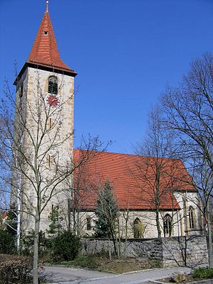
Tamm is a Stadt (town) in the district of Ludwigsburg, Baden-Württemberg, Germany. It is situated 6 km northwest of Ludwigsburg, 4 km south of Bietigheim-Bissingen, and approx. 17 km north of Stuttgart's city center.

Möglingen
Municipality in Baden-Württemberg, Germany
Distance: Approx. 3652 meters
Latitude and longitude: 48.88833333,9.12916667
Möglingen is a municipality in the district of Ludwigsburg, Baden-Württemberg, Germany. It is situated 13 km northwest of Stuttgart, and 5 km west of Ludwigsburg.

Bietigheim-Bissingen station
Railway station in Bietigheim-Bissingen, Germany
Distance: Approx. 3382 meters
Latitude and longitude: 48.94722222,9.13583333
Bietigheim-Bissingen station is a junction station in the town of Bietigheim-Bissingen in the German state of Baden-Württemberg where the Württemberg Western Railway separates from the Franconia Railway. With its eight station tracks it is the largest station in the district of Ludwigsburg. It is also served by line S 5 of the Stuttgart S-Bahn.

Leudelsbach
River in Germany
Distance: Approx. 2859 meters
Latitude and longitude: 48.92638889,9.07777778
The Leudelsbach is a small river of Baden-Württemberg, Germany. The 6.5 kilometer long river flows into the Enz near Unterriexingen.
Asperg station
Railway station in Asperg, Germany
Distance: Approx. 2778 meters
Latitude and longitude: 48.90694444,9.14805556
Asperg station is a station on the network of the Stuttgart S-Bahn in the German state of Baden-Württemberg, located at the 17.6 kilometre mark of the Franconia Railway.

Tamm (Württ) station
Railway station in Tamm, Germany
Distance: Approx. 735 meters
Latitude and longitude: 48.92166667,9.12527778
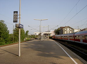
Tamm (Württemberg) station (abbreviated to Tamm (Württ) is a station on the network of the Stuttgart S-Bahn in Tamm in the German state of Baden-Württemberg, located at the 20.2 kilometre mark of the Franconia Railway.

Kleinaspergle
Distance: Approx. 3208 meters
Latitude and longitude: 48.89739,9.142977
Kleinaspergle is an early La Tène burial mound north of Hohenasperg, in Baden-Württemberg. In 1879, the mound was excavated by Oscar Fraas. Two burial chambers were uncovered.

EgeTrans Arena
Distance: Approx. 3461 meters
Latitude and longitude: 48.95080556,9.12080556
EgeTrans Arena is a multi-purpose arena in Bietigheim-Bissingen, Germany. It is the home arena of handball team SG BBM Bietigheim and professional ice hockey team SC Bietigheim Steelers.
Weather in this IP's area
clear sky
-1 Celsius
-3 Celsius
-2 Celsius
0 Celsius
1037 hPa
84 %
1037 hPa
999 hPa
10000 meters
1.46 m/s
1.01 m/s
127 degree
