192.207.55.182 - IP Lookup: Free IP Address Lookup, Postal Code Lookup, IP Location Lookup, IP ASN, Public IP
Country:
Region:
City:
Location:
Time Zone:
Postal Code:
IP information under different IP Channel
ip-api
Country
Region
City
ASN
Time Zone
ISP
Blacklist
Proxy
Latitude
Longitude
Postal
Route
Luminati
Country
ASN
Time Zone
America/Chicago
ISP
TLSN-TX
Latitude
Longitude
Postal
IPinfo
Country
Region
City
ASN
Time Zone
ISP
Blacklist
Proxy
Latitude
Longitude
Postal
Route
IP2Location
192.207.55.182Country
Region
texas
City
marble falls
Time Zone
America/Chicago
ISP
Language
User-Agent
Latitude
Longitude
Postal
db-ip
Country
Region
City
ASN
Time Zone
ISP
Blacklist
Proxy
Latitude
Longitude
Postal
Route
ipdata
Country
Region
City
ASN
Time Zone
ISP
Blacklist
Proxy
Latitude
Longitude
Postal
Route
Popular places and events near this IP address

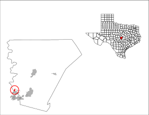
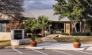
Cottonwood Shores, Texas
City in Texas, United States
Distance: Approx. 3146 meters
Latitude and longitude: 30.555,-98.3275
Cottonwood Shores is a city in Burnet County, Texas, United States. The population was 1,403 at the 2020 census.

Granite Shoals, Texas
City in Texas, United States
Distance: Approx. 4206 meters
Latitude and longitude: 30.58888889,-98.38166667
Granite Shoals is a city in Burnet County, Texas, United States with a 2020 census population of 5,129.

Highland Haven, Texas
City in Texas, United States
Distance: Approx. 6125 meters
Latitude and longitude: 30.6075,-98.395
Highland Haven is a city in Burnet County, Texas, United States. The population was 418 at the 2020 census.
Meadowlakes, Texas
City in Texas, United States
Distance: Approx. 4597 meters
Latitude and longitude: 30.56388889,-98.29527778
Meadowlakes is a city in Burnet County, Texas, United States. The population was 1,907 at the 2020 census.

Horseshoe Bay, Texas
City in Texas, United States
Distance: Approx. 5823 meters
Latitude and longitude: 30.53972222,-98.375
Horseshoe Bay is a city in Llano and Burnet counties in the U.S. state of Texas. Situated on Lake Lyndon B. Johnson and the south branch of the Colorado River, it is known in the region for its golf courses, hotel and resort, and water sports. Prior to its incorporation in September 2005, it was a census-designated place (CDP).

Texas Highland Lakes
Distance: Approx. 4497 meters
Latitude and longitude: 30.5678,-98.3827
The Texas Highland Lakes are a chain of fresh water reservoirs in Central Texas formed by dams on the lower Colorado River. The Texas Colorado River winds southeast from West Texas to Matagorda Bay and the Gulf of Mexico. The lower Colorado River basin has a history of major flooding.

Wirtz Dam
Dam in Texas, U.S.
Distance: Approx. 2900 meters
Latitude and longitude: 30.55555556,-98.33777778
Wirtz Dam (formerly Granite Shoals Dam) was constructed from 1949 to 1951 to provide hydroelectric power and to form Lake Lyndon B. Johnson (formerly Lake Granite Shoals), one of the Texas Highland Lakes. Lake LBJ ‒ as it is more commonly referred to ‒ provides cooling water for the Lower Colorado River Authority's Thomas C. Ferguson Power Plant along Horseshoe Bay. Wirtz Dam was originally named Granite Shoals Dam until 1951 when it was renamed in honor of Alvin J. Wirtz who had been instrumental in the formation of the LCRA. Likewise, Lake LBJ was originally named Lake Granite Shoals until 1965 when it was renamed for another advocate of the LCRA, U.S. President Lyndon B. Johnson.
Lake Lyndon B. Johnson
Reservoir in the United States
Distance: Approx. 2900 meters
Latitude and longitude: 30.55555556,-98.33777778
Lake Lyndon B. Johnson (more commonly referred to as Lake LBJ and originally named Lake Granite Shoals) is a reservoir on the Colorado River in the Texas Hill Country about 45 miles northwest of Austin. The reservoir was formed in 1950 by the construction of Granite Shoals Dam by the Lower Colorado River Authority (LCRA). The Colorado River and the Llano River meet in the northern portion of the lake at Kingsland.

Thomas C. Ferguson Power Plant
Distance: Approx. 4193 meters
Latitude and longitude: 30.5575,-98.37222222
The Thomas C. Ferguson Power Plant consists of dual natural gas fired turbines and a single steam turbine run by exhaust heat from the gas turbines in a combined cycle configuration that generates 540 megawatts (MW) of electricity. The facility is located near Horseshoe Bay in Llano County, Texas, United States. It is owned and operated by the Lower Colorado River Authority (LCRA) and was named for Thomas C. Ferguson, a member of LCRA's first Board of Directors.

Granite Mountain (Texas)
Mountain in Burnet County, Texas, United States
Distance: Approx. 3670 meters
Latitude and longitude: 30.58833333,-98.30111111
Granite Mountain is a solid dome, also known as a bornhardt, of pink granite (pink granite is also known as Sunset Red) rising over 860 feet one mile west of Marble Falls, Texas. Since quarry operations began in the late 19th century, the distinctive pink-red colored rock has been used in the construction of the Texas State Capitol in Austin, Texas, and also for the construction of the Galveston Seawall. In 1882, three businessmen and the owners of Granite Mountain, G. W. Lacy (of the Lacy Lans Ranch), N. L. Norton and W. H. Westfall, donated the amount of granite necessary to build the Texas State Capitol.

Marble Falls, Texas
City in Texas, United States
Distance: Approx. 5552 meters
Latitude and longitude: 30.56666667,-98.28333333
Marble Falls is a city in Burnet County, Texas, United States. As of the 2020 United States Census, the city population was 7,037. Lake Marble Falls is part of the Highland Lakes on the Colorado River, the largest chain of lakes in Texas.
Sherwood Shores, Burnet County, Texas
Unincorporated community in Texas, United States
Distance: Approx. 2360 meters
Latitude and longitude: 30.59361111,-98.35888889
Sherwood Shores is an unincorporated community in Burnet County, Texas, United States. According to the Handbook of Texas, the community had an estimated population of 870 in 2000.
Weather in this IP's area
overcast clouds
19 Celsius
20 Celsius
18 Celsius
19 Celsius
1017 hPa
83 %
1017 hPa
979 hPa
10000 meters
3.6 m/s
7.72 m/s
170 degree
100 %
