192.203.134.44 - IP Lookup: Free IP Address Lookup, Postal Code Lookup, IP Location Lookup, IP ASN, Public IP
Country:
Region:
City:
Location:
Time Zone:
Postal Code:
IP information under different IP Channel
ip-api
Country
Region
City
ASN
Time Zone
ISP
Blacklist
Proxy
Latitude
Longitude
Postal
Route
Luminati
Country
ASN
Time Zone
America/Chicago
ISP
INS-AS
Latitude
Longitude
Postal
IPinfo
Country
Region
City
ASN
Time Zone
ISP
Blacklist
Proxy
Latitude
Longitude
Postal
Route
IP2Location
192.203.134.44Country
Region
texas
City
dallas
Time Zone
America/Chicago
ISP
Language
User-Agent
Latitude
Longitude
Postal
db-ip
Country
Region
City
ASN
Time Zone
ISP
Blacklist
Proxy
Latitude
Longitude
Postal
Route
ipdata
Country
Region
City
ASN
Time Zone
ISP
Blacklist
Proxy
Latitude
Longitude
Postal
Route
Popular places and events near this IP address
Farmers Branch, Texas
City in Texas, United States
Distance: Approx. 3272 meters
Latitude and longitude: 32.92722222,-96.86388889
Farmers Branch, officially the City of Farmers Branch, is a city in Dallas County, Texas, United States. It is an inner-ring suburb of Dallas and is part of the Dallas–Fort Worth metroplex. Its population was 35,991 at the 2020 census.

Carrollton, Texas
City in Texas, United States
Distance: Approx. 4255 meters
Latitude and longitude: 32.95361111,-96.89027778
Carrollton is a city in Dallas, Denton, and Collin counties in the U.S. state of Texas. As of the 2020 census, its population was 133,434, making it the 27th-most populous city in Texas.
R. L. Turner High School
Secondary school in Carrollton, Dallas County, Texas, United States
Distance: Approx. 3651 meters
Latitude and longitude: 32.94828,-96.8916
R. L. Turner High School is a public high school located in Carrollton, Texas, (USA) in the Carrollton-Farmers Branch Independent School District. The school serves portions of Carrollton, Farmers Branch, and Addison. In 2015, the school was rated "Met Standard" by the Texas Education Agency.
Dallas Christian College
Private college in Texas, U.S.
Distance: Approx. 825 meters
Latitude and longitude: 32.9137,-96.8876
Dallas Christian College (DCC) is a private Christian college in Farmers Branch, Texas. It is affiliated with the Christian Church and accredited by the Association for Biblical Higher Education.
Farmers Branch station
DART light rail station in Farmers Branch, Texas
Distance: Approx. 702 meters
Latitude and longitude: 32.922004,-96.896229
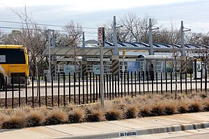
Farmers Branch station (formerly Farmers Branch Park & Ride) is a DART light rail station in Farmers Branch, Texas. It serves the Green Line. The station initially opened as a bus-only park & ride facility in the 1990s.
Le Cordon Bleu Institute of Culinary Arts – Dallas
Culinary institute
Distance: Approx. 2441 meters
Latitude and longitude: 32.91111111,-96.87055556
Le Cordon Bleu Institute of Culinary Arts – Dallas was founded in 2007 and is affiliated with the Le Cordon Bleu Schools in North America. Located in Dallas, Texas, LCB Dallas is a branch of Texas Culinary Academy which is owned by Career Education Corporation under a licensing agreement with Le Cordon Bleu in Paris. All US Le Cordon Bleu College locations are scheduled to close in 2017.
Zero Gravity Amusement Park
Former amusement park in Dallas, Texas
Distance: Approx. 3448 meters
Latitude and longitude: 32.885,-96.901
Zero Gravity Thrill Amusement Park was an amusement park in Dallas, Texas, with rides themed around freefall and simulated flying. Owned by Amusement Management International, Zero Gravity was in operation from 1992 until 2021.
Royal Lane station
DART light rail station in Dallas, Texas
Distance: Approx. 2311 meters
Latitude and longitude: 32.896,-96.88829
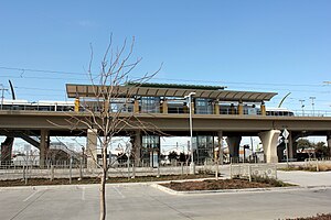
Royal Lane station is a DART light rail station in Dallas, Texas. It is located in Northwest Dallas and serves the Green Line. The station opened as part of the Green Line's expansion in December 2010.
Walnut Hill/Denton station
DART light rail station in Dallas, Texas
Distance: Approx. 3978 meters
Latitude and longitude: 32.881504,-96.883752
Walnut Hill/Denton station is a DART station in Dallas, Texas. It is located in Northwest Dallas and serves DART's Green Line. The station opened as part of the Green Line's expansion in December 2010.
Parker University
College
Distance: Approx. 4024 meters
Latitude and longitude: 32.879639,-96.893174
Parker University is a private university focused on healthcare and located in Dallas, Texas. The university operates a second chiropractic clinic in Irving, Texas, the site of its first campus. It is accredited by the Southern Association of Colleges and Schools, the Council on Chiropractic Education, and the Commission of Massage Therapy Accreditation.
Honors Academy
American group of state charter schools
Distance: Approx. 3116 meters
Latitude and longitude: 32.9431,-96.8893
Honors Academy Charter School District was a group of state charter schools with its administrative offices in Farmers Branch, Texas, in the Dallas-Fort Worth Metroplex.
Asian Trade District, Dallas
Place in Texas, United States
Distance: Approx. 2353 meters
Latitude and longitude: 32.895,-96.891
The Asian Trade District (ATD) is a neighborhood in Northwest Dallas, Texas (USA). Located at the crossroads of Harry Hines Boulevard and Royal Lane, the district has been home to numerous Asian-owned businesses, wholesale retailers, and restaurants since the 1980s. The area is recognized as the city's Koreatown, and has been designated as a special district since 1999.
Weather in this IP's area
overcast clouds
13 Celsius
12 Celsius
12 Celsius
13 Celsius
1015 hPa
92 %
1015 hPa
998 hPa
10000 meters
1.54 m/s
130 degree
100 %


