Country:
Region:
City:
Latitude and Longitude:
Time Zone:
Postal Code:
IP information under different IP Channel
ip-api
Country
Region
City
ASN
Time Zone
ISP
Blacklist
Proxy
Latitude
Longitude
Postal
Route
Luminati
Country
ASN
Time Zone
America/Chicago
ISP
MICLOUD
Latitude
Longitude
Postal
IPinfo
Country
Region
City
ASN
Time Zone
ISP
Blacklist
Proxy
Latitude
Longitude
Postal
Route
db-ip
Country
Region
City
ASN
Time Zone
ISP
Blacklist
Proxy
Latitude
Longitude
Postal
Route
ipdata
Country
Region
City
ASN
Time Zone
ISP
Blacklist
Proxy
Latitude
Longitude
Postal
Route
Popular places and events near this IP address

Tri-City Pavilions
Former shopping mall in Mesa, Maricopa County, Arizona, US
Distance: Approx. 2477 meters
Latitude and longitude: 33.4167128,-111.8720862
Tri-City Pavilions, formerly Tri-City Mall, is a shopping mall in Mesa, Arizona, United States. It was developed in 1968 as an enclosed shopping mall featuring Diamond's and JCPenney as the anchor stores. The mall underwent a period of decline following the opening of Fiesta Mall in 1979, particularly after Diamond's consolidated with its store in that mall in 1984.
Mesa Riverview
Shopping mall in Arizona, United States
Distance: Approx. 598 meters
Latitude and longitude: 33.43541111,-111.86538056
Mesa Riverview is an outdoor shopping center in Mesa, Arizona (part of the Phoenix metropolitan area) located in the northwestern corner of the city near Loop 202 and Dobson Road. The shopping center has a gross leasable area of 1,115,112 square feet (103,000 m2). Anchor stores include Bass Pro Shops, Cinemark Theatre, Home Depot, Bed Bath and Beyond, Petco, Walmart, Marshalls, Office Max, and Jo-Ann Fabrics.

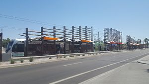
Sycamore/Main Street station
Light rail station in Mesa, Arizona
Distance: Approx. 2618 meters
Latitude and longitude: 33.41486111,-111.87111111
Sycamore/Main Street, also known as The Asian District, is a station on the Valley Metro Rail line in Mesa, Arizona, United States. The station is located one block east of the intersection of Dobson Road and Main Street, in front of the former Tri City Mall. It was the original eastern terminus for Valley Metro Rail when the line opened in 2008.
Mesa Grande
Archaeological site in Arizona, United States
Distance: Approx. 1294 meters
Latitude and longitude: 33.43415,-111.845271
Mesa Grande Cultural Park, in Mesa, Arizona, preserves a group of Hohokam structures constructed during the Classic Period. The ruins were occupied between AD 1100 and 1400 (Pueblo II – Pueblo IV Era) and were a product of the Hohokam civilization that inhabited the Salt River Valley. There the Hohokam constructed an extensive system of water canals.
Riverview Lake
Waterbody in Maricopa County, Arizona
Distance: Approx. 1637 meters
Latitude and longitude: 33.430519,-111.8753034
Riverview Lake is a lake in Riverview Park at Mesa, Arizona, United States. The lake is located west of Dobson Road and north of 8th Street. Golden algae has caused recent fish die offs during the summer of 2018.
Westwood High School (Mesa, Arizona)
Public high school in Mesa, Arizona, United States
Distance: Approx. 1163 meters
Latitude and longitude: 33.42861111,-111.85027778
Westwood High School is a 4-year public high school in the western part of Mesa, Arizona, United States under the jurisdiction of Mesa Public Schools. It was opened in 1962 with Elias Brimhall as the founding principal. In the 1983–84 school year, it was honored as a Blue Ribbon school.
East Valley Institute of Technology
School in Mesa, Arizona, United States
Distance: Approx. 2597 meters
Latitude and longitude: 33.413251,-111.864662
The East Valley Institute of Technology (EVIT) is a public school district serving the eastern portion of the Phoenix, Arizona metro area. It is a joint technological education district with programs are available to students at the member high schools. EVIT serves 10th, 11th, and 12th grade students from the sending districts that meet class prerequisites.
Riverview High School (Arizona)
Public alternative high school in Mesa, Arizona, United States
Distance: Approx. 2164 meters
Latitude and longitude: 33.446902,-111.839625
Riverview High School is one of two alternative high schools operated by Mesa Public Schools. It was formerly known as Mesa Vista High School.

Sloan Park
Baseball park in Mesa, Arizona
Distance: Approx. 2166 meters
Latitude and longitude: 33.4313,-111.8816
Sloan Park is an American baseball park in Mesa, Arizona, that opened in 2014. The primary operator is the Chicago Cubs and the ballpark serves as their spring training home and is also the home of the Arizona League Cubs of the Arizona League and the Mesa Solar Sox of the Arizona Fall League. Sloan Park was built and paid for by residents of the City of Mesa, approved by ballot measure.
Arizona Medical Training Institute
Healthcare institute in Mesa, Arizona, US
Distance: Approx. 1877 meters
Latitude and longitude: 33.44308,-111.84061
Arizona Medical Training Institute (AMTI) is a private, vocational healthcare institute located in Mesa, Arizona. They provide entry-level medical training for students seeking careers in nursing, clinical laboratory science and the assisted living career fields.
Wilkes University, Mesa
Private university in Mesa, Arizona, US
Distance: Approx. 2679 meters
Latitude and longitude: 33.419459,-111.838163
Wilkes University, Mesa was a campus of Wilkes University located in Mesa, Arizona. It began offering classes in Arizona in 2013. The university was established to provide first-generation college students access to higher education.

Alma School/Main Street station
Valley Metro Rail station in Mesa, Arizona
Distance: Approx. 2371 meters
Latitude and longitude: 33.415,-111.85555556
Alma School/Main Street is a station on the Metro light rail line in Mesa, Arizona, United States. The station is located one block east of the intersection of West Main Street and Alma School Road and opened on August 22, 2015.
Weather in this IP's area
clear sky
15 Celsius
13 Celsius
13 Celsius
17 Celsius
1009 hPa
30 %
1009 hPa
967 hPa
10000 meters
4.12 m/s
260 degree
07:01:24
17:23:56

