Country:
 Sweden
Region:
City:
Latitude and Longitude:
Time Zone:
Postal Code:
IP information under different IP Channel
ip-api
Country
Region
City
ASN
Time Zone
ISP
Blacklist
Proxy
Latitude
Longitude
Postal
Route
IPinfo
Country
Region
City
ASN
Time Zone
ISP
Blacklist
Proxy
Latitude
Longitude
Postal
Route
MaxMind
Country
Region
City
ASN
Time Zone
ISP
Blacklist
Proxy
Latitude
Longitude
Postal
Route
Luminati
Country
SEASN
Time Zone
Europe/Stockholm
ISP
Tele2 SWIPnet
Latitude
Longitude
Postal
db-ip
Country
Region
City
ASN
Time Zone
ISP
Blacklist
Proxy
Latitude
Longitude
Postal
Route
ipdata
Country
Region
City
ASN
Time Zone
ISP
Blacklist
Proxy
Latitude
Longitude
Postal
Route
Popular places and events near this IP address

Härryda Municipality
Municipality in Västra Götaland County, Sweden
Distance: Approx. 4705 meters
Latitude and longitude: 57.66666667,12.11666667
Härryda Municipality (Härryda kommun) is a municipality in Västra Götaland County in western Sweden. Its seat is located in the town of Mölnlycke, with about 19,000 inhabitants. Göteborg Landvetter Airport, Sweden's second-largest airport is situated near the locality of Härryda, after which the municipality is named.

Partille Municipality
Municipality in Västra Götaland County, Sweden
Distance: Approx. 7074 meters
Latitude and longitude: 57.73055556,12.10694444
Partille Municipality (Partille kommun) is a municipality in Västra Götaland County in western Sweden. Its seat is located in Partille, which constitutes a part of the contiguously built-up Gothenburg urban area. The municipality is by area one of the smallest in Sweden with only 59.35 km2.

Göteborg Landvetter Airport
Airport serving Gothenburg, Sweden
Distance: Approx. 6681 meters
Latitude and longitude: 57.66,12.29111111
Göteborg Landvetter Airport (IATA: GOT, ICAO: ESGG) also known as Gothenburg Landvetter Airport is an international airport serving the Gothenburg (Swedish: Göteborg) region in Sweden. With just over 6.8 million passengers in 2018 it is Sweden's second-largest airport after Stockholm–Arlanda. Landvetter is also an important freight airport.
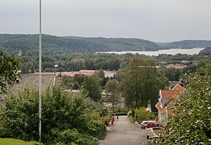
Landvetter
Place in Västergötland, Sweden
Distance: Approx. 693 meters
Latitude and longitude: 57.68333333,12.2
Landvetter is a locality situated in Härryda Municipality, Västra Götaland County, Sweden. It had 7,152 inhabitants in 2010. It is the second largest town in the municipality and has given its name to the international airport Göteborg Landvetter Airport, located 5 km east of Landvetter.

Mölnlycke
Place in Västergötland, Sweden
Distance: Approx. 4705 meters
Latitude and longitude: 57.66666667,12.11666667
Mölnlycke is a small town nearby Greater Gothenburg, a locality and the seat of Härryda Municipality, Västra Götaland County, Sweden. It had 17,499 inhabitants in 2019. The urban area stretches over two municipalities.
Härryda
Place in Västergötland, Sweden
Distance: Approx. 6636 meters
Latitude and longitude: 57.68333333,12.3
Härryda (Swedish pronunciation: [ˈhæ̂ˌrːyːda]) is a locality situated in Härryda Municipality, Västra Götaland County, Sweden. It had 968 inhabitants in 2010. Despite its name it is not the seat of the municipality, which is the much larger Mölnlycke.
Öjersjö
Place in Västergötland, Sweden
Distance: Approx. 4617 meters
Latitude and longitude: 57.7,12.11666667
Öjersjö is a locality situated in Partille Municipality, Västra Götaland County, Sweden with 3,543 inhabitants in 2010.
Benareby
Place in Västergötland, Sweden
Distance: Approx. 4033 meters
Latitude and longitude: 57.65,12.16666667
Benareby is a locality situated in Härryda Municipality, Västra Götaland County, Sweden. It had 384 inhabitants in 2010.

Nya Långenäs
Place in Västergötland, Sweden
Distance: Approx. 4033 meters
Latitude and longitude: 57.65,12.16666667
Nya Långenäs is a locality situated in Härryda Municipality, Västra Götaland County, Sweden. It had 268 inhabitants in 2010.
Tahult
Place in Västergötland, Sweden
Distance: Approx. 1775 meters
Latitude and longitude: 57.7,12.18333333
Tahult is a locality situated in Härryda Municipality, Västra Götaland County, Sweden. It had 585 inhabitants in 2010.

Pixbo
Distance: Approx. 7244 meters
Latitude and longitude: 57.65095,12.08403
Pixbo is a locality in Västergötland, Sweden. Most of it lies within Härryda Municipality, except for a minor part which belongs to Mölndal Municipality. The urban area to which it belongs is Mölnlycke.
Gökskulla
Distance: Approx. 1330 meters
Latitude and longitude: 57.6928,12.1728
Gökskulla is a residential area in Tahult, Landvetter in Härryda Municipality in Sweden. Television presenter Clara Henry was born here.
Weather in this IP's area
mist
12 Celsius
12 Celsius
11 Celsius
13 Celsius
1017 hPa
97 %
1017 hPa
1008 hPa
900 meters
2.57 m/s
160 degree
100 %
07:52:45
17:59:36