Country:
Region:
City:
Latitude and Longitude:
Time Zone:
Postal Code:
IP information under different IP Channel
ip-api
Country
Region
City
ASN
Time Zone
ISP
Blacklist
Proxy
Latitude
Longitude
Postal
Route
IPinfo
Country
Region
City
ASN
Time Zone
ISP
Blacklist
Proxy
Latitude
Longitude
Postal
Route
MaxMind
Country
Region
City
ASN
Time Zone
ISP
Blacklist
Proxy
Latitude
Longitude
Postal
Route
Luminati
Country
ASN
Time Zone
America/Chicago
Latitude
Longitude
Postal
db-ip
Country
Region
City
ASN
Time Zone
ISP
Blacklist
Proxy
Latitude
Longitude
Postal
Route
ipdata
Country
Region
City
ASN
Time Zone
ISP
Blacklist
Proxy
Latitude
Longitude
Postal
Route
Popular places and events near this IP address
South Street Park
Distance: Approx. 712 meters
Latitude and longitude: 39.76222222,-86.15388889
South Street Park is a former baseball ground located in Indianapolis, Indiana, U.S. The ground was home to the Indianapolis Blues of the National League for the 1878 season and was also known then as National Park. The ground first hosted baseball for the city's International Association entry during 1876–1877. It was also a neutral site for some Chicago White Stockings games during 1878.

Latin School of Indianapolis
Distance: Approx. 457 meters
Latitude and longitude: 39.7582,-86.1484
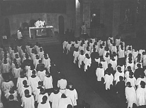
The Latin School of Indianapolis served from 1955 to 1978 as a pre-seminary boys' high school for the Roman Catholic Archdiocese of Indianapolis. In its first two academic years, the Latin School operated as part of Cathedral High School, an all-boys Catholic high school founded in 1918. The first class had 24 boys enrolled.

Fletcher Place
United States historic place
Distance: Approx. 470 meters
Latitude and longitude: 39.7575,-86.14611111
Fletcher Place is a historic district and neighborhood in the city of Indianapolis, Indiana named after Calvin Fletcher, a prominent local banker, farmer and state senator. The neighborhood is clearly defined by I-70/I-65 to the south and East Street to the west. The northern border of the neighborhood is along South Street, Lord Street, Fletcher Avenue, and Bates Street, depending on specific location.

Cole Motor Car Company
Car manufacturer
Distance: Approx. 627 meters
Latitude and longitude: 39.76722222,-86.14416667
The Cole Motor Car Company was an early automobile maker based in Indianapolis, Indiana. Cole automobiles were built from 1908 until 1925. They were quality-built luxury cars.

Indianapolis Downtown Heliport
Heliport in Indianapolis, Indiana, U.S.
Distance: Approx. 543 meters
Latitude and longitude: 39.765876,-86.148875
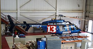
Indianapolis Downtown Heliport is a heliport located in the city center of Indianapolis. The heliport was opened in 1969 as a private use heliport under the name Beeline Heliport and, in 1979, was turned into a public facility operated by the Indianapolis Airport Authority (IAA). In 1983, the FAA picked the heliport to be part of its National Prototype Demonstration Heliport Program, a project launched to illustrate the usefulness and viability of full-service downtown heliports in the United States, and as a result it received considerable funding for improvements and expansion.

Heier's Hotel
United States historic place
Distance: Approx. 688 meters
Latitude and longitude: 39.76638889,-86.15083333
Heier's Hotel is a historic hotel building located at Indianapolis, Indiana. It was built in 1915–1916, and is a three-story, five-bay, brick building. It features two tall brick piers and terra cotta cornice-like projecting elements.

Indiana Oxygen Company building
Historic building in Indiana
Distance: Approx. 284 meters
Latitude and longitude: 39.76138889,-86.14888889
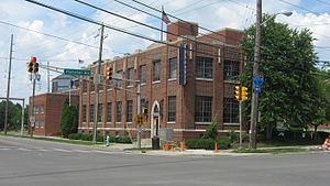
The Indiana Oxygen Company Building is a historic industrial building located at Indianapolis, Indiana. It was built in 1930, and consists of a two-story, rectangular main building on a raised basement, with an attached one-story, U-shaped warehouse. Both building are constructed of brick.

Holy Rosary–Danish Church Historic District
Historic district in Indiana, United States
Distance: Approx. 607 meters
Latitude and longitude: 39.75638889,-86.14722222
Holy Rosary–Danish Church Historic District, also known as Fletcher Place II, is a national historic district located at Indianapolis, Indiana. The district encompasses 183 contributing buildings in a predominantly residential section located in the central business district of Indianapolis. It was developed between about 1875 and 1930, and include representative examples of Italianate, Gothic Revival, Tudor Revival, and Renaissance Revival style architecture.

Gaseteria, Inc.
United States historic place
Distance: Approx. 747 meters
Latitude and longitude: 39.76666667,-86.13972222
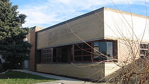
Gaseteria, Inc., also known as ACLU, Indiana, is a historic apartment building located at Indianapolis, Indiana. It was built in 1941, and is a one-story, Art-Moderne-style, buff-color and red brick building with limestone detailing and a flat roof. It features curved walls and glass-block windows.

Jackson Buildings
United States historic place
Distance: Approx. 697 meters
Latitude and longitude: 39.76722222,-86.14944444
Jackson Buildings, also known as the Standard Grocery/Capital Furnace, were two historic commercial buildings located at Indianapolis, Indiana. One was a four-story brick building built about 1882–83, and the other, a five-story building built about 1923. The older building exhibited Italianate and Beaux-Arts style design elements.

Market East, Indianapolis
Cultural district in Indianapolis, Indiana, U.S.
Distance: Approx. 421 meters
Latitude and longitude: 39.76,-86.15
Market East is the newest of seven designated cultural districts in Indianapolis, Indiana. The district is on the east side of downtown (in the area where Market Square Arena once stood) and is bounded to the north by New York Street, to the south by the railroad tracks, to the west by Delaware Street and to the east by East Street.

The Idle
Park in Indianapolis, Indiana, U.S.
Distance: Approx. 699 meters
Latitude and longitude: 39.75555556,-86.14388889
The Idle is a public park overlooking the I-65 and I-70 interstate interchanges in Indianapolis, Indiana. The park is located right off the Indianapolis Cultural Trail on Virginia Avenue, directly in-between the city's Fletcher Place and Fountain Square neighborhoods, which themselves are geographically separated by I-65. The concept behind The Idle was conceived in 2013, through the vision of Tom Battista, a local Indianapolis property developer and entrepreneur.
Weather in this IP's area
clear sky
12 Celsius
11 Celsius
10 Celsius
14 Celsius
1018 hPa
69 %
1018 hPa
992 hPa
10000 meters
3.09 m/s
330 degree
07:47:00
19:17:13