192.169.21.141 - IP Lookup: Free IP Address Lookup, Postal Code Lookup, IP Location Lookup, IP ASN, Public IP
Country:
 USA
USARegion:
City:
Location:
Time Zone:
Postal Code:
ISP:
ASN:
language:
User-Agent:
Proxy IP:
Blacklist:
IP information under different IP Channel
ip-api
Country
Region
City
ASN
Time Zone
ISP
Blacklist
Proxy
Latitude
Longitude
Postal
Route
db-ip
Country
Region
City
ASN
Time Zone
ISP
Blacklist
Proxy
Latitude
Longitude
Postal
Route
IPinfo
Country
Region
City
ASN
Time Zone
ISP
Blacklist
Proxy
Latitude
Longitude
Postal
Route
IP2Location
192.169.21.141Country
usRegion
california
City
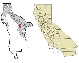
redwood city
Time Zone
America/Los_Angeles
ISP
Language
User-Agent
Latitude
Longitude
Postal
ipdata
Country
Region
City
ASN
Time Zone
ISP
Blacklist
Proxy
Latitude
Longitude
Postal
Route
Popular places and events near this IP address
Emerald Lake Hills, California
Census-designated place in California, United States
Distance: Approx. 1013 meters
Latitude and longitude: 37.46444444,-122.26638889
Emerald Lake Hills or Emerald Hills is a census-designated place and neighborhood in unincorporated San Mateo County, in the state of California, United States. Situated among oak-studded hills between Woodside, Redwood City, and San Carlos roughly bounded by Edgewood Road, Alameda de las Pulgas, Farm Hill Boulevard, and Interstate 280. The population was 4,406 at the 2020 census and the per-capita income was $68,966, making it the 22nd wealthiest place in California and the 82nd highest income places in the United States Emerald Lake Hills was originally conceived as a resort community for city-weary San Franciscans during World War I. Emerald Lake Hills actually consists of two large subdivisions created around 1920: Emerald Lake (even though there are two lakes) and Emerald Hills.

Redwood City, California
City in California, United States
Distance: Approx. 2727 meters
Latitude and longitude: 37.48277778,-122.23611111
Redwood City is a city on the San Francisco Peninsula in Northern California's Bay Area, approximately 27 miles (43 km) south of San Francisco, and 24 miles (39 km) northwest of San Jose. Redwood City's history spans its earliest inhabitation by the Ohlone people to being a port for lumber and other goods. The county seat of San Mateo County in the heart of Silicon Valley, Redwood City is home to several global technology companies including Oracle, Electronic Arts, Evernote, Box, and Informatica.

Cañada College
Community college in Redwood City, California
Distance: Approx. 1928 meters
Latitude and longitude: 37.4479941,-122.2649672
Cañada College is a public community college in Redwood City, California. It is located on 131 acres (53 hectares) in the western part of Redwood City. The college offers 80 A.A./A.S. degree programs and 48 certificate programs.

Sequoia Union High School District
School district in California, United States
Distance: Approx. 2636 meters
Latitude and longitude: 37.4821,-122.2367
The Sequoia Union High School District is a public union school district in the San Francisco Bay Area, primarily serving the southern San Mateo County communities of Atherton, Belmont, East Palo Alto, Ladera, San Carlos, Menlo Park, Portola Valley, Redwood City, and Woodside.

Woodside High School (California)
Comprehensive public high school in Woodside, California, United States
Distance: Approx. 2933 meters
Latitude and longitude: 37.44444444,-122.23194444
Woodside High School is a public high school in Woodside, California, United States, on the border with Redwood City. It is part of the Sequoia Union High School District (SUHSD). Woodside serves students from the surrounding communities of Portola Valley, Woodside and Redwood City.

Redwood City station
Train station in Redwood City, California, U.S.
Distance: Approx. 3254 meters
Latitude and longitude: 37.48583333,-122.23138889
Redwood City station is a Caltrain commuter rail station located in Redwood City, California. It is served by all trains. The station has two side platforms serving the two tracks of the Peninsula Subdivision.

Sequoia High School (Redwood City, California)
School in Redwood City, California, USA
Distance: Approx. 2822 meters
Latitude and longitude: 37.4845761,-122.2374441
Sequoia High School (established in 1895) is a high school in downtown Redwood City, California, United States. Today, it is one of the few schools to offer the International Baccalaureate (IB) Diploma Programme within the San Francisco Bay Area.
Sequoia Hospital
Hospital in California, United States
Distance: Approx. 1794 meters
Latitude and longitude: 37.4795142,-122.2547128
Sequoia Hospital is a hospital in Redwood City, California, US. It is operated by Dignity Health.

Union Cemetery (Redwood City, California)
United States historic place
Distance: Approx. 3032 meters
Latitude and longitude: 37.4738267,-122.223299
Union Cemetery is a historic cemetery on Woodside Road (CA 84) near El Camino Real in Redwood City, San Mateo County, California. The cemetery was named a California Historical Landmark #816 in 1967, then added to the National Register of Historic Places in 1983.

Edgewood County Park
Distance: Approx. 2396 meters
Latitude and longitude: 37.47394444,-122.27863889
Edgewood County Park and Natural Preserve is a 467-acre (189 ha) protected area located in San Mateo County, California, United States, and is best known for its spring wildflower displays. The park receives about 50,000 visitors each year.
Runnymede Sculpture Farm
Distance: Approx. 2728 meters
Latitude and longitude: 37.444668,-122.274911
Runnymede Sculpture Farm is a private sculpture park in Woodside, California. It displays approximately 140 pieces of contemporary sculpture on 120 acres. The land was purchased in 1930 by Alma Spreckels Rosekrans for her horses and named after her father's prized stallion, Runnymede, sire of Kentucky Derby winner Morvich.

Atherwood
Place in California, US
Distance: Approx. 2733 meters
Latitude and longitude: 37.46072,-122.224254
Atherwood is a subdivision in Redwood City, California, that was built in 1950 by housing developer Joseph Eichler. It was one of Eichler's first developments working with an architect and his first major subdivision in San Mateo County. It consists of 64 original single family homes designed by architectural firm Anshen and Allen based on their AA-1 design.
Weather in this IP's area
scattered clouds
4 Celsius
3 Celsius
3 Celsius
6 Celsius
1019 hPa
89 %
1019 hPa
999 hPa
10000 meters
1.79 m/s
2.68 m/s
161 degree
40 %